Download
1 / 10
100 likes | 282 Views
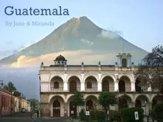
CLIMATE CHANGE NATIONAL STRATEGY Ministry of Environment and Natural Resources Jamaica, july 2009. GUATEMALA. Location: Central América. Territorial Extension : 108, 889 kms 2 Population: 13.0 million. Indigenous: 55% Climate per Region: Tropic, Mountains, Coast. Context.

E N D
CLIMATE CHANGE NATIONAL STRATEGY Ministry of Environment and Natural ResourcesJamaica, july 2009
GUATEMALA • Location: Central América. • Territorial Extension :108,889 kms 2 • Population: 13.0 million. Indigenous: 55% • Climate per Region: Tropic, Mountains, Coast
Context • In accordancewiththe IPCC, the global warmingiscausedbytheincrease of greenhouse gases emissionsprovokedbyhumanbeingsactions, mainlythosewholive in industrializedcountries. • Although Guatemala contributesverylittletotheincrease of the global temperature (nationalemissions of greenhouse gases are reduced), our country isbeingseriouslyimpactedbytheclimatechange and variability. Theirintensity and frequencyhaveincreased.
ClimateChange and VariabilityEfects • “El Niño” phenomenom 1991 • Mitch Hurricane 1998 • Drought 2001 • Tropical Storm “Stan” 2005 • Flooding, sinking 2008 landslides, deaths
NegativeImpacts • Loss of biodiversity, farming, basicinfraestructure and services • Foodsecurity • Quality and quantityreduction of hydrologicalresources • Increase of soilerosionprocesses • Increase of illnesses • Tourism Thissituationaffectsmainlythe rural and urban marginal population. Consecuentlytopeople in extreme poverty
Policy Framework onClimateChange National: • Government Plan 2008-2012 • EnvironmentalImprovement Plan 2008-2032 • EnvironmentalPolicy • GovernmentalStrategic Plan • ClimateChange National Strategy International: • ClimateChange Regional Strategy • MesoamericanStrategy of EnvironmentalSustentability
Adaptation and its contribution to the reduction of Poverty • Promotion of goodpracticesto reduce negativeimpacts of variability and climatechange • Increasetheknowledge of extreme meteorologicalphenomenonto reduce thelevel of incertity • Preparation of models and scenarios in climatechangetopredicttheclimatefuturebehaviors • Encouragetheparticipation of allsectorstoraisethemethodologicalissue and implementation of concretactions • Reinforcethenational and local coordinationtoguaranteecoherencebetweenactions in climatechange and otherobjectives of nationalpolicies.
How do weimplementtheStrategy? MainActions: • Second National Communication • ClimateChangePolicy • COP Copenhague Preparation • JointProgram “EnvironmentalGovernance in theface of ClimateRisk in Guatemala” • Education National ProgramonClimateChangefocusedtoStrengthenthe local capacities • SupportProgramto reduce climatevulnerability in theDryCorridor (KfW) • Strengtheningthecapacity of adaptationtoClimateChange (Japón) • MesoamericanBarrierReefSystem (GEF) 9. Small GrantsProgram
JointProgram “StrengtheningEnvironmentalGovernance in theface of ClimateRisks in Guatemala” • DryCorridor: 6 departaments. • Focal Area: 6 municipalities in Baja Verapaz. • DemostrativeArea: 6 micro-watershed in Baja Verapaz.