Download
1 / 14
140 likes | 245 Views
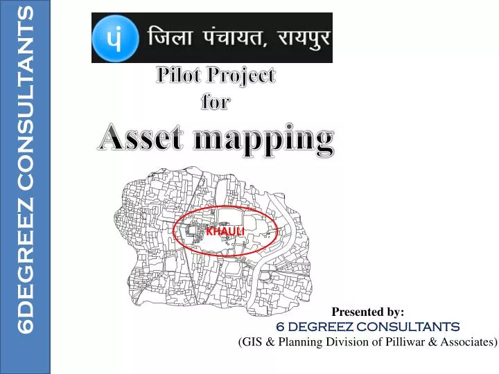
Pilot Project for Asset mapping. 6DEGREEZ CONSULTANTS. KHAULI. Presented by: 6 DEGREEZ CONSULTANTS (GIS & Planning Division of Pilliwar & Associates). N. Khauli Village. Khauli village Boundary. DETAILS. Input Data. Khauli Digital map Details of all Assets from field survey Road

E N D
Pilot Project for Asset mapping 6DEGREEZ CONSULTANTS KHAULI Presented by: 6 DEGREEZ CONSULTANTS (GIS & Planning Division of Pilliwar & Associates)
N Khauli Village Khauli village Boundary
Input Data • Khauli Digital map • Details of all Assets from field survey • Road • School • Hand pump • Talab • Shamshan Ghat • Bore well • Panchayat Bhawan • Water tank • Bank • Ration Shop • Others…………( AnganWadi etc)
Drinking Sources Georeferenced Image of khauli village and its surrounding taken from Google earth with co-ordinates Georeference Image Road Map School & Talab Final Assets map 21°19'28.66"N 81°54'33.13"E 21°19'12.77"N 81°54'43.85"E
Khauli Road Map (Digitized) Drinking Sources Georeference Image Road Map School & Talab Final Assets map - Length-3215.28 mtrs. - Length-1772.17 mtrs. - Length-1417.38 mtrs. - Length-2336.88 mtrs.
Drinking Sources Drinking Source in Khauli village Georeference Image Road Map School & Talab Final Assets map School Map -2 -13 -2
Drinking Sources School with Assest point on the Map Georeference Image Road Map School & Talab Final Assets map School
Drinking Sources All Talab (Nirmala Ghat) Georeference Image Road Map School & Talab Final Assets map
Drinking Sources PHC with Image and Details On the Map Georeference Image Road Map School & Talab Final Assets map
Drinking Sources School with Details and Co-ordinates Georeference Image Road Map School & Talab Final Assets map
Web Application (Tentative) for Showing all Assets with Location