Download
1 / 27
270 likes | 377 Views
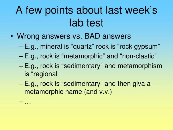
A few points about last week ’ s lab test. Wrong answers vs. BAD answers E.g., mineral is “ quartz ” rock is “ rock gypsum ” E.g., rock is “ metamorphic ” and “ non-clastic ” E.g., rock is “ sedimentary ” and metamorphism is “ regional ”

E N D
A few points about last week’s lab test • Wrong answers vs. BAD answers • E.g., mineral is “quartz” rock is “rock gypsum” • E.g., rock is “metamorphic” and “non-clastic” • E.g., rock is “sedimentary” and metamorphism is “regional” • E.g., rock is “sedimentary” and then giva a metamorphic name (and v.v.) • …
Last week’s lab • Messy messy messy work. • Work in PENCIL!!!!! • The point is not to get it done (i.e., get it done as fast as possible and out of lab as fast as you can) • The point of the lab is to do it (i.e., do it carefully, neatly, completely and understand what you’re doing)
Topographic profile • Across Gaspereau Valley • Use the Leaning Object to remind yourself how to do this (if you need to). • Use pencil and don’t draw on map • Follow the instructions • Position (UTM coordinates) • Vertical scale (1:5 000) • How far apart are the lines of the profile? • What does that convert to in the “real world”?
Contouring lake levels • Use contour values to determine lake surface heights • Assign an arbitrary x-5 value (i.e., 5 m lower than closest contour) • Contour the lake surface heights • This is a contour of the groundwater surface • Show direction of groundwater flow Note that not all enclosed depression contours will have “ticks” on them.
Contouring lake levels 80 70 90 85 65 95 75 85 65 95 75 75 65 95 85 95 75 85 65
Topographic profile • Across Paradise Valley • Use the Leaning Object to remind yourself how to do this (if you need to). • Use PENCIL and don’t draw on map • Follow the instructions • Position (UTM coordinates) • Scale (1:20 000) • How far apart are the lines of the profile? • What does that convert to in the “real world”?
Aerial photographs • Two photos from a slightly different position • Viewed simultaneously • Brain generates a “3-D” image