Download
1 / 38
420 likes | 790 Views
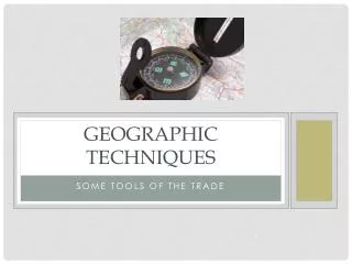
Geographic Techniques. Some Tools of the Trade. What is GIS ?. Geographic Information Systems A GIS is a powerful computer mapping and analysis system Links geographic locations with information/data about them so you can create maps and analyze data in new ways

E N D
Geographic Techniques Some Tools of the Trade
What is GIS? • Geographic Information Systems • A GIS is a powerful computer mapping and analysis system • Links geographic locations with information/data about them so you can create maps and analyze data in new ways • Techniques for handling, processing, and analyzing data specifically referenced to the surface of the Earth
What is GIS? Components of GIS
What makes GIS unique? • Ability to use specific spatial techniques • Buffer and overlay, for example
Questions a gis could answer • Location • What is at the location? • Condition • How is it? • Trends • What has changed since? • Patterns • What spatial patterns exist? • Modeling • What if?
Who uses GIS? • Government • Academia • Private industry
Practical applications of gis • Street network based analysis • Address matching • Vehicle routing • Location routing, site selection • Development of evacuation plans
Practical application of gis • Natural resource based (management) • Wildlife habitat • Wild & scenic rivers • Recreation resources • Floodplains • Wetlands • Agricultural lands • Aquifers • Forests
Practical applications for gis • Land parcel based analysis • Zoning, subdivision plan review • Land acquisition • Maintenance of ownership
Practical applications of gis • Facilities management • Locating underground utilities • Planning facility maintenance
Practical Application of GIS • Historic structures • Cataloging • Maintenance
GIS application areas Gator Farming with GISby Gregory Hymel, Geographic Computer Technologies, LLC “Eggs, collected from wild nests in area wetlands, are hatched on farms. Some of the young hatched on farms are released back into the wild. As a result of this program, alligator populations in the southeastern United States have grown substantially, and the species was declared recovered in 1987 and removed from the Endangered Species List. An alligator farm in Louisiana has begun using GIS to manage egg collection.”
Remote sensing • Any of the several techniques of obtaining images of an area or object without having the sensor in direct physical contact with it, as by aerial photography or satellite sensors.
Remote sensing Early remote sensing
Remote sensing Visible spectrum
Remote sensing • Sensor record specific bands of the EMR spectrum
Remote sensing applications Amazon River
Remote sensing applications Rondonia, Brazil 1975
Remote sensing applications Rondonia, Brazil 1986
Remote sensing applications Rondonia, Brazil 1992
Remote sensing applications Tracking tornado damage
gps: the global positioning system • Uses measurements from 3+ satellites
How accurate is gps? • Depends on several variables • Design of receiver • $100 - $50,000 • Little spent collecting readings • Positions/geometry of satellites • Differential corrections • Removal of measurement errors
Global positioning system Low end receivers
Global positioning receivers High end receiver
GPS applications Agriculture
GPS applications • Wildlife tracking
Gps applications Vehicle use