Download
1 / 19
190 likes | 289 Views
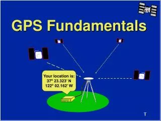
GPS Fundamentals. Your location is: 37 o 23.323’ N 122 o 02.162’ W. Global Positioning System. Your location is: 37 o 23.323’ N 122 o 02.162’ W. Satellite Signal Structure. Carrier L1 L2 Frequency 1575.42 MHz 1227.60 MHz Wavelength 19cm 24cm

E N D
GPS Fundamentals Your location is: 37o 23.323’ N 122o 02.162’ W
Global Positioning System Your location is: 37o 23.323’ N 122o 02.162’ W
Satellite Signal Structure Carrier L1 L2 Frequency 1575.42 MHz 1227.60 MHz Wavelength 19cm 24cm Code Modulation C/A-code - P(Y)-code P(Y)-code NAVDATA NAVDATA C/A - Coarse Acquisition Code P - Precise Code (Y-Code when encrypted) NAVDATA - Satellite health, satellite clock corrections, and ephemeris parameters.
Autonomous Position Relative Position What is Measured? GPS Observables Code Ranges Carrier Phases
Code Range Results Autonomous Position +/- 100 m (330 ft) error (horizontal) +/- 156 m (515 ft) error (vertical)
Measured Reduced D X = -408.251 m D Y = -84.830 m D Z = -369.413 m OR Carrier Phase Results Baseline or Vector (cm precision) Azi = 212o 42’ 49.8244” Dist = 557.05307 m DEll Ht = 4 .8751 m
+Z Z Y X -Y +X ECEF Coordinate System ECEF X = -2691542.5437 m Y = -4301026.4260 m Z = 3851926.3688 m
a = semi-major axis b = semi-minor axis b b a a Reference Ellipsoid H f WGS-84 Ellipsoid a = 6378137.000000 m b = 6356752.314245 m 1/f = 298.2572235630 l
+Z H b Z f Y X a l -Y +X ECEF and WGS-84 ECEF X = -2691542.5437 m Y = -4301026.4260 m Z = 3851926.3688 m WGS-84 f = 37o 23’ 26.38035” N l = 122o 02’ 16.62574” W H = -5.4083 m
GPS Heights vs. Elevations Earth’s Surface H H h h H h N Ellipsoid N N Geoid h = Orthometric Height H = Ellipsoid Height N = Geoid Height h = H - N
Errors Sources in GPS • Selective Availability (SA) and Anti-Spoofing (AS) • Multipath • Ionospheric Noise • Human Error
SA and AS • Selective Availability (SA) • Clock dither • Ephemeris error • Anti-Spoofing (AS) • Encryption of the P-code signal ???????? 100 meters
Ionospheric Effects Ionosphere > 10 km < 10 km
10:35 10:30 Survey Requirements
Summary • There are three segments to GPS. All must be working to use GPS. • There are 2 GPS signals, L1 and L2. • Code Range measurements result in autonomous positions with several meter precision. • Carrier Phase measurements result in relative positions with centimeter precision.
Summary (cont.) • GPS results are in reference to an ECEF coordinate system and the WGS-84 ellipsoid. • Errors in GPS can be minimized by planning and utilizing proper surveying techniques. • At least 4 SVs are required to determine a position or survey with GPS. • At least 2 receivers are required to survey with GPS.