Download
1 / 1
0 likes | 19 Views
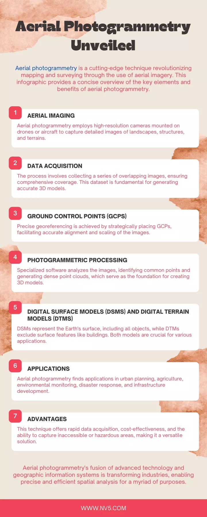
Aerial photogrammetry is a cutting-edge technique revolutionizing<br>mapping and surveying through the use of aerial imagery. This<br>infographic provides a concise overview of the key elements and<br>benefits of aerial photogrammetry.<br>

E N D
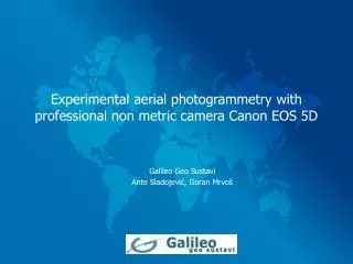
Aerial Photogrammetry Unveiled Aerial photogrammetry is a cutting-edge technique revolutionizing mapping and surveying through the use of aerial imagery. This infographic provides a concise overview of the key elements and benefits of aerial photogrammetry. 1 AERIAL IMAGING Aerial photogrammetry employs high-resolution cameras mounted on drones or aircraft to capture detailed images of landscapes, structures, and terrains. 2 DATA ACQUISITION The process involves collecting a series of overlapping images, ensuring comprehensive coverage. This dataset is fundamental for generating accurate 3D models. 3 GROUND CONTROL POINTS (GCPS) Precise georeferencing is achieved by strategically placing GCPs, facilitating accurate alignment and scaling of the images. 4 PHOTOGRAMMETRIC PROCESSING Specialized software analyzes the images, identifying common points and generating dense point clouds, which serve as the foundation for creating 3D models. 5 DIGITAL SURFACE MODELS (DSMS) AND DIGITAL TERRAIN MODELS (DTMS) DSMs represent the Earth's surface, including all objects, while DTMs exclude surface features like buildings. Both models are crucial for various applications. 6 APPLICATIONS Aerial photogrammetry finds applications in urban planning, agriculture, environmental monitoring, disaster response, and infrastructure development. 7 ADVANTAGES This technique offers rapid data acquisition, cost-effectiveness, and the ability to capture inaccessible or hazardous areas, making it a versatile solution. Aerial photogrammetry's fusion of advanced technology and geographic information systems is transforming industries, enabling precise and efficient spatial analysis for a myriad of purposes. WWW.NV5.COM