Download
1 / 25
250 likes | 327 Views
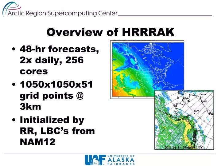
Overview of HRRRAK. 48 - hr forecasts, 2x daily, 256 cores 1050x1050x51 grid points @ 3km Initialized by RR, LBC’s from NAM12. HRRR-AK Process Flow (00Z Forecast). Every 6 hours. 20:00Z. 21:30Z. Lots of postprocessing. FetchAndUngrib NAM11. Metgrid NAM11. Real NAM11.

E N D
Overview of HRRRAK • 48-hr forecasts, 2x daily, 256 cores • 1050x1050x51 grid points @ 3km • Initialized by RR, LBC’s from NAM12
HRRR-AK Process Flow (00Z Forecast) Every 6 hours 20:00Z 21:30Z Lots of postprocessing FetchAndUngrib NAM11 Metgrid NAM11 Real NAM11 wrfbdy_d01 Done by 02:00Z Merge Wrf wrfinput_d01 21:50Z GRIB2 Production FetchAndUngrib RR Metgrid RR Real RR 22:00Z Hourly 20:00Z 21:35Z
HRRRAK Distribution ARSC/UAF Fairbanks Anchorage Juneau WFO Juneau AWIPS
Verification Post Processing GDAS prepbufr HRRRAK netcdfwrfout files U Wyoming Raobs Raobsvs HRRRAK Soundings WRF postprocessor (wrfout2grib) FetchPREPBUFRAndDecode (used PB2NC) R Scripts • Boxplots • Station time series • Scatter plots GDAS netCDF HRRRAK GRIB1 Web graphics with menu pointstat output RunForecastPointStat Archived long-term
Namelist Options • WSM 3-class simple ice, now looking at 3.3.1 version of Thompson graupel microphysics • RRTM LW physics, Dudhia SW • Monin-Obukhovsfclay physics • Thermal diffusion surface physics (need to change soon!), now Noah LSM, looking at RUC • PBL Physics - YSU, now MYNN 2.5 level TKE, looking at experimental approach • No cumulus parameterization • Default layers, now heights of 8, 31, 74, 149, … meters
A quick study in GSI / cold / warm cycling • Question – initialize direct from RR, assimilate, or warm-cycle and assimilate? • Primary goal here – understand the GSI process for cold/warm starting • Preliminary tests to gain insight for future activities
FH00 FH06 FH12 FH18 FH24 RR 00Z Control RR 06Z Control RR 12Z Control RR 18Z Control RR 00Z Cold Start Obs 06Z Warm Start Obs 12Z Warm Start Obs 18Z Warm Start Obs
Arbitrary 24 hour forecast 2010-08-05/12Z Surface analysis (courtesy Anchorage Forecast Office
FH24, 18Z Warm StartSample 2D areal diff analysis 10m Wind (m/s) 2m Temperature (degC)
Initial case study in assimilation of AIRS radiances and profiles with GSI
Control minus GDAS surface Control minus GDAS surface and AIRS profiles Control minus GDAS surface and AIRS radiances
AIRS radiances +GDAS Prepbufr AIRS profile +GDAS Prepbufr Control GDAS Prepbufr
Simultaneous HRRRAK and AIRS Assimilation (AIRSAss) runs • April-July 2012 • 00Z HRRRAK run normally, cancelled the 12Z runs • Instead of 12Z HRRRAK, ran an identical 00Z run, but with AIRS profiles assimilated in to initial conditions • Archived products, graphics, comparisons • No idea if AIRSAss resulted in forecast improvements