Download
1 / 17
170 likes | 326 Views
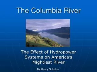
Restoration in the Lower Columbia River and Estuary. September 13, 2007 Debrah Marriott, Executive Director Evan Haas, Habitat Restoration Coordinator. Lower Columbia Challenges. Bi-State Investment 1989 - 1995 Combined monitoring efforts at over 500 sites –

E N D
Restoration in the Lower Columbia River and Estuary September 13, 2007 Debrah Marriott, Executive Director Evan Haas, Habitat Restoration Coordinator
Lower Columbia Challenges • Bi-State Investment 1989 - 1995 • Combined monitoring efforts at over 500 sites – • looking at fish tissue, sediment and water quality • Habitat decreased by as much as 75% from historical levels • Beneficial uses impaired • High levels of sediment contamination • DDEs, PCBs, dioxins and furans, and PAHs • Contaminants are bioaccumulating at harmful levels • Bald eagle, osprey, and river otters • High water temperature and dissolved gas levels
Lower River & EstuaryManagement Plan Objectives • Protect the ecosystem and species -restoring 16,000 acres of wetlands and habitat by 2010 • Reduce toxic and conventional pollution -conducting long term monitoring. • Provide information about the river to a range of audiences -compiling and evaluating data, offering education programs for children and building public and private partners.
Science Program Components Habitat Restoration • Regional Prioritization Strategy • Shoreline Videography: Assessment of Conditions/ Landscape Analysis • Inventory • Project Implementation & Effectiveness Monitoring • Sediment Management Species Recovery Monitoring and Toxic Reduction
Restoration Tools & Data: Defining Regional Strategies and Priorities • Emerging Information • Monitoring for toxic contaminants • Fish Surveys • Ecosystem Classification: Lidar • Prioritization Strategy • Classifies lower river based on landscape characteristics • Defines needed restoration activities • Improves cost effectiveness • Project Review Criteria • 100 Scientists, Directs project selection • Shoreline Inventory • 630 miles videographed and classified shoreline features • Identifies high priority restoration sites
Active Partners • Council / BPA: $4,000,000 2003-2007; estimated $4,500,000 2008-2010 • Council / BPA: Pile Dike Removal (proposed) • NOAA – Community Based Restoration Partnership: $666,250 2004-2007, est. $750,000 2008-2010 • NOAA – Marine Debris: $100,000 2008 • EPA – Targeted Watershed $700,000 2003-2005 • Corps of Engineers - Section 536: $2M since 2002 Implementers Estuary Partnership, Local Governments, Conservation Organizations, Watershed Councils, CREST, WA Fish Recovery Board
Potential Marbled Murrelet Nesting Habitat Active Bald Eagle Nest Tidegate Removal Existing Cross Dike Backwater Channels Existing Dike Partial Road Removal 4 Listed Salmonid Species Dike Breach Dike Breach Tidegate Removal Active Bald Eagle Nests (3) Grays Bay and Columbia River Confluence Deep River Dike Breach Columbia Land Trust and partners restoring 154 acres Salmon protection, Flood Prevention, Water Quality Post Project Monitoring = juvenile salmon using site and water temps are cooling.
Brownsmead/Blind SloughTidal Reconnection CREST and project partners reconnected 7 miles of slough to tidal influence Remove culvert barriers Install fish friendly tidegates Post Monitoring shows water temperatures are declining.
Restoration Projects - 2008 Restoration • Otter Point: dike breach • Stephens Creek: CSO pipe removal/wetland grading • Mirror Lake: culvert replacement • Scappoose Bottomlands: wetland revegetation • Crazy Johnson Creek: land acquisition Marine Debris • Coal Creek Slough: remove abandoned pile dikes. Pile Dike Removal • Proposed for 2008: build off work at Coal Creek Slough and increase removal throughout the estuary
Sediment Management Sediment Plan will: • Provide regional decision making context • Assess Contamination Issues • Identify disposal issues: location, costs • Impacts to habitat • Creation of predator habitat • Loss of instream habitat
Species RecoveryNWPCC, BPA & NOAA Confirm recovery priorities in Management Plan: • Sub Basin Plan for lower river and estuary, 2004 – six priority areas: hydro system effects, habitat, toxic contaminants, non-native species, predation, and uncertainty • Phase 2 Recovery module for lower river and estuary 2007 Threats: flow, sediment impairment, structures, food web and predators, riparian practices and toxic contaminants. • Action Agencies- Comprehensive Analysis – August 2007
Estuary Partnership Monitoring Strategy Developed 1996-1999 with USGS and large work group of public and private sector scientists Assessed current activities, needs and gaps Defined plan to fill gaps The plan includes the following components: Monitoring Oversight Data Management Habitat Monitoring Exotic Species Conventional Pollutants Toxic Contaminants Primary Productivity and Food Web Dynamics
Monitoring to Date • 1989 – 1996: Bi-State $6,000,000: Gives us Baseline at over 500 sites • 1996- 2005: One time Snapshots gives us quick look • EPA EMAP: $500,000 & USGS BEST: $3,000,000 • 2003-2007: Council & BPA investment $2,300,000 gave us: • Ecosystem Classification System • Habitat Monitoring (exotic species) • Water Quality Monitoring – USGS matched BPA funds • Salmonid Sampling –NOAA matched BPA funds • Toxics Model Development • 2008-2010: Council & BPA investment $1,875,000 will give us: • Trend Ability • Ecosystem Classification System • Habitat monitoring (exotic species) • Salmonid Sampling (No toxics) – NOAA matching
Results of Monitoring Project Legacy, Bioaccumulative, Persistent • Contaminants banned from 1970s still detected in sediments and fish, including pesticides, (DDT), coolants and lubricants (PCBs) • PCBs in salmon tissue and PAHs present in salmon prey exceed estimated thresholds for delayed mortality, increased disease susceptibility, and reduced growth Emerging, sublethal • Flame retardants (PBDEs) on the rise and salmon in the vicinity of Portland have levels within the top 10% of those reported for resident fish in the region • Copper detected at concentrations known to interfere with salmon olfaction: imprinting, homing, schooling, shoaling, predator detection, predator avoidance, and spawning • Juvenile Chinook salmon collected from the Portland area have abnormal levels of an estrogen-regulated yolk protein
Future Activities: Based On What We Know, What Do We Need? • More strategic approach • More aggressive identification of projects • Continue tidal reconnection projects and increase marine debris and pile dike removal projects • Link effectiveness monitoring to results • Expand knowledge of fish use in tidal freshwater portion of the estuary • Expand involvement from local, state, federal and tribal partners