Download
1 / 24
260 likes | 629 Views
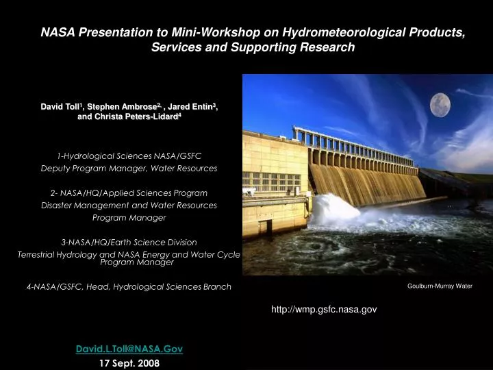
NASA Presentation to Mini-Workshop on Hydrometeorological Products, Services and Supporting Research. David Toll 1 , Stephen Ambrose 2, , Jared Entin 3 , and Christa Peters-Lidard 4 1-Hydrological Sciences NASA/GSFC Deputy Program Manager, Water Resources 2- NASA/HQ/Applied Sciences Program

E N D
NASA Presentation to Mini-Workshop on Hydrometeorological Products, Services and Supporting Research David Toll1, Stephen Ambrose2, , Jared Entin3, and Christa Peters-Lidard4 1-Hydrological Sciences NASA/GSFC Deputy Program Manager, Water Resources 2- NASA/HQ/Applied Sciences Program Disaster Management and Water Resources Program Manager 3-NASA/HQ/Earth Science Division Terrestrial Hydrology and NASA Energy and Water Cycle Program Manager 4-NASA/GSFC, Head, Hydrological Sciences Branch David.L.Toll@NASA.Gov 17 Sept. 2008 Goulburn-Murray Water http://wmp.gsfc.nasa.gov
NASA Applied Sciences ProgramA Pathway Between Earth Science & Society Results of NASA Earth Science Research Uses by Partners and Stakeholder Communities NASA Applied Sciences Program
NASA Hydrology Related Missions SMAP - Global Soil Moisture
Precipitation from Space Tropical Rainfall Measurement Mission (TRMM) Global Precipitation Measurement (GPM) • TRMM is the first "space-based rain gauge" that uses microwaves to "see" how much precipitation falls from clouds around the tropics over land and ocean with unparalleled accuracy. TRMM also is the primary mission for studying El Nino. • Global precipitation measurement with TRMM: a great leap forward! • 10 85 GHz radiometers • 13.6 GHz precipitation radar (FIRST!) • Needed improvements: • - Longer record length • - High latitude precipitation including snowfall • - Better accuracy • - Spatial-temporal sampling • - Improved vertical resolution
Hurricane Ike in Cuba--Heavy, but not extreme rain, flooding (calculated from hydrological model) and landslide potential (from real-time landslide algorithm) indicated along south side of mountains 24-hr Rain from TRMM Multi-satellite product http://trmm.gsfc.nasa.gov/publications_dir/potential_flood_hydro.html
GRACE Is the First Satellite to Monitor Groundwater Levels Mississippi River basin Rodell et al., Hydrogeology, 2006 New estimates match groundwater well measurements in the U.S., and can be applied globally Illinois Yeh et al., WRR, 2006
GRACE Data Enables More Accurate Water Budget Predictions GRACE water storage, mm January – December 2005 Loop Model assimilated water storage, mm January – December 2005 Loop Zaitchik, Rodell, and Reichle, in preparation Matt Rodell NASA GSFC
Water, Energy & Carbon Cycles • Water and Food • Water Quality and Human Health • Water and the Environment Hydros/Soil Moisture Active/Passive (SMAP) Mission Planning • Decadal Survey recommended that: • a dedicatedsoil moisture mission recently selected as one of two new Earth science mission • NASA fly an active / passive microwave soil moisture & F/T mission in the 2013 timeframe • SMAP consists of an L-Band radar & radiometer in a low Earth, sun-synchronous orbit Societal Benefits: • Weather & Climate Prediction • Severe Storm Forecasts
Value of Soil Moisture Data to Weather and Climate New space-based soil moisture observations and data assimilation modeling can improve forecasts of local storms and seasonal climate anomalies NWP Rainfall Prediction Seasonal Climate Predictability Predictability of seasonal climate is dependent on boundary conditions such as sea surface temperature (SST) and soil moisture – soil moisture is particularly important over continental interiors. Summer Rainfall differences: 1993 (flood) minus 1988 (drought) Buffalo Creek Basin Observed Rainfall 0000Z to 0400Z 13/7/96 (Chen et al., 2001) Without Realistic Soil Moisture Observations 24-Hours Ahead High-Resolution Atmospheric Model Forecasts Prediction driven by SST and soil moisture Prediction driven just by SST With Realistic Soil Moisture High resolution soil moisture data will improve numerical weather prediction (NWP) over continents by accurately initializing land surface states (Schubert et al., 2002) -5 0 +5 Rainfall Difference [mm/day]
Surface Water Mission Concept (SWOT) Stream Discharge and Surface Water Height • Motivation: • critical water cycle component • essential for water resource planning • stream discharge and water height data are difficult to obtain outside US • find the missing continental discharge component Mission Concepts: Laser Altimetry Concept e.g. ICESat (GSFC) Radar Altimetry Concept e.g. Topex/Poseidon over Amazon R. Interferometer Concept (JPL) Targeted path Coincident w/ river reach
Land Information System Heritage: NLDAS and GLDAS North American LDAS 1/8 Degree Resolution Mitchell et al., JGR, 2004 Global LDAS 1/4 Degree Resolution Rodell et al., BAMS, 2004 Land Information System (http://lis.gsfc.nasa.gov) Multi-Resolution Ensemble LDAS Software Framework Kumar et al., EMS, 2006
LSM Initial Conditions LIS Running Modes Uncoupled or Analysis Mode Coupled or Forecast Mode Station Data WRF/ GFS/ GCE Global, Regional Forecasts and (Re-)Analyses ESMF Land Sfc Models (Noah, Catchment, CLM, VIC, HYSSiB) Satellite Products Kumar, S. V., C. D. Peters-Lidard, J. L. Eastman and W.-K. Tao, 2008. An integrated high-resolution hydrometeorological modeling testbed using LIS and WRF. Environmental Modelling & Software, Vol. 23, 169-181.
LIS Uncoupled/Analysis Mode Inputs Physics Outputs Applications Topography, Soils Land Surface Models Soil Moisture & Temperature Weather/ Climate Water Resources Agriculture Drought Military Ops Natural Hazards Land Cover, Vegetation Properties Evaporation Sensible Heat Flux Meteorological Forecasts, Analyses, and/or Observations Runoff Data Assimilation Modules Snow Soil Moisture Temperature Snowpack Properties
D4 D3 D2 D1 D0 Drought Monitoring Comparison
D4 D3 D2 D1 D0 Drought Monitoring Comparison
LIS-WRF Coupled Example 2:0-10 cm initial soil moisture (%)(1200 UTC 6 May 2004) Eta soil moisture LIS soil moisture • Much more detail in LIS (as expected) • LIS drier, especially over N. FL & S. GA • LIS slightly more moist over Everglades Difference (LIS – Eta) LIS Substantially Drier 17
LIS-WRF Coupled Example 2: Sea Breeze Evolution Difference(1800 UTC 6 May to 0300 UTC 7 May) Case, Jonathan L., William L. Crosson, Sujay V. Kumar, William M. Lapenta, Christa D. Peters-Lidard, 2008. Impacts of High-Resolution Land Surface Initialization on Regional Sensible Weather Forecasts from the WRF Model. In press, Journal of Hydrometeorology. 18
LIS-WRF Coupled Example 2: Sea Breeze Evolution Difference(Meteogram plots at 40J and CTY) 19
Mapping Evaporation and Moisture Stress from Space Using Thermal Remote Sensing (Anderson and others) SURFACE TEMPERATURE EVAPOTRANSPIRATION ALEXI (GOES Sounder) Continental ALEXI (GOES Imager) Regional DisALEXI (Landsat) Watershed DisALEXI (USU aircraft) Temperature (C) CORN Field scale Latent Heat (Wm-2) SOY
Water Resource and Climate Variability As the Earth has warmed, what has happened to Earth’s water resources? Recent Trends ● Precipitation Intensity Increases ● Increased floods and droughts & intensity ● Snowfall decrease ● Earlier runoff ● Melting of ice sheets and glaciers ● Sea level rise ● Increase in hurricanes and intensity 38 105 67 393 355 38 1000 km3/yr
Climate Downscaling & Impacts Assessment Observed Modeled Climate Downscaling ● Regional Climate Modeling (Left) - Examples from NASA Goddard Institute for Space Studies (Left) ● Statistical Down Scaling Modeling - Regional Ensemble Multi-Model - Percent likelihoods for Precipitation & Temperature Hydrologic Downscaling - Land Data Assimilation Systems Hydrologic Modeling (Streamflow, ET, Snowpack, etc.) - Climate Impacts for Hydro-Power, Dams and Levees, Snow Pack, Agriculture Planning, Groundwater Depletion, etc. Precipitation Temperature CCSR, GISS, UCONN
Water Resources Program Functional Themes –Projects Summary http://wmp.gsfc.nasa.gov FLOODS & STREAMFLOW FORECASTING Four projects - NOAA led examining improved streamflow for River Forecast Centers. - Using NASA satellite and modeling products for Seasonal Forecast in W. US - NASA-NOAA-USGS Flash Flood Project. - NASA Snow Products and LIS for NOAA Snow and Water Forecast IRRIGATION & WATER DELIVERY Three projects are currently addressing various aspects of improving ET estimates for use in the BoR AWARDS-ET Toolbox and similar DSTs. Focus on using MODIS data and LDAS/LIS estimates of ET & soil moisture. DROUGHT Four Projects. Two using satellite (AMSR-E, Quickscat/Sea Winds and MODIS) and modeling/data assimilation products to improve the US Drought Monitor. Two other improving seasonal predictions and the downscaling of climate predictions for US Drought Outlook. In support of the National Integrated Drought Information System (NIDIS). WATER QUALITY Nonpoint source pollution project to assess the impact of MODIS land data products and impact of LIS precipitation and ET products to improve the continuous hydrologic model, HSPF, used in the EPA BASINS DST.
NASA Approved Missions – Global Precipitation Measurement (GPM) and Soil Moisture Active Passive (SMAP) Phase II and III Satellite Sensors for Hydrology (SWOT, GRACE-II, and SCLP) Integrate Land Components for Earth System Models - Atmospheric (WRF/GCE/GFS/GEOS); Land Surface Models (LIS); Coastal/Ocean Models Downscaling climate predictions to local/regional scales - Hydrologic (streamflow, ET, snow) - Including impacts, vulnerability and adaptations Infusing short-term, seasonal and decadal forecasting information into decision tools New Focus on Regional and Topical Area (Gulf Coast, Water Quality, Climate Impacts) Water, Water, Water Actual water - Consumption, industry, ecosystems, etc. Water as the underlying element - Drought, wildfires, energy production, agriculture Assessing these Internationally Priorities of the Future