Download
1 / 28
280 likes | 481 Views
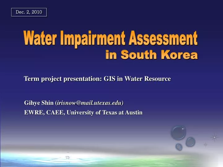
Dec. 2, 2010. Water Impairment Assessment . in South Korea. Term project presentation: GIS in Water Resource . Gihye Shin ( irisnow@mail.utexas.edu) EWRE, CAEE, University of Texas at Austin. Contents. 1. Background and Purpose of the project 2. Methodology

E N D
Dec. 2, 2010 Water Impairment Assessment in South Korea Term project presentation: GIS in Water Resource Gihye Shin (irisnow@mail.utexas.edu) EWRE, CAEE, University of Texas at Austin
Contents 1. Background and Purpose of the project 2. Methodology 3. Water impairment assessment 4. Conclusion 1. Background and Purpose of the project 2. Methodology 3. Water impairment assessment 4. Conclusion
1. Background & Purpose Overview Environment protection Development Balance? Sustainable Development - compromise or sustainability, optimal development Best Environmental Management Program - EIA (Environmental Impact Assessment) (sometimes substituted by SEA, EA etc.) - IWM (Integrated Watershed Management) TMDL (Total Maximum Daily Load), EFA (Environmental Flow Assessment)
1. Background & Purpose TMDL in US and South Korea TMDL (Total Maximum Daily Load) - a value of the maximum amount of a pollutant that a body of water can receive while still meeting water quality standards (Clean Water Act, 303(d)) Water Impairment Assessment - identifying water bodies not satisfied with water quality standard and causes of impairment Water Impairment Assessment Calculating TMDL Simple prediction model The role of local government and national environmental authority Build-up TMDL measures Assessment Unit Water quality index & standards Implementing TMDL program Duration of TMDL program implementation Monitoring and evaluation • Source: Draft Guidance for Water Quality-based Decisions : The TMDL Process (2nd Edition)", EPA (1999) • Navigating the TMDL Process : Evaluation and Improvements, IWA & Water Env. Federation (2003) • Technical guideline for TMDL Process : Evaluation and Improvements, Korean Ministry of Env. (2008)
1. Background & Purpose Surface water quality standard and index US South Korea Framework Act on Environmental Policy Clean Water Act National recommended and state-established standard National recommended standard Type of water body: River / Lake / Underground Use: ex) Human health, General (Public / Industrial supply / Oyster harvest / Irrigation supply etc.) Regulatory frame Type of water body: Freshwater / Saltwater Use: ex) General / Aquatic life / Recreation / Fish consumption / Public supply / Oyster harvest etc. Water Quality and Water ecosystem Conservation Act Clean Water Act Index BOD (Biologic Oxygen Demand) T-P (Total Phosphorous) Index & standard: Site-specific Metals, Pathogens Nutrients, Sedimentations / Siltation Organic enrichment / Low DO etc. TMDL Standard: Site-specific • Source: EPA (http://water.epa.gov) / Strategy for water quality standard and criteria, EPA (2003) • Technical guideline for TMDL Process : Evaluation and Improvements, Korean Ministry of Env. (2008)
1. Background & Purpose US Recreation Use General Use A index : 3 mg/L A index : 5 mg/L B index : … C index : … D index : … E index : … • Source: 2010 Guidance for Assessing and Reporting Surface Water Quality in Texas (2009)
1. Background & Purpose South Korea BOD
Objective GIS application for Best Environmental Management? Prediction Spatial Visualizing of status Assessment Automated input-data mining for modeling e.g. Sedimentation (RUSLE) Non-point load / runoff (HSPF, SWAT etc.) e.g. Identify impaired water Simple prediction for initial decision making e.g. 1D steady-state conservative-pollutant behavior estimation e.g. water quality Water quality status (Temporal-spatial visualizing), identifying impaired water in South Korea, using ArcGIS
Contents 1. Background and Purpose of the project 2. Methodology 3. Water impairment assessment 4. Conclusion
2. Methodology Project area: Nakdong-River Basin The longest river in South Korea (the second one in Korean peninsula) The region exposed frequently to water quality issues i.e. turbidity, non-point pollutions, toxic materials-spill (phenol etc.), etc. National-first-Dam for Environmental water supply is constructing turbidity, non-point pollutions, toxic materials-spill (phenol etc.) Basin length: 511 km Total flowline length: 68,888 km Drainage area: 23,702 km2 Basin avg. width: 46.3 km Basin avg. elevation: 291.18 m Basin Avg. slope: 32.26% Unity shape factor: 3.33
2. Methodology Procedure Used ArcGIS tools Watershed delineation from DEM - Data management tool/ Projection define and Projection - Spatial analysis tool/ Hydrology - Clip, Mask, Dissolve, Extract-Create new feature class - Data query table (for time-enable feature class) - Statistics, Merge etc. Assessment Unit assignment Water quality data & standard matching to AU Water quality status & Impaired water identification
2. Methodology Data source DEM National hydrography Dataset http://www.wamis.go.kr http://www.wamis.go.kr Satellite Image, Land cover map Env. Monitoring data http://www.wins.go.kr http://water.nier.go.kr http://egis.me.go.kr
Data overview monthly water quality monitoring data: since 1989 ~ present - monitoring site (river): 103 - other water body (lake, groundwater, pipe outlet, etc): 665 - open to public (web-service) - ph, DO, BOD, TN, TP, SS, E. coli., Metals, phenol (Total 35 parameters) Used for water impairment assessment daily water quality & streamflow data: since 2004 ~ - 8 consecutive day monitoring, 30 times per yr - monitoring site: 13 - partly open to public (approval process required) Using published data for comparing to the results daily streamflow data: runoff model result (web-service)
Contents 1. Background and Purpose of the project 2. Methodology 3. Water impairment assessment 4. Conclusion
2. Methodology Geography Transformation Projection (Trans-Mercator) Korea_1985_TM.prj Georeferrence (Korean Datum) Molodensky-Badekas Korean_1985_To_ITRF_2000.prj Geography Transformation Georeference (ITRF) ITRF_2000_TM.prj Projection (Trans-Mercator) • Reference: Technical Note (Geography transformation in ArcGIS), ESRI Korea, 2009
3. Water Impairment Assessment Assessment Unit – snap pour/watershed
Instead of Numerical mean, Annual average water quality during 3 yrs = (C1st + C2nd+ C3rd ) / 3 CA = (log(monitoring result) + … ) / Number of data V =((log(monitoring result) – CA) 2 + … ) / (Number of data -1) C = 10 – (CA+0.5V) • Source: Technical guideline for TMDL Process : Evaluation and Improvements, Korean Ministry of Env. (2008) T-P BOD • Source: Advanced strategies on water quality management in Nak-dong River , Jung (2009)
3. Water Impairment Assessment Water quality - Time-enable feature • Source: Long-term water quality trend analysis in Nak-dong River Basin, Lee et al., (2006)
3. Water Impairment Assessment Sea Inland water Uncovered land Mining Seashore wetland Inland wetland Grass Golf field Natural grass Forest (mixed) Forest (needle) Forest (broad) Other farm land Orchard Green House farm Farm Rice paddy Utilities Transportation sys. Municipal Urban area Industrial area Residential area
3. Water Impairment Assessment Land use change (’89~’10) Developed area Causes of impaired water and mitigations Not treated waster water (past) Non-point pollutant – rainfall, runoff flow and water quality dataset Low level flow & long residual time – Env. Flow Farm land Mountain
3. Water Impairment Assessment Future tasks : GIS Application for TMDL Prediction in organic way is not recommended dynamic model / 3D / Non-conservative pollutant model / processing loads Assistant tool for modeling automated input data extraction ex) Non-point source load (HSPF, SWAT), sediment yield (runoff) (GIS based RUSLE) - Pollutant delivery rate calculation tool Simple steady state prediction for initial decision making • - Duration Load Curve calculation tool (flow-water quality data required) https://engineering.purdue.edu/~ldc http://hygis.kict.re.kr/eng
3. Water Impairment Assessment Future tasks : GIS Application for EIA Initial planning : reject an environmentally undesirable project Cumulative effect assessment DB and assessment tool for development project planning e.g. Criteria for choosing dam construction project area not permitted to the region of national parks, green belt, wildlife habitat, or high-rank afforestation etc. not permitted to highly impaired water body, etc.
Contents 1. Background and Purpose of the project 2. Methodology 3. Water impairment assessment 4. Conclusion
5. Conclusion Long-term water quality changes in Nakdong-River Basin - 1989s ~ 2010 - Main reason Water impairment assessment in Nakdong-River Basin - Middle and downstream region is highly water-impaired - Mitigation measures GIS is a supportive tool for TMDL - Automated tool for statistics analysis / input data extraction e.g. LOWESS (LocallyWeighted Scatter plot Smoother) etc. Pollutant delivery rate, Non-point pollution runoff weight factor calculation
Thank you Any Questions? For the detailed information, you can reach me at my e-mail(irisnow@mail.utexas.edu), or find the details from the website,(https://webspace.utexas.edu/gs22543/GIS_project/)