Download
1 / 1
10 likes | 137 Views
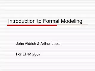
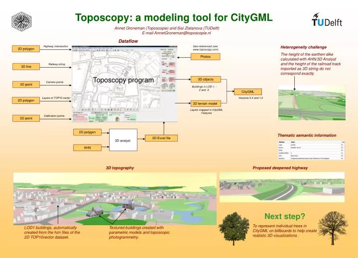
Toposcopy: a modeling tool for CityGML. Annet Groneman (Toposcopie) and Sisi Zlatanova (TUDelft) E-mail AnnetGroneman@toposcopie.nl. Dataflow. Highway intersection. Geo-referenced (see www.toposcopy.com). Heterogeneity challenge

E N D
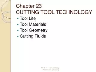
Toposcopy: a modeling tool for CityGML Annet Groneman (Toposcopie) and Sisi Zlatanova (TUDelft) E-mail AnnetGroneman@toposcopie.nl Dataflow Highway intersection Geo-referenced (see www.toposcopy.com) Heterogeneity challenge The height of the earthen dike calculated with AHN/3D Analyst and the height of the railroad track imported as 3D string do not correspond exactly. 3D polygon Photos Railway string 3D line Toposcopy program 3D objects Camera points 3D point Buildings in LOD-1, -2 and -3 CityGML Layers of TOP10 vector Versions 0.4 and 1.0 2D polygon 3D terrain model Layers mapped to CityGML Features Calibration points 2D point 2D polygon Thematic semantic information 3D Excel file 3D analyst AHN 3D topography Proposed deepened highway Next step? To represent individual trees in CityGML on billboards to help create realistic 3D visualizations . LOD1 buildings, automatically created from the hzn files of the 2D TOP10vector dataset. Textured buildings created with parametric models and toposcopic photogrammetry.