Download
1 / 18
200 likes | 438 Views
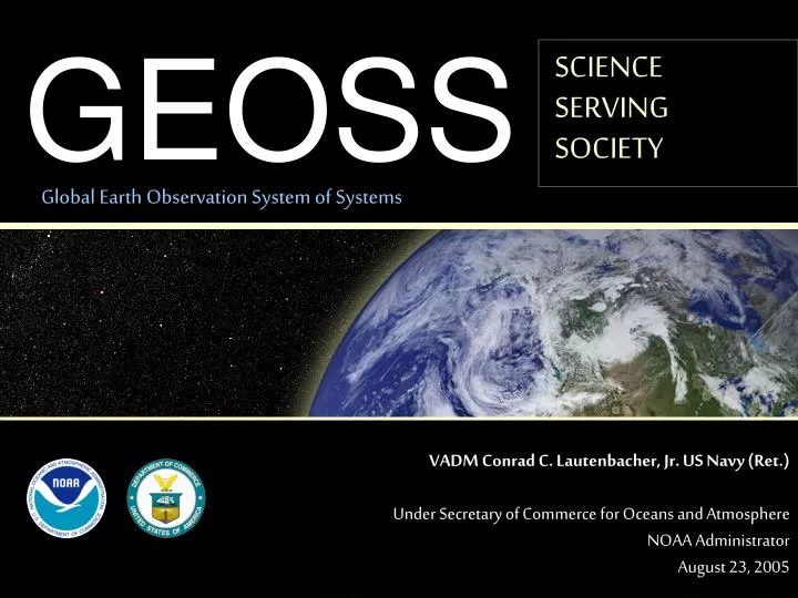
GEOSS. SCIENCE SERVING SOCIETY. Global Earth Observation System of Systems. VADM Conrad C. Lautenbacher, Jr. US Navy (Ret.) Under Secretary of Commerce for Oceans and Atmosphere NOAA Administrator August 23, 2005. GEOSS Overview. EOS I. EOS I July 31, 2003, Washington, D.C.

E N D
GEOSS SCIENCESERVINGSOCIETY Global Earth Observation System of Systems VADM Conrad C. Lautenbacher, Jr. US Navy (Ret.) Under Secretary of Commerce for Oceans and AtmosphereNOAA Administrator August 23, 2005
GEOSS Overview EOS I • EOS I • July 31, 2003, Washington, D.C. • 34 Countries and 20 International Organizations • EOS II • April 25, 2004, Tokyo, Japan • 47 Countries and 26 International Organizations • EOS III • February 2005, Brussels • Nearly 60 Countries and 40 International Organizations • 10-Year Implementation Plan • Commerce Secretary Gutierrez led the US delegation EOS II EOS III
3 1 3 2 3 Americas Europe Africa Asia/Oceania US (co-chair) Brazil Honduras EC (co-chair) Italy Germany SA (co-chair) Morocco China (co-chair) Japan Thailand Commonwealth of Independent States GEO Executive Committee Russia
Executive CommitteeGeneva, Switzerland • Second Meeting in Geneva, June 2005 • Third Meeting in Geneva, September, 2005 • Selected Professor Jose Achache as new GEO Secretariat Director (formerly with ESA) • Discussed rules of procedure for Group on Earth Observations • Set up Committees/Working Groups
GEO Committees • Tsunami Working Group (Jim Devine, USGS) • User Interface Committee • Science and Technology Committee • Architecture and Data Committee • Capacity Building and Outreach • Committees to be led by Executive Committee members; US to have strong participation on each committee
G8 Gleneagles Climate Change Plan of Action • Monitoring and Data Interpretation • 34. The G8 made a commitment at Evian to strengthen international cooperation on global Earth observations. We will continue to exercise leadership in this area, and welcome the adoption of the 10-year implementation plan for development of the Global Earth Observation System of Systems (GEOSS) at the Third Earth Observations Summit which took place in Brussels in February this year. • We will: • (a) move forward in the national implementation of GEOSS in our member states; • (b) support efforts to help developing countries and regions obtain full benefit from GEOSS, including from the Global Climate Observing System (GCOS) such as placement of observational systems to fill data gaps, developing of incountry and regional capacity for analysing and interpreting observational data, and development of decision-support systems and tools relevant to local needs; • (c) in particular, work to strengthen the existing climate institutions in Africa, through GCOS, with a view to developing fully operational regional climate centres in Africa.
G8 Gleneagles Tsunami Response • • We affirm the role of the Global Earth Observation System of Systems (GEOSS), key national and intergovernmental operators of earth observation systems as well as UN agencies, such as the Intergovernmental Oceanographic Commission participate to ensure a co-ordinated and compatible monitoring capacity that balances the need to gather data on a global scale with the need for rapid and effective dissemination.
Intergovernmental Oceanographic Commission • June 30, 2005 • IOC Assembly formally established Intergovernmental Coordination Group for the Indian Ocean Tsunami Warning and Mitigation System (ICG/IOTWS) • Resolution IOC-XXIII-12 • IOC leading the GEO tsunami / all-hazard warning working group with Italy and Thailand
The White House CommitmentFY07 OSTP/OMB Memo • Global earth observations support research in a wide range of sciences important for society. The U.S. Strategic Plan for an Integrated Earth Observations System (IEOS) provides guidance for agencies contributing to these efforts. Agencies should focus on near-term opportunities to pilot integrated observing systems, such as those that contribute to natural hazards assessment and disaster warnings. Agencies also should work through the NSTC U.S. Group on Earth Observations Subcommittee to ensure continued coordination and implementation of the U.S. Strategic Plan and continued strong U.S. leadership in the international community.
U.S. Administration S&T Structure National Science and Technology Council ScienceCommittee Environment & NaturalResources Committee Homeland & NationalSecurity Committee TechnologyCommittee Subcommittee on Global Change Research Air Quality ResearchSubcommittee Ecological SystemsSubcommittee Toxics & Risk AssessmentSubcommittee Subcommittee onDisasterReduction Subcommittee on Oceans USGroup onEarth Observations (US GEO) Subcommittee Subcommittee onWater Availability &Quality Subcommittee on Healthand the Environment(also reports to Committee on Science and Commission onHomeland and National Security
U.S. Contribution to GEOSSAn Interagency Effort IRIS comments to US Integrated Earth Observation System planning: -- recommendation that the GSN is one of the established in situ observation systems that should be components of both the US Integrated Earth Observation System and the Global Earth Observation System of Systems.
IEOS and GEOSSA System of Systems U.S. Component U.S. IEOS GEOSS Seismic Component of U.S. IEOS Seismic Component of GEOSS* FDSN *While not technically a system, FDSN is a participating organization in GEO.
Data Sharing • “The societal benefits of Earth observations cannot be achieved without data sharing.” • - GEOSS 10-Year Implementation Plan • GSN data is freely and openly available in real time via standard internet protocols – a good model for other GEOSS systems • Through the FDSN, IRIS has helped to coordinate technical standards, data exchange, and station siting
Interoperability Specialized Formats Non-Standard Metadata Proprietary Systems
Interoperability Standardized Formats Standard Metadata Open Systems
Identification of Gaps in Coverage • About 130 stations in place • 85% at real- or near-real time • Currently only one on the seafloor
From Vision to Action… • An AGU publication in February of this year stated that the Indian Ocean Tsunami provided the first full-scale test of GSN technical design goals, which scientists set more than 20 years ago. • Eos, Transactions of the American Geophysical • Union, Feb.8, 2004. • “The Indian Ocean tsunami warning system will be an early example of a coordinated and sustained effort in the family of systems foreseen in GEOSS." • UNESCO Director General Matsuura, • speaking to the IOC Tsunami Coordination Group, March 2005.
Challenges • Enhancing interagency, intergovernmental and interdisciplinary collaboration • Expansion to better coverage of the ocean floor • Sharing Infrastructure • multi-observation sensors at established and planned stations • Maintaining political and public visibility on the need for a comprehensive system, as the recovery effort in the Indian Ocean continues