Download
1 / 47
470 likes | 609 Views
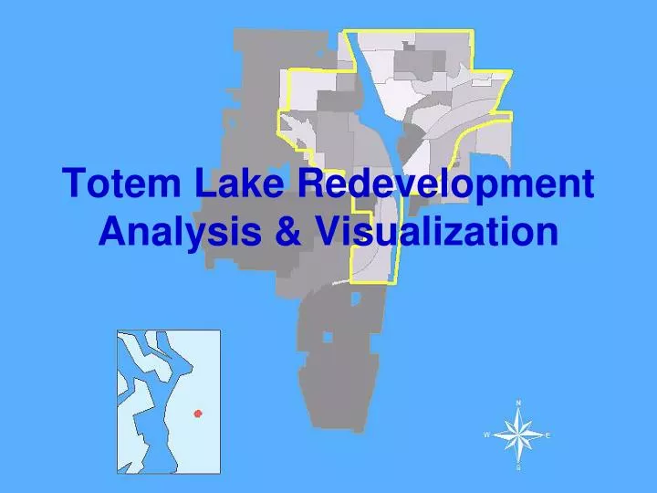
Totem Lake Redevelopment Analysis & Visualization. Project Team. Racheal Jones 3D and Visualization Analyst GIS Analyst Michael Horner 3D and Visualization Analyst GIS Analyst. Suzanne Palmason Project Manager GIS Analyst Korosh Dabestani GIS Analyst. Sponsor. City of Kirkland

E N D
Project Team Racheal Jones 3D and Visualization Analyst GIS Analyst Michael Horner 3D and Visualization Analyst GIS Analyst • Suzanne Palmason • Project Manager • GIS Analyst • Korosh Dabestani • GIS Analyst
Sponsor City of Kirkland • XiaoningJiang • GISAdministrator • EricShields • Director of Planning and Community Development • DorianCollins • Project Planner
The Original Idea 3-D Model Visualization For Totem Lake Commercial District • Thumbnail sketches • 3-D views of various development options • Viewsheds, streetscapes, transportation connections, environmental mitigation, etc.
FOR SALE Totem Square
Proposed Road from Slater to 120th (crossing 124th) Totem Lake Mall Totem Square Shopping Center
Problem Statement Evolution The Project Plan Problem Statement: Identify areas likely to redevelop Assess the current zoning codes capacity to absorb targeted growth. Communicate potential development scenarios to stakeholders. The Original Proposal Description: 3-D Visualization What they really wanted to know: • How does the redevelopment capacity change if we adjust the assumptions about the improvement to land value ratio used as a predictor of redevelopment? • What can you do with 3-D tools to help visualize a proposed road and potential redevelopment in the Totem Square area?
The Ratio: Two houses in the same neighborhood, with same lot size. Property is in a zone that allows four dwelling units on a lot this size. Which one is more likely to be redeveloped?
Methodology • Join Parcels layer with Assessor data tables • Identify redevelopable parcels based on criteria provided by City of Kirkland: • Exclude parks and government institutions • Exclude condominiums • Parcels completely within wetland & stream 50 foot buffer • For parcels that intersect wetland buffer: calculate % of parcel within buffer
Model #2 • Use zone-specific assumptions to calculate redevelopment capacity
Totem Lake Redevelopment Capacity Analysis Results If all parcels identified as redevelopable are developed to their maximum capacity, what’s the capacity for dwelling units and jobs? How does the capacity change if we increase the improvement value to land value ratio used to select redevelopable parcels?
Totem Lake Redevelopment Capacity Analysis Results Zone TL5 Scenario Variations These charts demonstrate the impact of changing assumptions for Office and Residential FAR within the TL 5 zone. Office and Residential FAR values for all other zones remain consistent in each scenario.
Advantages: Visual record of logic Easy for team to review steps and provide feedback Easy to change capacity assumptions & run “what if” scenarios Ability to delete intermediate data (save storage space) Challenges Multiple steps to join tables Select by location requires feature layer input (no shapefiles) Model Builder Pros & Cons
Risks and Challenges • Each review with sponsors uncovered new guidelines for parcels to exclude and forecasting assumptions • Number crunching using GIS • Planning terminology
Phase 2: 3-D Visualization
Methodology • The City of Kirkland asked us to model a potential redevelopment scenario in 3D using ArcScene and Google Sketchup. • Kirkland has design guidelines for future Totem Lake redevelopment. • We used these guidelines to model a redevelopment scenario in District TL 6A (map). • These guidelines call for: • Commercial uses • Multi-family housing • The extension of NE 120th Street
Methodology • Two Main Approaches • When using ArcGIS and Google Sketchup to create scenes there are two basic processes: • ArcGIS to Sketchup • Sketchup to ArcGIS
ArcGIS to Sketchup • To export feature classes, TINs or rasters from ArcGIS to sketchup you need the ArcGIS (beta) plugin. This tool appears after being activated. • Only works in ArcGIS 9.2
Sketchup to GIS How do you bring a sketchup model back into GIS? • Export model as an Autodesk .3ds, 3D modeling file (requires professional version of Sketchup)
Sketchup to GIS • Import .3ds file as an ArcGIS Style (Tools/Style Manager/Style Manager)
Sketchup to GIS • Create new Marker Symbol
Sketchup to GIS • Assign Marker Symbol as a point symbol • Note: You will need to convert polygons to points using ArcToolbox (requires ArcInfo)
Sketchup to GIS • If you need to change an attribute of your symbol after seeing it in the scene, you can do that in Style Manager. • Getting your Marker Symbol sized and aligned correctly will likely require a series of adjustments.
Risks and Challenges • Schedule (not enough time to complete the phase) • Access to resources • Knowledge about the process (best practices, challenges, what’s doable) • Software • Only have access to ArcInfo in UW lab • Don’t have access to SketchUp Pro (downloaded trial multiple times)
Risks and Challenges • Technological Issues • ArcGIS 9.3 not supported by the Sketchup 'Export to ESRI multipatch' and is not seamless in 9.2. • ArcScene is buggy. • Textures would not stay on polygons and lines. • The 3D library objects, after adding a new menu, would disappear and come back randomly. • Error messages and crashes occur constantly. • File corruption due to stability problems. • Takes a lot of power to run a 3D model smoothly • Hard to make models align with boundaries in the scene • Difficult to navigate around and get good shots.
Risks and Challenges • Limited functionality in ArcScene • Does not allow for detailing • Must create your own data to assign character to a scene (unless it is imported from SketchUp) THIS TAKES FOREVER!
Lessons Learned Look for work tracks that can happen in parallel. (Requires a good understanding of dependencies!) Creating a 3D scene takes time! Details are important for a good show. Ask sponsors for background info & reference materials. For 3-D visualization, access to the full software packages are important. It’s challenging to build a plan for something you’ve never done before. Get input, and keep revising as you go.
Highlights • Learned some new functions: • create random points • feature to point • convert 2D data to 3D data • create 3D data • Assigning textures and importing 3D objects • Geoprocessing with Model Builder • Data conversion • Provided City of Kirkland with reusable models for capacity analysis