Download
1 / 30
300 likes | 308 Views
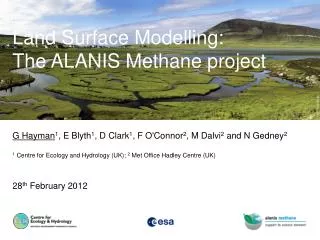
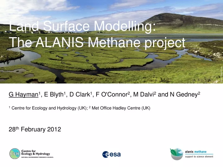
G Hayman 1 , E Blyth 1 , D Clark 1 , F O'Connor 2 , M Dalvi 2 and N Gedney 2 1 Centre for Ecology and Hydrology (UK); 2 Met Office Hadley Centre (UK) 28 th February 2012. Land Surface Modelling: The ALANIS Methane project. Contents and acknowledgements. Contents. Background

E N D
G Hayman1, E Blyth1, D Clark1, F O'Connor2, M Dalvi2 and N Gedney2 1 Centre for Ecology and Hydrology (UK); 2 Met Office Hadley Centre (UK) 28th February 2012 Land Surface Modelling: The ALANIS Methane project
Contents and acknowledgements Contents • Background • ALANIS Methane project • Land surface modelling with JULES • Key Messages and future activities Acknowledgements • ALANIS Methane project partners • European Space Agency • iLEAPS
ALANIS Methane: Project aims, objectives and outputs Aims and Objectives • To produce relevant Earth Observation products for land surface modelling of the methane emissions from wetlands • To improve the emission estimate of methane from boreal Eurasian wetlands Outputs • Earth Observation datasets relevant to methane emissions from wetlands • Modelled emission flux estimates from wetlands • Peer-reviewed papers
Background • Wetlands are largest natural source but there are large uncertainties • CH4 wetland emissions by diffusion across the soil or water interface, by ebullition (bubbling), and by plant-mediated transport US EPA, 2010 • Key parameters for land surface and climate modelling: • wetland extent • temperature • soil carbon 4 Source: http://www.riceweb.org/reserch/Res.issmethane.htm
ALANIS Methane: EO products for large-scale land surface modelling Column CH4 (Bremen) JULES (CEH) Wetland Extent (CNRS/Estellus) Surface State (Vienna)
ALANIS Methane: Focus on Northern Eurasia, 2007-2008 • Test Site #1: Western Siberia (N) • Subarctic-Arctic • continuous to discontinuous permafrost • hotspot of lake change • Test Site #2: Western Siberia (S) • Boreal • Ob river floodplains • sporadic to discontinuous permafrost • extensive peatlands • Test Site #3: Lower Lena River floodplain and delta • Subarctic to High Arctic lowlands • key region for understanding the basic processes of the dynamic and development of permafrost in the Siberian Arctic • upstream basin with flood plains • extensive delta area with several terraces 6
Estellus: Regional Wetlands Extent and Dynamics • Existing product • Use satellite data at different wavelengths (ERS scatterometer, SSM/I, AVHRR) • Global coverage with spatial resolution compatible with climate studies • Long time series (1993-2007) • Several publications [Prigent et al., GRL, 2001; JGR, 2007; Papa et al., JGR, 2010] • For ALANIS methane, adjustments in methodology • Use MetOP ASCAT scatterometer data • Higher temporal resolution (10 days from monthly)
TU Wien: Surface Water Bodies • New product based on ENVISAT ASAR Wide Swath • Classification of open water surfaces, 10-day updates for maps of wetland dynamics • Cross-comparison with the regional wetland product planned June 2007 September 2007
TU Wien: Snowmelt and Ground freeze/thaw • Metop ASCAT • Algorithm development based on ECMWF ERA-Interim soil temperature • Post-processing to identify day of year • Begin of thaw • End of thaw • Refreeze
SCIA WFMD v2.0.2 Schneising et al., ACP, 2011 NOAA surface CH4 South Pole IUP, Bremen: Sciamachy atmospheric column methane Recent increase (~ 7-8 ppb/yr) Noisier after Oct. 2005 due to detector degradation
JULES – Modelling methane emissions from wetlands FwCH4 = kCH4* fw * Cs * Q10(Tsoil)(Tsoil-T0)/10 FwCH4 = methane flux from wetlands kCH4 = scaling factor fw = wetland fraction Cs = “substrate”: fixed soil carbon content Q10 = temperature sensitivity • Gedney et al [2003, 2004] parameterisations of large-scale hydrology and wetland biogeochemistry • Modelled wetland fraction is based on soil moisture saturation • Current version has no overbank inundation • Can be used in different configurations: • Point/Offline • Gridded/Offline • Coupled into atmospheric chemistry model http://www.jchmr.org/jules/ 11
Use of EO products with JULES • Inundation products • Test ability of JULES to reproduce spatial and temporal patterns of ’wetland’ extent • Products can be to evaluate (’constraint’) or define (’driver’) wetland extent • Surface state • Test soil physics in JULES • Products can be to evaluate (’constraint’) • Sciamachy CH4 columns • Test of JULES wetland scheme • NOTE: Other products also being used (e.g., Land surface temperature, snow cover, ....)
JULES Offline model configuration • Several versions of JULES, resolutions and input datasets have been used. • Runs presented here use: • JULES v3.0 (the latest version) • 0.5x0.5° global grid (some runs on test areas only) • CRU-NCEP 6-hourly meteorological data • New input fields (“ancillary files”) for this grid including topographic index data from Hydro1k • TOPMODEL-based parameterisation of wetlands (and runoff generation) • Prescribed vegetation (no dynamic vegetation model) 13 Background Boreal Wetlands African Wetlands Future/Summary
Offline JULES vs. EO Regional Wetland product Estellus JULES Western Siberia Lena 1st -10th September 2007
Regional Wetland product: Area averages North Western Siberia (North+South) South
Offline JULES vs. EO Surface State product: area averages Lena Western Siberia (North+South) • Timeseries of fraction of area with frozen ground • Currently no direct equivalent diagnostic in JULES • Use frozen and/or melting fraction • ‘Autumn melt’ events in JULES.
Comparison with TU Wien Surface Soil Moisture product Circumpolar product, regridded to 0.5°. Soil moisture (as fraction of maximum) on 15th April 2007.
Comparison with Surface Soil Moisture product: Area averages Lena Western Siberia (North+South) Some differences in seasonality. Amplitude good.
Surface Soil Moisture product: 1st-10th September 2007 Western Siberia (North+South) TU Wien JULES
JULES as land surface module in HadGEM2/3-A • Intention to use latest generation Hadley Centre climate model (HadGEM3) : • Can be nudged to observed meteorology • Regional configurations available • Initial runs showed that the configuration of the model used was not ‘reactive’ enough; this could not be corrected by tuning of parameters • Reverted to HadGEM2-ES • Used for IPCC AR5 Assessment • Paper in GMD [Collins et al., 4, 1051, 2011] • Nudged version of ‘optimised’ AR5 HadGEM2-ES run created UKCA tropospheric chemistry scheme Emitted species: CO, NOx , CH4, C2H6, C3H8, HCHO, CH3CHO and CH3COCH3
JULES: HadGEM2 AR5 CH4 emission inventories • All sources (526 Tg CH4 per annum) • All sources except wetlands (345 Tg CH4 per annum) • Wetlands from Fung et al (1991) (181 Tg CH4 per annum)
Wetland emissions • Modelled 2000-2005 period using different wetland emission scenarios: • ‘AR5’ distribution based on Fung et al. (total =181 Tg pa) • JULES masked by EO (total =181 Tg pa) • JULES driven with EO (total =181 Tg pa) • JULES driven with EO (total =200 Tg pa) • JULES driven with EO (total =165 Tg pa) • JULES unconstrained not used
Model runs for ALANIS methane • HadGEM2-ES • Year-on-year sea surface temperatures and sea ice distribution • Nudged using ECMWF ERA40 • Created year-on-year emission inventories • EDGAR v4.2 for anthropogenic, shipping and aviation • GFED v3.1 for biomass burning (scaled to give AR5 decadal mean) • Natural sources as used before • NOTE increase in anthropogenic CH4 (and other) emissions (*) • (*) See Monteil et al, ACP, 2011
Comparison with surface measurements AR5 emissions JULES (masked) JULES+EO • Atmospheric Methane Dry Air Mole Fractions, 1983-2009 • NOAA ESRL Carbon Cycle Cooperative Global Air Sampling Network • Used 15 sites
Comparison with Sciamachy: Annual mean (preliminary) • xgxja: AR5 emissions based on Fung et al. [1991] • xfzal: JULES wetland emissions masked with EO • xfzam: JULES wetland emissions with EO wetland fraction
Comparison with Sciamachy: Zonal means (preliminary) • Black: Sciamachy • Red: AR5 wetlands [Fung et al., 1991] • Green: JULES (masked) • Blue: JULES (EO) • Blue lines: JULES (EO) sensitivity runs
HadGEM Next Steps and Summary Next steps • Check the spatial patterns of the wetland emissions – rice/paddy fields: in progress • Investigate column profiles (fall off of methane too strong in UKCA??): Sciamachy stratospheric CH4 products • Further model runs, potentially including those from inverse modelling (to 2008) Summary • Nudged version of HadGEM2-ES setup to investigate wetland methane emissions • First use of Sciamachy to test model performance; preliminary analysis indicates that the model underestimates the methane column, greater than differences in inventories • Value of EO inundation product (increases extra-tropical contribution)
Website and Data Dissemination http://www.alanis-methane.info
Summary and future activities Summary • New EO products developed relevant to methane emissions from wetlands • EO and emission datasets produced for boreal Eurasia for 2007-2008 • Land surface modelling using the UK JULES model in 3 configurations • EO products have identified areas for improvement in the model in hydrology and biogeochemistry Future activities • Ongoing activities to model wetlands (through NERC grants on African and high latitude wetlands) • Established links with UKCA team (Cambridge/Met Office) • Developing links with NCEO atmosphere (Palmer, Chipperfield) • Bring insight gained from NCEO Atmosphere and Land themes into forward modelling • Longer term – benchmarking datasets