Download
1 / 22
220 likes | 468 Views
Introduction to Ricoh Camera & GPS-Photo Link – Ricoh Edition. Camera & Software that maps your photos. The Problem. More and more industries are using photographs to illustrate the data points they collect with their GPS.

E N D
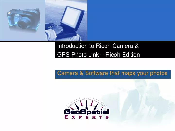
Introduction to Ricoh Camera & GPS-Photo Link – Ricoh Edition Camera & Software that maps your photos
The Problem More and more industries are using photographs to illustrate the data points they collect with their GPS. After collecting data in the field all day, field workers come back to the office and try to match their photos with their location.
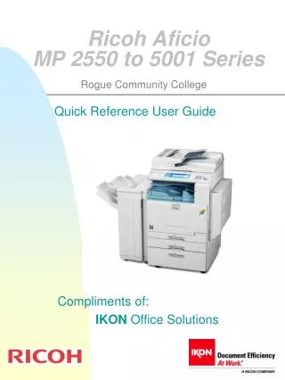
Solution# 1 • Ricoh Digital Camera with GPS + • GPS-Photo Link- Ricoh Edition
Ricoh Camera Features • 8.0 mega pixels with 3X optical zoom • Ruggedized waterproof and shock resistant • Bluetooth built-in with Optional Wi-Fi Card • Memos to record attributes • Video Clips • WAAS GPS
GPS-Photo Link Software GPS-Photo Link software that “links” digital photos to the GPS coordinates where they were taken. The simple “wizard style” interface processes hundreds of photos in minutes, not weeks.
How to use Camera/GPS-Photo Link-Ricoh Edition Step 1 Step 2 All Done! Take pictures while GPS collects data. NO GPS Expertise NEEDED! Run GPS-Photo Link on your computer. GPS-Photo Link will download your pictures with GPS data, creating shape files and web pages. View your pictures with location labeled. View webpage with your photos on maps. Use shape files and ArcView Extension to create your own maps using ESRI’s ArcView products..
Or use the simpleOne-Click Processing The Ricoh Edition of GPS-Photo Link features a “one-click” option for processing pictures. • GPS-Photo Link creates a toolbar within ESRI’s ArcGIS versions 8.x or 9.x. Simply click on the icon to start GPS-Photo Link. • Then in one click, your photos will be brought into ArcGIS as shape files where you can view them as thumbnails or full-size photos.
Solution #2 • Camera (e.g. Ricoh 500SE without GPS) + • GPS with Bluetooth + • LTI TruPulse (optional) + • GPS-Photo Link
GPS Features GPS: Trimble with Bluetooth • GeoXM & GeoXT • Recon & Recon GPS Card ed. • Pro XT & Pro XH receivers • Pathfinder XB receiver The Bluetooth sends the coordinates to the camera so that they are embedded with the picture.
Integration with TruPulse • GPS-Photo Link will work with TruPulse data incorporating them as attributes of the photos. • Maps will show the direction and distance to the object in the picture.
The Finished Product Web Pages & ArcGIS Shape Files
Web page output GPS-Photo Link creates an overview page with: • an overview map indicating where all the photos were taken (click on a point and that photo will pop up), • a thumbnail directory of all photos. Overview Maps Thumbnail Directory
Web pages for each photo A web page is created for each photo including: • watermarked photo • maps downloaded from the internet • information about the photo including date, time, location and any comments. Watermarked Photo Maps downloaded from the Internet Information about the photo
ArcGIS Extension • ArcView 8.x & 9.x extension allows • hot-linked photos plus: • Hover over a point and the thumbnail photo will popup (must have "Web Pages (HTML)" selected as file output in GPS-Photo Link). • Click on a point in the picture.shp theme, the watermarked photo will then be displayed. • Load Picture as Layer : Loads the photo as a theme in ArcMap. Useful for use in layouts. • Load Background Image - Loads a downloaded background image, such as an aerial photo or topo map.
Google Earth • GPS-Photo Link automatically imports your photos and track logs into Google Earth. Google Earth allows you to view from the ground perspective in metro areas. Distance data from the Laser allows you to create 3d cones showing photo area.
Potential Uses Anywhere that a GPS and camera are in the field. Typical uses include: • Natural Resources & Environmental Management (inc. local, state, national governments in parks, forests, wetlands, etc.) • Military and Homeland Security • Emergency response (inc. natural disasters, fire mitigation & insurance assessments) • Utilities (inc. telecommunications, electricity, water) • Oil & Gas • Survey & Engineering Companies • Departments of Transportation
Who are current customers? There are over 1000 organizations using GPS-Photo Link. Here is a sample from a variety of fields: • United States Marines, Army, Army Corps of Engineers, Air Force, DOD, Department of State, Northrop Grumman Missile Systems • Centers for Disease Control and Prevention, Federal Emergency Management Administration • Duke Energy, Pole Maintenance Company, Oil Spill Response, Ltd., Osmose Utility Services, Raytheon • Departments of Transportation in Georgia, Texas, Minnesota, Florida • U.S. Bureau of Land Management, U.S. Forest Service, U.S. National Parks, U.S. Fish & Wildlife, Federal Highway Administration, National Marine Fishery • Manitoba Hydro, Nuecess River Authority, Honolulu Board of Water Supply • Missoula County Weed Control, U.S. Department of Agriculture • Universities of Guelph, Copenhagen, British Columbia, New Mexico, Auburn University, Pontifica Universidad Catolica Del Peru • Austrialia Department of Environment and Heritage, State of Qatar, British Embassy, Ontario Ministry of Natural Resources • Smithsonian Museum, Rhode Island Natural History Survey
Use Case #1 Streetlight Inventory was Easy for EMA • EMA, Inc, a workflow optimization company, needed to quickly inventory and geo-locate all of a city’s light poles and record the wattage, arm-length, pole material, pole height, and light source. • “We needed a way to identify and photograph almost 30,000 street lights,” says A.J. Romanelli of EMA, Inc. “After researching all available options, the Pro G3 stood out as the optimal device for our application. The camera did exactly what we needed it to do and allowed us to finish the project ahead of schedule and without errors.” • In the end, four one person teams were able to inventory, geo-locate, and collect field notes on 26,501 poles and 28,313 luminaries in only three months – and that includes post-processing. The EMA team averaged one pole per minute. • Imagine what the 500SE and GPS-Photo Link could do for your next survey.
Advantages to using Camera/GPS-Photo Link Without GPS-Photo Link, field workers take pictures and write down the coordinates on a notepad. GPS-Photo Link is a superior solution because it automatically labels pictures and creates maps. For customers, this solution: • Saves time in the field (no note taking) • Saves time in the office (process hundreds of photos in minutes) • Increases accuracy • Simple to use in the field • Involves no additional wires • Can be processed in central office.
Use Case #2 GPS-Photo Link Saves Time for U.S. Forest Service Dick Ford is a Fisheries Biologist who uses GPS-Photo Link for geo-referencing photos of temperature monitoring locations, remote automated weather stations, and stream cross section surveys. “We can geolocate photos a lot more quickly than we did before. In fact, it is easier to send someone out in the field to take new pictures and process them with GPS-Photo Link, than it is to try and map old pictures manually.”
Contact Information • Website: www.geospatialexperts.com • Address: GeoSpatial Experts 12000 N Washington STE 385 Thornton, CO 80524 USA • Phone: 303-255-2908 • Fax: 303-362-7129 • Email: Info@GeoSpatialExperts.com