Download
1 / 35
350 likes | 352 Views
This proposal aims to assess tsunami hazards and model potential tsunami inundation along the U.S. East Coast. The project will review existing literature, conduct probabilistic analysis, and simulate tsunamis from various sources. The goal is to identify high-risk areas and create maps for targeted sites.

E N D
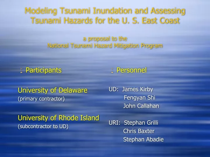
Modeling Tsunami Inundation and Assessing Tsunami Hazards for the U. S. East Coasta proposal to the National Tsunami Hazard Mitigation Program • Participants University of Delaware (primary contractor) University of Rhode Island (subcontractor to UD) • Personnel UD: James Kirby Fengyan Shi John Callahan URI: Stephan Grilli Chris Baxter Stephan Abadie
Project Goals • Assess tsunami hazard from a range of event types with possible impact on the U.S. East Coast. • Identify most likely candidate sites for mapping and modeling. • Perform local inundation studies and begin construction of inundation and evacuation maps for targeted sites.
Approach • Project is divided into five tasks, all of which fall within the scope of Section 1: Mapping and Modeling, and all of which support the NTHMP Strategic Metric 1: “Successful execution of NTHMP tsunami mapping, modeling, mitigation, planning and education efforts”
Task 1.1:Review of Existing Literature on Tsunami Hazard Assessment and Tsunamigenic Sources affecting the U. S. East Coast • Lack of historical tsunami records • Uncertainty regarding the magnitude and return periods of potential large-scale transoceanic events (e.g., large co-seismic source from the Azores-Gibraltar convergence zone or Puerto Rico; volcanic island flank collapse, e.g., Cumbre Vieja) • Most significant tsunami hazard in this region may arise from “local” Submarine Mass Failures (SMF) triggered on the continental slope by moderate seismic activity (e.g., the 1929 Grand Bank landslide tsunami)
Task 1.1:Review of Existing Literature on Tsunami Hazard Assessment and Tsunamigenic Sources affecting the U. S. East Coast • assess tsunami hazard from the above and other relevant tsunami sources recently studied in the literature (ten Brink et al., 2008; MG special issue, 2009) => assess tsunami hazard from the above and other relevant tsunami sources recently studied in the literature [ten Brink et al. (2008); Marine Geol. special issue (2009)]
Task 1.2:Probabilistic analysis of coastal hazards associated with submarine mass failures (SMF) • SMF tsunami hazard will be obtained from a probability analysis, using a Monte Carlo (MC) model, which was developed and applied to the region from New Jersey to Maine (Grilli et al, 2009). • This MC model will be extended to coastal regions down to the Florida border: hs [Selected shelf transect geometry]
Task 1.2:Probabilistic analysis of coastal hazards associated with submarine mass failures (SMF) • This MC model will be extended to coastal regions down to the Florida border: • => Stochastic selection of • sediment properties, SMF • type, size and location/depth • => Selection of seismic • ground acceleration based • on location and return period => Stochastic slope stability analysis (transl. or rotational) => Tsunami generation based on SMF parameters from earlier numerical modeling of SMF tsunami (Grilli et al, 2005, 2009)
Task 1.2:Probabilistic analysis of coastal hazards associated with submarine mass failures (SMF) • This MC model will be extended to coastal regions down to the Florida border. [Global seismicity] [Local seismicity]
Task 1.2:Probabilistic analysis of coastal hazards associated with submarine mass failures (SMF) • This MC model will be extended to coastal regions down to the Florida border:
Task 1.2:Probabilistic analysis of coastal hazards associated with submarine mass failures (SMF) • This MC model will be extended to coastal regions down to the Florida border: [Tsunami propagation] [Ex.: Runup: 100 y (---); 500 y (- -)]
Task 1.2:Probabilistic analysis of coastal hazards associated with submarine mass failures (SMF) • This MC model will be extended to coastal regions down to the Florida border: => The extended MC model will be run from Florida to Maine => Based on MC results, parameters will be selected for a large number of realistic SMF sources, representing specific SMF tsunami hazard in the region (e.g., 100, 500 years). => The selected SMF tsunami sources will be used to perform actual simulations of tsunami generation, propagation, and coastal impact (-> inundation and runup in nested grids). => Other relevant SMF sources from historical cases known in the region (e.g., 1929 Grand Bank, Piper et al., 1999; Currituck slide, Geist et al., 2009, Locat et al., 2009) will also be designed and simulations will be performed.
Task 1.2:Probabilistic analysis of coastal hazards associated with submarine mass failures (SMF) • Example of SMF modeling using Spherical BM (FUNWAVE) in the Aleutian arc (Waythomas, Watts, Shi and Kirby , 2009):
Nearfield calculations: 2 km x 2 km UTM gridSource configurations from TOPICS model (Watts)
Task 1.3: Simulation of transoceanic tsunamis from co-seismic sources and volcanic island flank collapse (e.g., Cumbre Vieja Volcano; CVV) • Co-seismic sources will be designed and their parameters selected, based on available literature (e.g., USGS, 2001; ten Brink and Lian, 2004; ten Brink, 2005; Dawicki, 2005; Jansma, 2008; Grilli et al., 2008, 2010; Barkan et al., 2009), for the Carribean subduction zone (North of PR), the Azores-Gibraltar convergence zone, and other relevant cases (e.g., Leeward Island subduction zone). • Transoceanic propagation of each selected source will be simulated in nested grids (ocean basin -> coastal), using our latest spherical FNBM (Kirby et al., 2009), initialized using Okada’s (1985) method.
Example of co-seismic source : Boussinesq model simulation of 2004 Indian Ocean event • Source parameters optimized based on Indian Ocean tide gage records, and Jason II satellite altimeter record [Grilli, Ioualalen, Asavanant, Shi, Kirby, Watts (2007)]
Example of co-seismic source : Boussinesq model simulation of 2004 Indian Ocean event • Source parameters optimized based on Indian Ocean tide gage records, and Jason II satellite altimeter record [Grilli, Ioualalen, Asavanant, Shi, Kirby, Watts (2007)]
Boussinesq model simulaiton of 2004 Indian Ocean event • Optimized source used to perform high resolution simula- tions of impact on coast of Thailand [Ioualalen, Asavanant, Kaewbanjak, Grilli, Kirby and Watts (2007)]
Simulations:=> revealextreme spatial variability in runup heights due to bathy-metric complexity[Ioualalen et al (2007)
Simulations: => revealextreme spatial variability in runup heights due to bathy-metric complexity[Ioualalen et al (2007) [Model Grid Nesting]
=> Model simulations recover measured runups with good accuracy[Ioualalen et al (2007)]
Task 1.3: Simulation of transoceanic tsunamis from co-seismic sources and volcanic island flank collapse (e.g., Cumbre Vieja Volcano; CVV) • Preliminary simulations of a Puerto Rico 9.1 co-seismic source
Task 1.3: Simulation of transoceanic tsunamis from co-seismic sources and volcanic island flank collapse (e.g., Cumbre Vieja Volcano; CVV) • Preliminary simulations of a Puerto Rico 9.1 co-seismic source
Task 1.3: Simulation of transoceanic tsunamis from co-seismic sources and volcanic island flank collapse (e.g., Cumbre Vieja Volcano; CVV) • Realistic CVV sources will be designed and their parameters selected, based on earlier work (e.g., Moss et al., 1999; Day et al., 1999; Ward and Day, 2001; Hildenbrand et al., 2003; Pérignon, 2006; Grilli et al., 2006; Lovholt et al., 2008; Abadie et al, 2009a,c) . • 3D simulations of these subaerial landslide tsunami sources, will be performed using a multi-fluid Navier-Stokes (NS) VOF model (Abadie et al., 2008, 2009a,b,d). Recent surveys of CVV topography and seafloor bathymetry will be used (Abadie et al., 2009c). • Transoceanic propagation performed as above
Task 1.3: Simulation of transoceanic tsunamis from co-seismic sources and volcanic island flank collapse (e.g., Cumbre Vieja Volcano; CVV) • Preliminary work on CVV included surveys and slope stability analyses using a FEM model : => Failure parameters (geometry, 60 km3, volume )
Task 1.3: Simulation of transoceanic tsunamis from co-seismic sources and volcanic island flank collapse (e.g., Cumbre Vieja Volcano; CVV) • Preliminary work on CVV source :
Task 1.3: Simulation of transoceanic tsunamis from co-seismic sources and volcanic island flank collapse (e.g., Cumbre Vieja Volcano; CVV) • Preliminary work on CVV source propagation :
Task 1.4: Inundation Modeling for High Risk East Coast Communities • Modeling will be performed using the Boussinesq wave model FUNWAVE, developed at UD. • Modeling to be carried out using high resolution DEM’s (existing or under development) where available. • Initial prioritization of communities to be based on prior studies. Subsequent choice of communities will use results from the proposed effort.
Simulation Model: FUNWAVE • Model developed at UD (fully nonlinear and dispersive Boussinesq model). • Cartesian grid version has been used extensively in studies of nearshore processes and tsunami generation/propagation/inundation (see above). • Spherical grid version available for ocean-scale simulation. Model is parallelized for efficient application. • Performance relative to PMEL-135 benchmarks will be documented separately.
Task 1.5: Construction of Inundation maps for Modeled East Coast Communities • Inland flood inundation maps will be based on high resolution DEMs, likely LiDAR based, consistent with DEMs used in Task 1.4. • Output flood maps will be created in web and print form at 1 foot increments, similar to the vertical resolution/RMSE of many large scale LiDAR datasets. • Maps will be created using a GIS. • Flood areas will be displayed along with local area data (roads, aerial imagery)
U. Delaware/ U. Rhode IslandFY 10 Funding Plan/Proposal Total request for FY10: $196,081
U. Delaware / U. Rhode IslandFY 11 Funding Plan/Proposal Total request for FY11: $197,774
U. Delaware / U. Rhode IslandFY 12 Funding Plan/Proposal Total request for FY12: $199,854. Total request for project: $593,709