Download
1 / 30
300 likes | 305 Views
This document discusses the census mapping process in Portugal, focusing on the use of geographical information systems (GIS) for the Census 2011. It covers the development of census maps, national territorial divisions, the digital census mapping program, and the 2007 technological infrastructure.

E N D
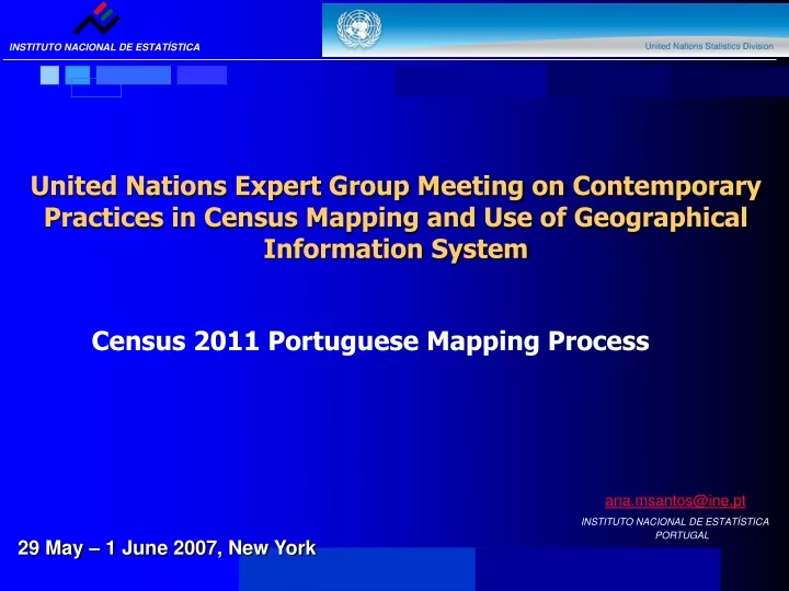
United Nations Expert Group Meeting on Contemporary Practices in Census Mapping and Use of Geographical Information System Census 2011 Portuguese Mapping Process ana.msantos@ine.pt INSTITUTO NACIONAL DE ESTATÍSTICA PORTUGAL 29 May – 1 June 2007, New York
AGENDA • Census Maps (1981 - 1991 – 2001) • National Territorial Divisions • Administrative • Statistical • Digital Census Mapping Program • Activities carried out during the period 1997/2001 • The 2007 Technological Infra-structure • 2011 Census Maps • Final Notes
1. CENSUS MAPS • For the 1981 Census: • cartography as a means of support for data collection • major cities
1. CENSUS MAPS • For the 1991 Census: • A full geographical basis of the whole Portuguese territory • “Geographic Spatial Referencing Basis” (BGRE 1991) – analogical format –
1. CENSUS MAPS • In 1995 – Beginning of the work on the cartographic infra-structure to support the 2001 Census • “Geographic Information Referencing Basis” (BGRI 2001)
2.NATIONAL TERRITORIAL DIVISION NATIONAL ADMINISTRATIVE DIVISION • DISTRICTS - 18 AUTONOMOUS REGIONS – 2 • MUNICIPALITIES – 308 • PARISHES - 4260
2.NATIONAL TERRITORIAL DIVISION NATIONAL STATISTICAL DIVISION – BGRI 2001 Each basic administrative unit, the “Parish”, is subdivided into smaller statistical areas – statistical sections and subsections • STATISTICAL SECTIONS –16 094 Territorial unit representing the continuous area of a single Parish with approximately 300 dwellings • STATISTICAL SUBSECTIONS – 177 893Territorial unit which identifies the smallest homogeneous area, whether built-up or not, existing within the statistical section. It represents a block in urban areas, a locality or part of a locality in rural areas
2.NATIONAL TERRITORIAL DIVISION NATIONAL STATISTICAL DIVISION EXAMPLE: District of FARO subdivided into 15 Municipalities
2.NATIONAL TERRITORIAL DIVISION NATIONAL STATISTICAL DIVISION EXAMPLE: Municipality of FARO subdivided into 6 Parishes
2.NACIONAL TERRITORIAL DIVISION NACIONAL STATISTICAL DIVISION EXAMPLE:Statistical Section subdivide into 18 statistical subsections
3. DIGITAL CENSUS MAPPING PROGRAM 1997/2001 – Implementing a full digital Census mapping program • Main Decisions and Tasks: SETTING UP A GIS UNIT WITHIN THE NATIONAL STATISTICAL OFFICE in a regional structure • Acquiring the specific skills (new staff members, continuous training) • Acquiring GIS technologies • Providing access to geographic data
3. DIGITAL CENSUS MAPPING PROGRAM • Main Decisions and Tasks: COOPERATION STRATEGY • Partnerships between: • The Portuguese National Statistical Institute • Major institutional producers or users of geographic data: • National Mapping Agency • Portuguese Postal Services • Army Geographical Institute • Municipal Associations and Municipalities
3. DIGITAL CENSUS MAPPING PROGRAM • Main Decisions and Tasks: BUILDING STAGES - Updating the 1991 census mapping - BGRE 1991 This process was carried out following different stages: • Building the digital version of analogical BGRE 1991 (performed by the Army Geographical Institute) • Editing the BGRE 1991 - preliminary BGRI 2001 – (performed by National Statistical Institute and very fewMunicipalities) • Datavalidation (performed by the Municipalities) • Printing process (performed by the Army Geographical Institute) • All the following information was verified and ratified: • the administrative boundaries of each Parish • the identification of localities (place, names and perimeters) • the model of statistical division proposed
3. DIGITAL CENSUS MAPPING PROGRAM • Main Decisions and Tasks: MAJOR PROBLEMS • Inexistence of updated and standard geographical reference data for the whole country • Different versions of administrative boundaries– Municipalities (NUTS 4) and Parishes (NUTS 5) – and difficulties in defining both the name of localities and boundaries • Inexistence of updated data about the number of dwellings in each statistical section, for the purpose of size definition • The large dimension of the editing process and maps plotting • The difficulty in importing and checking the quality of local edited data, when the municipalities had assumed the responsibility to create the BGRI 2001
4. THE 2007 TECHNOLOGICAL INFRA-STRUCTURE DATA INFRA-STRUCTURE (GEODATABASE) • The geographical information : - stored in a centralized Database of images and vectorial data - divided into 6 logical groups: • Reference Data • Administrative Units • NUTS Units • Census Units • Streets • Buildings
4. THE 2007 TECHNOLOGICAL INFRA-STRUCTURE • features of the NSI spatial data infra-structure
ArcSDE ArcIMS ArcGis Server ArcView3 ArcGis9 ERDAS Desktop Server Files DBMS Data 4. THE 2007 TECHNOLOGICAL INFRA-STRUCTURE • ESRI SOFTWARE • The NSI has acquired, since 1997, ESRI software products
5. 2011 CENSUS MAPS GOALS • The essential target of the preparation of census cartography for the 2011 Census (BGRI 2011)can be established according tothe following : • to update in an exhaustive way the geographical/administrative and statistical boundaries • to update the contents of statistical sections (enumeration districts), related to the number of dwellings This set of goals ensures the production of a mapping support identical to the one used during the 2001 Census
5. 2011 CENSUS MAPS GOALS • Data infra-structure improvements- regarding the quality of the streets logical group database with:from sources already available: • street names • building numbers • municipalities • commercial firms of street networks • Advantages to the Census operation: • the identification of the majority of addresses visited by the enumerators
5. 2011 CENSUS MAPS GOALS • Apart from this, a street network providing addresses would allow : • a comparative analysis of all files used at NSI (as long as they contain an address) • the beginning of an infra-structure of greater flexibility in the creation of sample bases
5. 2011 CENSUS MAPS STRATEGY • NSI should privilege a cooperation strategy with official organizations producing or owning geographical information:for: • National Mapping Agency • Municipal Associations and Municipalities • the acquisition of updated reference cartography of large scale • the updating of the Geographical Reference Infrastructure
5. 2011 CENSUS MAPS METHODOLOGIES • Key procedures adopted by NSI to create the 2011 Census map: • The use of official administrative boundaries • The use of large scale orthophotomaps to perform the editing process • Choosing ArcGis Server to develop a web application to support the editing process • Conducting an assessment of the possibility of using external commercial or municipality data to build a network street file
5. 2011 CENSUS MAPS METHODOLOGIES • In spite of :the need to do the editing and classification work, related to the: • Existence of geometrically wrongly positioned arcs • Out of date data (digitalization of new arcs) • Inexistence or deficient classification of arcs with attribute addresses • The technical use of commercial data, as nuclear data for the updating of the geographical reference infra-structure is possible • it enables NSI to minimize the effort of digitalization of new arcs and polygons, and increase the availability of address attributes
New Administrative Boundaries Editing Data Set Reference Data Streets Network Editing Reference Data Rules Other Editing Structuring Elements Funcionalities BGRI 2011 Polygon Creation Process • BGRI 2011 building stages:
5. 2011 CENSUS MAPS DIFFICULTIES in classifying the statistical subsections of the 2011 BGRI: • The Codification System in 1991 BGRE and 2001 BGRI uses a numerical sequenciality but does not allow the use of the same code when changes occur to the boundaries of statistical subsections or sections • Because: • the identification system offers two digits while numbering the subsection within the section • the definition of a considerable number of new statistical subsections is expected • This codification system is no longer valid
5. 2011 CENSUS MAPS DIFFICULTIES • Census 1991 / Census 2001 • MAINTENANCE OF HISTORY: • made possible by the creation of a Minimum Common Base (BMC) 1991 BGRE 2001 BGRI BMC
5. 2011 CENSUS MAPS PROBLEMS /DIFFICULTIES • MAINTENANCE OF HISTORY: • Census 1991 / Census 2001/ Census 2011 • Having a codification system no longer valid and • an enlarged dimension of the expected Minimum Common Base • the maintenance of history will be guaranteed by the geo-reference of building Census 2011
5. 2011 CENSUS MAPS FINAL NOTES • The existing infra-structure of a strictly polygon nature concerning small statistical areas is used for data collection and data dissemination This hierarchy level enables the user to define any superior level • This infra-structure is the starting point in the creation of 2011 census maps, a process started by NSI in 2006
5. 2011 CENSUS MAPS FINAL NOTES • In order to develop the spatial data infra-structure, NSI decided to assess the costs/benefits of implementing a new component (a street network providing addresses) to perform a new set of activities (apart from Census 2011): • the definition of a new 2011 Master Sample • the use of administrative files • the increasing geocoding of statistical unit files • the increasing dissemination of geographical data • the preparation of the spatial data infra-structure to enable the transition to a new census model in 2021
THANK YOU FOR YOUR ATTENTION ana.msantos@ine.pt INSTITUTO NACIONAL DE ESTATÍSTICA PORTUGAL