Download
1 / 40

E N D
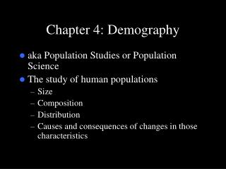
Demography is the study of population. In this chapter, you will study the factors that influence where people settle and the processes that lead to changes in settlement patterns. You will also examine population density maps and population pyramids, and investigate recent trends in population growth and distribution. Chapter 10 - Demography
What factors influence where people settle? Is the world’s population growing too fast? Essential Questions
Many human and physical factors influence the size and distribution of human settlements. These factors include landforms, climate, nearness to bodies of water, natural resources, economic activities, the level of technology, and relationships with neighboring peoples. Many processes lead to changes in settlement patterns, including urbanization, transportation, access to resources, and economic activities. Important Ideas
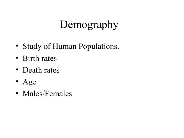
Demographers use population density maps, population pyramids, and other geographic data to describe population characteristics and trends. A population density map shows where population is distributed in an area. A population pyramid shows the distribution of population in a country by age and sex. The world’s populationis now growing at an accelerating rate. More people are alive now than at any other time in history. Important Ideas
Demography Urbanization Settlement Patterns Population Density Population Pyramid Shanty Towns Geographic Terminology in this Chapter
Most anthropologistsbelieve that humans first appeared in the Great Rift Valley in East Africa many hundreds of thousands of years ago. From there, humans spread to the Middle East, Asia, Europe, the Americas and Oceania. A Brief History of Human Settlement: The First Human Settlements
Around 10,000 years ago, people in the Middle East discovered they could plant seeds to grow their own food. Wherever agriculture was introduced, people no longer needed to follow a nomadic way of life – wandering in constant search of food. Instead, populations settled in one location and grew. Although agriculture was first discovered in the Middle East, it was later discovered independently in China, India, Africaand the Americas. A Brief History of Human Settlement: The First Human Settlements
In some areas, agriculture became especially successful. This was true in the river valleys of Egypt, Mesopotamia, India, and China, which had fertile soil from annual flooding. This led to abundant harvests. In these locations, the first cities arose. People were able to grow a surplus of food to feed a non-farming urban population. Urban dwellers included new specialized groups – priests, soldiers, traders, scribes, and craftspeople. As urban populations increased in size, a need for government developed. A Brief History of Human Settlement: The Emergence of Urban Populations
Starting in the 1700s, the Industrial Revolution greatly increased the speed of urbanization – the movement of greater numbers of people into cities. People began to leave the rural countryside to find jobs in the new factories. Towns and cities started to grow up around these factories. Cities also grew up at points where goods were exchanged or transferred – such as seacoast ports where rivers met, and later, where different railroad lines crossed. A Brief History of Settlement: Industrialization and Urbanization
What explains the distribution of people around the world? Both physical and human factors affect where people settle, even today. Three-quarters of the world’s population now live on less than 5% of Earth’s surface. Most of the world’s population is concentrated in five areas, with more than half in the first two: East Asia, including China, Korea, Japan, and Taiwan South Asia, with India, Pakistan, Bangladesh, and Sri Lanka Southeast Asia Europe North America Factors Influencing Where People Settle
Physical factors play a very large role in where people live. Population tends to cluster around seaports and fresh water sources. Most people live near the ocean or near a river with access to the ocean. In fact, two thirds of the world’s population today live within 500 miles of ocean. Factors Influencing Where People Settle: Physical Factors
Much of the Earth’s land surface is unfriendly to human habitation. In fact, eight of the 10 most populous cities in the world are on or near earthquake faults. Population is typically sparse in extremely dry, wet, cold, or mountainous areas. These areas usually have a low population density. Instead, people tend to settle in low-lying areas with fertile soil and a temperate or mild climate. Factors Influencing Where People Settle: Physical Factors
Human factors also affect where people settle. The need to establish a capital city at a central location or to establish new transportation routes may lead people to settle in a particular area. As technology improves, people are able to explore and settle in new areas, despite physical barriers. Economic activities also bring people to new areas. The discovery of valuable resources, such as gold, diamonds, or oil, may attract settlers to an otherwise unfavorable area. Factors Influencing Where People Settle: Human Factors
Geographers measure patterns of settlement by looking at population density – how many people live within a given area. They often measure the average number of people in a square mile. Geographers also use special maps to show the distribution of population density. Population Density Maps
A dot population map uses dots to indicate where major towns and cities are located. Each dot represents a certain number of residents. The key to the map tells how many people each dot represents. Other symbols, like diamonds or circles, may be used to indicate larger cities. Population Density
In this map, each dot represents 300,000 people. The map shows a concentration of people along the Nile, the coast of the eastern Mediterranean, the north side of Turkey, the rivers of Iraq, and the central plateau of Iran. Notice also that in the desert areas of Saudi Arabia and Egypt, there is an absence of dots. This indicates fewer people live in those areas. Population Density
A population density map can also use patterns or colors to show how many people live in a given area. Regions of different population density are separately indicated. The key explains what each pattern or color represents. Population Density Maps
For example, in this map of Africa, light gray horizontal lines indicate a population of 0 to 10 people per square mile. In other words, on average 10 or fewer people live on each square mile of any areas shown with gray horizontal lines. Population Density Maps
The map shows this very sparse population across North Africa, where the Sahara Desert is located. Along the Nile River at the northeast tip of Africa, and along several coastal locations, the population density is greater than 150 people per square mile. These densely populated areas include the cities of Cairo, Alexandria, Lagos, and Capetown. Population Density Maps
Throughout history, cities have exhibited variations in their size and distribution. Cities began undergoing changes as they matured. Often the business district was located in the city’s center, surrounded by residential neighborhoods. As newcomers from the countryside moved to the center of the city, wealthier residents often began to move to the city’s outskirts. Patterns in the Size and Distribution of Cities
In more recent times, suburbs have developed outside cities. Often, these suburbs come to form satellite cities around the older city center. As the population increases further, these cities may merge into a single metropolitan region. Patterns in the Size and Distribution of Cities
In less developed countries, people often arrive from the countryside without education or resources. These newcomers may settle in squatter settlements or shanty towns, usually found outside of the city. A shanty town is a slum settlement where poor people live in dwellings made from scrap materials, such as plywood, corrugated metal, and plastic sheets. Patterns in the Size and Distribution of Cities
ln less developed countries, people often arrive from the countryside without education or resources. These newcomers may settle in squatter settlements or shanty towns, usually found outside of the city. Squatters
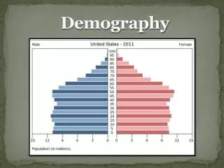
Demographers study the characteristics of human populations as well as where people settle. For example, they compare the numbers of males and females in a society. They also look at the average ages of its members. Population Pyramids
Population pyramids are used to show information about the age and gender of people in a specific country. Male Female There is also a high Death Rate. In this country there is a high Birth Rate Population in millions This population pyramid is typical of countries in poorer parts of the world (LEDCs.)
In some LEDCs the government is encouraging couples to have smaller families. This means the birth rate has fallen.
Male Female In this country the number of people in each age group is about the same. Population in millions The largest category of people were born about 40 years ago. In this country there is a low Birth Rate and a low Death Rate. This population pyramid is typical of countries in the richer parts of the world (MEDCs.)
Male Female Population in millions In the future the elderly people will make up the largest section of the population in this country. In this country the birth rate is decreasing. This is happening more and more in many of the world’s richer countries.
To display this information, demographers use a population pyramid. The pyramid typically shows the number of males on the left side and the number of females on the right. A vertical line runs through the middle. Each age group is represented by a different bar. In a sense, a population pyramid is actually a type of bar graph. The different bars are stacked up to create the pyramid. Population Pyramids
Demographers can tell a great deal about a culture by examining its population. For example, the population pyramid of Japan in 2010 shows a society in which there are large numbers of people between the ages of 35 and 40 and between 60 and 65. Population Pyramids
Because of good health care and a healthy lifestyle, many Japanese are living into old age. A very large number of women are even older than 80. However, not so many Japanese families are having large numbers of children. In fact, the number of people over 60 years old in Japan is greater than the number of people under 20 years old. Population Pyramids
By contrast, the population pyramid of Iranin 2010 shows a much younger population. Very few people are older than 80. The number of people under 20 is much greater than the number of people older than 60. Compared to Japan, Iran’s population is much younger. Iran will therefore have very different social needs than Japan has. Population Pyramids
Patterns of settlement and distribution of the world’s population have changed greatly over time. World population growth was uneven until agriculture was first introduced. World population then grew gradually. Famines, plagues, and war kept population growth in check. Trends in World Population Growth
During the Industrial Revolution, Europe and North America became the final places to use new farming techniques and to apply modern science to decrease death rates. As a result, population growth accelerated by almost ten times in Great Britain. Trends in World Population Growth
At the same time, average birth rates in these regions gradually decreased from the 1700s onwards. This kept the pace of population growth somewhat in check. Trends in Population Growth
As Europeans colonized new areas, they spread their medical advances and new farming methods to these regions. This enabled local peoples to live longer. These peoples did not always decrease their birth rates. There has been a population explosion in Asia, Africa, and Latin America, especially in years since World War II (1939-1945). Trends in Population Growth
Many countries in Asia, Africa, and Latin America are now struggling to reduce their birth rates to bring population growth under control. For example, China encourages families in cities and towns to have only one child. Trends in Population Growth