Download
1 / 37
370 likes | 510 Views
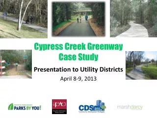
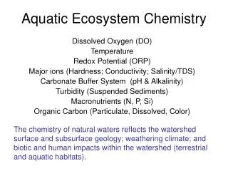
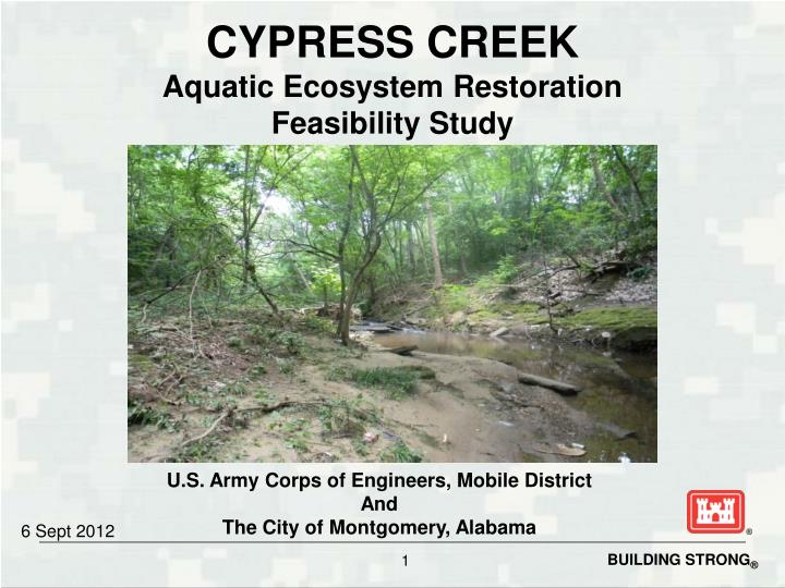
CYPRESS CREEK Aquatic Ecosystem Restoration Feasibility Study. U.S. Army Corps of Engineers, Mobile District And The City of Montgomery, Alabama. 6 Sept 2012. MONTGOMERY, ALABAMA. CYPRESS CREEK STUDY AREA. Inlet. Cypress Creek - approx. 5,042 feet. REACH 1. Reach 1 – approx. 1,295 feet.

E N D
CYPRESS CREEKAquatic Ecosystem Restoration Feasibility Study U.S. Army Corps of Engineers, Mobile District And The City of Montgomery, Alabama 6 Sept 2012
CYPRESS CREEK STUDY AREA Inlet Cypress Creek - approx. 5,042 feet
REACH 1 Reach 1 – approx. 1,295 feet
REACH 2 Reach 2 - approx 1,970 feet
REACH 3 Reach 3 – approx. 807 feet
REACH 4 Reach 4 – approx. 970 feet
PROJECT AUTHORITY • Section 206 of the Water Resource Development Act of 1996, as amended • Aquatic Ecosystem Restoration Project • Federal Funding Limit $5,000,000
COST SHARE • 100% Federal – Initiate Background Study to determine Federal interest • 50/50% Federal and non-Federal - Feasibility Phase Study • 65/35% Federal and non-Federal - Design and Construction Phases
TWO PART PLANNING PROCESS • Feasibility • Define problems and opportunities; identify potential solutions. • Estimate benefits and costs of solutions to determine prospects for an implementable project. • Determine Federal interest in potential solutions. • Estimate costs of feasibility study. • Corps and non-Federal sponsor must agree to share equally in the cost of the feasibility study. (50% Federal / 50% non-Federal)
TWO PART PLANNING PROCESS (Continued) • Feasibility Phase • More detailed planning and evaluation of alternative solutions to water resources problems. • Determine what plan(s) merit Federal participation. • Complete the feasibility report recommending solutions for implementation. • Non-Federal sponsor provides a letter of intent. • Coordination of feasibility report with Federal, State and local agencies. • Feasibility Report Approval
TWO PART PLANNING PROCESS(Continued) • Design & Implementation • The non-federal sponsor and USACE sign Project Partnership Agreement agreeing to 65% Fed / 35% non-Fed cost share • Prepare Designs • Designs go out for bid by Contractors • Construction
TWO PART PLANNING PROCESS(Continued) • Monitoring • Begins after construction is complete • Biological monitoring occurs until ecological success is achieved • Cost shared under construction for up to 10 years • If needed after 10 years it becomes 100% non-federal cost
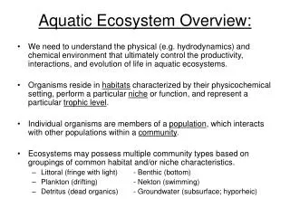
GENERAL INFORMATION & PROBLEMS • Cypress Creek: Approximately 5,042 ft. in length • Lack of native fish species due to lack of riffle/pool habitat & barriers to fish passage • Lack of meanders to due channelization of the creek • Low flow within the creek • Significant debris along Cypress Creek and at the mouth of Cypress Inlet • Invasive Plant Species • Reach 3 is underground • Lack of fluvial exchange with the Alabama River and Cypress Inlet • Increased sedimentation due to lack of floodplain and channelization of creek
GENERAL INFORMATION & PROBLEMS(Continued) • Disrupted riparian corridors and lack of mature native tree canopy • Lack of woody debris inputs, stream shading, refuge habitats and streambank stability
OPPORTUNITIES • Improve hydrologic connectivity • Restore the surface water connection between Cypress Creek and the Alabama River • Reduce nuisance flooding by improving structures at stream crossings • Increase native species • Improve aquatic habitat • Restore riffle/pool habitats and remove barriers to native, sensitive aquatic species, and increase species richness/evenness • Restore natural flow regimes and reconnect the stream to the floodplain
OPPORTUNITIES(Continued) • Reduce sedimentation and preventing further habitat embeddedness • Increase in-stream food availability, refuge, and stream shading by removing invasive vegetation and adding woody, native vegetation in currently disturbed riparian areas.
DELIVERABLES BY OCT 2012 • Updated Project Management Plan • Survey data • Write up detailing HEC-HMS and HEC-RAS models and results for existing and future without conditions. • Background of socio-economic conditions • Draft Real Estate Plan • Phase 1 Environmental Site Assessment – HTRW • Initial Coordination letters to other Federal/State agencies (USFWS, ADEM, etc.)
DELIVERABLES BY OCT 2012(Continued) • Write up of environmental model factors • Fish Sampling Report • Problems Area Report • Conceptual model • Initial Cultural Resources letters (Tribal, SHPO) • Write up of geotechnical analysis
WHAT’S NEXT? • Receive additional funding (Federal and non-Federal) • Continue developing Environmental Benefits Model • Inventory and Forecast Future with project conditions • Formulate Alternative Plans • Evaluate Effects of Alternative Plans • Compare Alternative Plans • Select Recommended Plan • Report Approval • DI Phase
QUESTIONS? Contact Information: Kerry Gates, Planner 251-694-3809