Download
1 / 77
950 likes | 1.77k Views
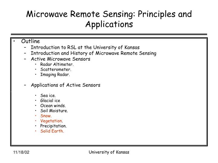
Microwave Remote Sensing: Principles and Applications. Outline Introduction to RSL at the University of Kansas Introduction and History of Microwave Remote Sensing Active Microwave Sensors Radar Altimeter. Scatterometer. Imaging Radar. Applications of Active Sensors Sea ice. Glacial ice

E N D
Microwave Remote Sensing: Principles and Applications • Outline • Introduction to RSL at the University of Kansas • Introduction and History of Microwave Remote Sensing • Active Microwave Sensors • Radar Altimeter. • Scatterometer. • Imaging Radar. • Applications of Active Sensors • Sea ice. • Glacial ice • Ocean winds. • Soil Moisture. • Snow. • Vegetation. • Precipitation. • Solid Earth. University of Kansas
Microwave Remote Sensing: Principles and Applications • Passive Microwave Sensors • Radiometers • Traditional • Interferometer • Polarimetric Radiometer • Application of Passive Microwave Sensors • Sea ice. • Glacial ice • Soil Moisture. • Atmospheric sounding • Snow. • Vegetation. • Precipitation University of Kansas
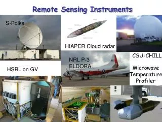
Radar Systems and Remote Sensing Laboratory Windvector Measurements over the Ocean Radar at 14 GHz. Concept developed at KU. USA, Europe and Japan are planning to launch satellites to obtain data continuously. University of Kansas
Radar Systems and Remote Sensing Laboratory Founded in 1964. 4 Faculty members, 20 Graduate students - Ph. D & M.S. 4-6 Undergraduate students, 2 Staff Now satellites based on concepts developed at RSL are in operation. NSCAT, QUICKSCAT- Radars to measure ocean surface winds. ADEOS-2 (JAPAN), Europeans Met Office is planning to launch satellite to support operational applications. ScanSAR- Radarsat- Canadian satellite Envisat - European SRTM -Shuttle Radar Topography Mission.Radar Systems and Remote Sensing Laboratory University of Kansas
Radar Systems and Remote Sensing Laboratory • Shuttle Radar Topography Mission (SRTM) • to collect three-dimensional measurements of the Earth's surface. • Acquired data to obtain the most complete near-global mapping of our planet's topography to date. • This would not have been possible without ScanSAR operation--- concept developed at KU. University of Kansas
ITTC– Information Technology & Telecommunication Center • Communications academic emphasis and research programs established in 1983. • Now RSL is a part of the Center • Graduated students • degrees in EE, CS, CoE, Math • 29 faculty, 15 staff researchers, 6 Center staff • Current student population ~ 130 • ~ 13 Ph.D., ~81 M.S., ~37 B.S. University of Kansas
EM Spectrum • Microwave region • 300 MHz – 30 GHz. Millimeter wave • 30 GHz – 300 GHz. IEEE uses a different definition • 300 MHz – 100 GHz University of Kansas
Microwave Remote Sensing: Principles and Applications. • Advantages • Day/night coverage. • All weather except during periods of heavy rain. • Complementary information to that in optical and IR regions. • Disadvantages • Data are difficult to interpret. • Coarse resolution except for SAR. University of Kansas
Microwave Remote Sensing— history • US has a long history in Microwave Remote Sensing. • Clutter Measurement program after the WW-II. • Ohio State University collected a large data base of clutter on variety of targets. • Earnest studies for the remote sensing of the earth can be considered to have began 1960s. • In 1960s NASA initiated studies to investigate the use of microwave technology to earth observation. University of Kansas
Microwave Remote Sensing— history • The research NASA and other agencies initiated resulted in: • Development of ground-based and airborne sensors. • Measurement of emission and scattering characteristics of many natural targets. • Development of models to explain and understand measured data. • Space missions with microwave sensors. • NIMBUS • Radiometers. • SKYLAB • Radar and Radiometers University of Kansas
Microwave Remote Sensing • Radar • Radio Detection and Ranging. • Texts: • Skolnik, M. I., Introduction to Radar Systems, McGraw Hill, 1981. • Stimson, G. W., Introduction to Airborne Radar, SciTech Publishing, 1998. Applications Civilian Navigation and tracking Search and surveillance Imaging & Mapping Weather Sounding Probing Remote sensing Military Navigation and tracking Search and surveillance Imaging & Mapping Weather Proximity fuses Counter measures University of Kansas
Review – EM theory and Antennas • Propagation of EM waves is governed by Maxwell equations. • For time-harmonic variation we can write the above equations as University of Kansas
EM Theory • Helmholtz Equation • From the four Maxwell equations, we can derive vector Helmholtz equations • For each component of E and H field we can write a scalar equation University of Kansas
Uniform plane wave Amplitude and phase are constant on planes perpendicular to the direction of propagation. TEM case– no component in the direction of propagation. For a TEM wave propagating in z direction Ez = 0 and Hz =0 Ex(z,t) = Eo e-αzCos(ωt-jβz) University of Kansas
EM theory • α and β are determined by material properties. • Materials are classified as insulators and conductors University of Kansas
EM Theory • Reflection and refraction • Whenever a wave impinges on a dielectric interface, part of the wave will be reflected and remaining will be transmitted into the lower medium. θi θr θt University of Kansas
EM Theory--Scattering • Microwave Scattering from a distributed target depends on • Dielectric constant. • Surface roughness. • Internal structure. • Homogeneous • Inhomogeneous • Wavelength or Frequency. • Polarization. University of Kansas
θi θr Microwave Scattering • Surface scattering • A surface is classified as smooth or rough by comparing its surface height deviation with wavelength. • Smooth h < λ/32 cos(θ) • For example at 1.5 GHz and = 60 deg., • h < 1.25 cm Smooth surface Moderately rough surface Very rough surface University of Kansas
Microwave Scattering • Rough surface scattering University of Kansas
Microwave Scattering • Volume scattering • Material is inhomogeneous such as • Snow • Firn • Vegetation • Multiyear ice University of Kansas
Microwave Scattering • Surface scattering models • Geometric optics model • Surface height standard deviation is large compared to the wavelength. • Small perturbation model • Surface height standard deviation is small compared to the wavelength. • Two-scale model • Developed to compute scattering from the ocean • Small ripples riding on large waves. University of Kansas
Antennas • Antennas are used to couple electromagnetic waves into free space or capture electromagnetic waves from free space. • Type of antennas • Wire • Dipole • Loop antenna • Aperture • Parabolic dish • Horn University of Kansas
Antennas • Antennas are characterized by their: • Directivity • It is the ratio of maximum radiated power to that radiated by an isotropic antenna. • Efficiency • Efficiency defines how much of the power is the total power radiated by the antenna to that delivered to the antenna. • Gain • It is the product of efficiency and directivity • Beamwidth • Width of the main lobe at 3-dB points. dipole University of Kansas
Antenna gain University of Kansas
Antennas • An array of antennas is used whenever higher than directivity is needed. • Can be used to electronic scanning. • Most of the SAR antennas are arrays. University of Kansas
Antenna Array • Let us consider simple array consisting of isotropic radiators. R1 Ro d q P University of Kansas
Radar Principles • Radar classified according to the trasmit waveform. • Continuous • Doppler • Altimeter • Scatterometer • Pulse • Wide range of applications University of Kansas
Radar Principles • Radar measures distance by measuring time delay between the transmit and received pulse. • 1 us = 150 m • 1 ns = 15 cm Radar University of Kansas
Radar— principle • Unambiguous range and Pulse Repetition Frequency (PRF) • PRF also determines the maximum doppler we can measure with a radar— SAR. • PRF > 2 fdmax University of Kansas
Radar equation For a monostatic radar GT = GR Radar sensitivity is determined by the minimum detectable signal set by the receiver noise. No = kTBF F= noise figure Signal-to-noise ratio Radar—Principle PT GT R University of Kansas
Microwave Remote Sensing • Radar cross section characterizes the size of the object as seen by the radar. Where Es = scattering field Ei = incident field r University of Kansas
Radar Equation • A distributed target contains many scattering centers within the illuminated area. It is characterized by radar cross section per unit area, which is refereed to as scattering coefficient be ba qo R University of Kansas
Radar Equation For a distributed power received falls off as 1/R2 For a point target power received falls off as 1/R4 University of Kansas
Antenna Array • Let us consider simple array consisting of isotropic radiators. R1 Ro d q P University of Kansas
Antenna Array • Let us consider simple array consisting of isotropic radiators. R1 Ro d q P University of Kansas
Microwave Remote Sensing: Principles and Applications— History • Active Microwave sensing • Studies related to active sensing of the earth beagn in 1960s. • Clutter studies • SkYLab – radar altimeter and scatterometer in 1960s • SEASAT in 1978 • ERS-1, JERS-1, ERS-2, RADARSAT, GEOSAT, Topex-Posoidon University of Kansas
Active Sensors – Radar Altimeter • Radar altimeter is a short pulse radar used for accurate height measurements. • Ocean topography. • Glacial ice topography • Sea ice characteristics • Classification and ice edge • Vegetation • http://topex-www.jpl.nasa.gov/technology/images/P38232.jpg University of Kansas
Missions Radar Altimeter University of Kansas
Radar Altimeter— Waveform • Satellite altimeters operate in pulse-limited mode. University of Kansas
Radar Altimeter • A short pulse radar • Uses pulse compression to obtain fine range resolution or height measurement. • Range measurement uncertainty of a pulse radar. University of Kansas
Radar altimeter • Other sources of errors • Atmospheric delays • Troposheric delays. • EM bias • Pointing errors • Orbit errors • Accuracies of few cms are being achieved with new generation sensors. • Dual-frequency • Water vapor— radiometers • GPS – orbit determination • Calibration. Resti et al, “The Envisat Altimeter System RA-2,”ESA Bulletin 98, June 1999 sigma=5.5 cm University of Kansas
Radar Altimeter—typical system Resti et al, “The Envisat Altimeter System RA-2,”ESA Bulletin 98, June 1999 University of Kansas
Radar Altimeter • Waveform analysis • Time delay is measured very accurately and converted into distance. • Spreading of the pulse is related to SWH. • Scattering coefficient can be obtained by determining the power. Resti et al, “The Envisat Altimeter System RA-2,”ESA Bulletin 98, June 1999 University of Kansas
Radar Altimeter- typical system • Block diagram of Envisat RA Resti et al, “The Envisat Altimeter System RA-2,”ESA Bulletin 98, June 1999 University of Kansas
Active sensors • Scatterometer • Scatter o Meter – A calibrated radar used to measure scattering coefficient. • They are used to measure radar backscatter as a function of incidence angle. • Ground and aircraft-based scatterometers are widely used. • Experimental data on variety of targets to support model and algorithm development activities. • Developing algorithms for extracting target characteristics from data. • Understanding the physics of scattering to develop empirical or theoretical models. • Developing target classification algorithms University of Kansas
Active sensors— Scatterometers • Wide range of applications • Wind vector measurements • Sea and glacial ice • Snow extent. • Vegetation mapping • Soil moisture • Semi-arid or dry areas. University of Kansas
Microwave Remote Sensing— Atmosphere and Precipitation • Global precipitation mission • Will consist of a primary spacecraft and a constellation. • Primary Spacecraft • Dual-frequency radar. • 14 and 35 GHz. • Passive Microwave Radiometer • Constellation Spacecraft • Passive Microwave Radiometer University of Kansas
Microwave Remote Sensing—Active Sensors Imaging Radars
Imaging Radars & Scatterometers • Imaging Radars • Real Aperture Radar (RAR) • Synthetic Aperture Radar (SAR) • Widely used for military and civilian applications. • RAR • Thin long antenna mounted on the side of an aircraft. University of Kansas
RAR Resolution is determined by antenna beamwidth in the along track direction Pulse width in the cross-track direction RAR geometry Imaging radars University of Kansas