Download
1 / 20
200 likes | 523 Views
Prospects for using Forest Inventory and Analysis and related data for monitoring forest carbon offsets. Linda S. Heath USDA Forest Service Northern Research Station, FIA Forest Carbon Accounting and Research Durham, NH. Forest and Agriculture GHG Forum, Shepardstown, WV, April 6-9, 2009.

E N D
Prospects for using Forest Inventory and Analysis and related data for monitoring forest carbon offsets Linda S. Heath USDA Forest Service Northern Research Station, FIA Forest Carbon Accounting and Research Durham, NH Forest and Agriculture GHG Forum, Shepardstown, WV, April 6-9, 2009
Acknowledgments: • Rich Birdsey • Ken Brewer • Ray Czaplewski • Andy Lister • Hobie Perry • Rachel Riemann • Chip Scott • Brad Smith • Jim Smith • Chris Swanston • Ty Wilson • Chris Woodall
Outline • Carbon stocks • What are FIA data? --focus on annualized survey --not only carbon per area but also area --what about after the forest? --basis for text, tabular, graphs…maps? • Prospects for the near future --foundation for the ultimate carbon observation system!?
Net C sequestration, Land Use Change and Forestry for the United States Forests offset >10% of all emissions Forests, urban forests, and wood burned for energy offset 18% of fossil fuel emissions Fire emissions? Source: EPA (2008), Inventory of US GHG emissions and sinks (all are net sinks, no non-CO2)
•extent of forest land volume, growth, and removal of forest resources; and •health and condition of the forest. National program goals for FIA To conduct strategic forest inventories of the United States to estimate:
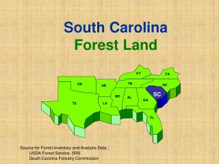
Over 300 million hectares of forest – 4th most forested nation in the world Geographic span of FIA From the Artic Circle to the Tropic of Capricorn. From the Virgin Islands to Palau, west of Sidney Fast Fact: FIA operates in 12 different time zones Ground data becoming available from most of island territories—starting again in Hawaii—southeast AK
What kind of FIA data can inform the carbon debate? • Phase 2 - forest mensuration • -- 1 plot per 6000 acres • -- visit plot every 5 years • Phase 3 – forest health • -- each 16th P2 plot • -- soils, forest floor, down woody nationally • -- 1 plot per 96,000 acres • -- soils sampled every 2nd visit • Phase 1 – remote sensing • -- reduce variance through stratification
What kind of FIA data (continued)? • Harvested wood & products • --Utilization Studies • --Timber Products Output • Ownership survey • National Inventory & Monitoring Applications Center
Sampling frame –where locate plots? • Adopted hexagonal sampling frame • Shape allows plots to be equidistant • Shape allows for further tessellation For US: -- 125,000 forested P2 plots -- 7,800 P3 plots State of Minnesota, P2/P3 grid
FIA typically produces reports that include textual, tabular, and graphical descriptions of the forest resource…
But what about maps? Carbon stocks per hectare by county Includes all forest ecosystem carbon components, based on FORCARB2 and 2002 RPA Forest Data
Maps from FIA data, other data, and models • Cubist&NLCD • (Blackard et al 2008) • Some others: • Landsat • (Cohen et al) • MODIS • (Wilson et al) Soon will be many maps….
2010 Nevada Photo-based Inventory Project NPIP MODIS k-NN mapping NFS Region 1 SAFIS/Current annual FIA 2000 Minnesota AFIS 1990 North Carolina mid-cycle update Alaska 4-phase 1980 RMRS/NASA RET Program 1970 NE sampling with partial replacement 1960 2.Pilot studies FIA has tested a lot of novel RS technologies Source: Czaplewski
.0001 0 – 5 5 – 20 20 – 30 30 - 73 Mapping– Scaling: Plot vs pixel-level maps Plot-based map Greatest Nearest Neighbor Source: Rachel Riemann
Mapping estimates and variances Acres of forestland Percent sampling error Data Delivery System -- FIDO Ty Wilson, in preparation
Precision of estimates vs. area Ty Wilson, in preparation
National Inventory & Monitoring Applications Center (NIMAC) -- in FIA Mission: To develop forest ecosystem inventory and monitoring methods and tools to help FIA and other organizations monitor forests, producing comparable results across the landscape. Examples: Eastern National Forests: using planning tool Natl Forest in Missouri: 2X P2 sample and 7X P3 Wisconsin DNR: monitoring 500,000 ac State Forests Indiana DNR: monitoring 150,000 ac State Forests
State of Indiana lands - Increased FIA plot intensity Green dots=FIA P2 plots Black dots=1 subplot only Zoom into State forest
Summary…for now • FIA Data: • Poised to be a foundation • --carbon stocks, stock change, carbon fate beyond forests, land use change • Data are being collected annually • Documentation, analysis, data delivery system needs time to catch up • Data integration/fusion with RS techniques and modeling produce even more useful results