Download
1 / 56
560 likes | 670 Views
Plate techtonics. See p. 41. Ocean currents. Convection Current. Do questions 3-10 on p. 63. Link. Link. Link. Link. d. Define the following terms. Wave Swell Breaker Headland Bay Shoal. Sandbar Sea cave Sea arch Sea stack Breakwater Jetty/wharf.

E N D
Link Link
Define the following terms • Wave • Swell • Breaker • Headland • Bay • Shoal • Sandbar • Sea cave • Sea arch • Sea stack • Breakwater • Jetty/wharf
Canadian agencies that support scientific and technological research involving the oceans • Environment Canada – keep track of ocean wave movements and weather systems that begin over the oceans • Federal fisheries and oceans - the lead federal government department responsible for developing and implementing policies and programs in support of Canada's economic, ecological and scientific interests in oceans and inland waters. This includes responsibility for conservation and sustainable use of Canada's fisheries resources while continuing to provide safe, effective and environmentally sound marine services. • The ocean sciences centre - a cold ocean research facility operated in conjunction with Memorial University of Newfoundland. Located in Logy Bay, NL, the Centre houses laboratories where research is conducted on the North Atlantic fishery, aquaculture (farming aquatic organisms), oceanography, ecology, behaviour and physiology (how the body works). Research is conducted on organisms ranging from bacteria to seals. • C-CORE (Centre for Cold Ocean Research) – an engineering firm that works with companies involved in offshore oil, pipelines, mining and electricity.
p. 47 • Continental margins are made up of the continental shelf and the continental slope. The continental shelf is the submerged (underwater) part of the continent between the coast and the edge of the basin. Continental shelves slope gradually away from the land before dropping steeply downward at the shelf edge. The continental slope is beyond the continental shelf, and slopes steeply down to the ocean basin.
p. 47 continued 2. Sonar mapping uses sound waves to probe the seabed. The depth of water is found be sending sound waves to probe the seabed. The depth of water is found by sending sounds waves directly down from a ship and measuring the time it takes for the signals to hit the sea floor and bounce back to the surface. 3. There are several advantages to satellites mapping are: • Satellites can survey very large areas of ocean in a short time. • Satellites are able to record and transmit data in all kinds of weather, at any time. • Satellites can receive information from buoys that are anchored to the ocean floor at fixed points. Instruments on these buoys collect information about water and air temperature, and transmit the info to satellites. The satellites then transmit this information to stations worldwide. This can help predict the weather and monitor water movements.
p. 47 con’t 4. Two types of submersibles are: • Manned submersibles – they carry people inside and allow them to make their own observations of the deep sea. • Remotely-operated vehicles (ROVs) – they allow people to control the vehicle from a ship that is safely on the surface. They can control the arms, lights and cameras of the vehicle with a device that is similar to the joystick you use for playing video games. ROVs can stay down much longer than manned submersibles and are constantly sending data to the ship.
p. 51 • A) The 5 major oceans on Earth are the Atlantic ocean, the Pacific ocean, the Indian ocean, the Arctic Ocean and the Southern ocean (All People In Australia Swim). B) The Pacific ocean is largest and the Arctic ocean is smallest 2. Scientists speculate that water on Earth may have come from 2 sources: • Water trapped inside volcanic materials when the Earth first formed was released into the atmosphere in the form of water vapour. As the water cooled and condensed, it fell to the Earth’s surface as precipitation. Gravity carried the water downhill to the lowest parts of the Earth’s surface, the ocean basins. • Ice trapped in comets fell to Earth and melted to liquid water and then was pulled by gravity to the ocean basins.
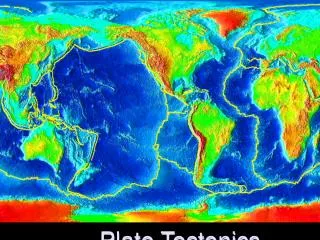
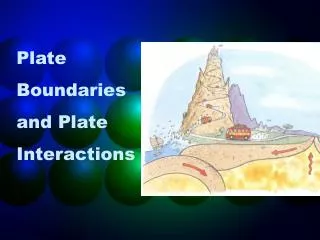
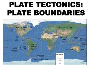
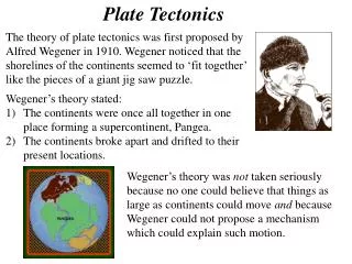
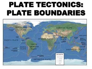
p. 51 con’t 3. The wide flat areas of the ocean basin are called abyssal plains. 4. The place on the ocean floor where two tectonic plates are moving apart is called an ocean ridge. 5. When one tectonic plate is forced underneath another tectonic plate an ocean trench is formed. 6. The steep side on the edge of a continent is called the continental slope. 7. The entire surface of the Earth is made up of large, slow moving sections of rock called tectonic plates. These sections of rock are solid, but float over a layer of molten rock called magma. As the magma heats up from the heat energy in the Earth’s core, the molten rock rises. This pressure can force two plates apart. Over millions of years these plates moved the land into the map that we are familiar with today. This is a process called plate tectonics.
p. 51 con’t 8. Erupting volcanoes helped to form the oceans. The planet started out as a hot ball of molten rock. The outside gradually cooled off, but heat from deep inside the Earth was still released by volcanoes. Water trapped inside the materials released by the volcanoes was released into the atmosphere as water vapour, which then condensed to form liquid water. 9. a) An ocean ridge is formed when two tectonic plates are forced apart, allowing the underlying magma to ooze up. This magma then hardens, and forms a long undersea mountain (a ridge). b) A trench is formed when plates moving apart from a mid-ocean ridge come into contact with other plates. When these plates collide with a continental plate, the denser ocean plate is forced to bend steeply down beneath the less dense continental plate, forming a trench. Most trenches form around the edges of the Pacific ocean.
p. 51 continued 10. 11. Some modern technologies that have helped scientists explore the deep ocean are: Satellites Sonar Submersibles Deep sea cameras and video
Answers p.56 • An ocean current is a large amount of ocean water that moves in a particular and unchanging direction. There are more than 20 major ocean currents. • Surface currents are shaped by the wind, the Earth’s rotation, and the shape of the continents. • As air moves across the ocean’s surface, its energy is transferred by friction to the water molecules, causing the ocean water to move.
p. 56 continued 4. The Earth spins from west to east. Depending on what side of the equator the wind is on, it will be redirected no matter what way it is blowing. Wind in the northern hemisphere (above the equator) always get redirected to the right. Wind in the southern hemisphere (below the equator) always gets redirected to the left. The wind then causes a change in the ocean water’s movement (see #3). 5. Moving currents are forced to turn when they meet a solid surface, like the continents. The way the continents are shaped determines where the water will be forced to go. Continents will deflect East-West currents either to the North or the South.
Answers p. 59 • A density current is a movement or flow to water along the sea floor caused by the sinking of dense water (cold water has higher density than warm water, and highly salty water has higher density than water with low salinity). • Diagram done whiteboard in class. See also p. 57. • Melting icebergs, rivers running into the ocean, and rain falling on the ocean are some examples of fresh water being added to ocean water.
p. 59 con’t 4. Upwellings are vertical (up and down) movements of water from the sea floor to the ocean surface. They are most common along coastlines where strong winds blow offshore. The winds push the surface water away from the land. Cold, deep water then rises from below to replace the surface water that has been moved out to sea. 5. Upwelling water contains large amounts of nutrients from the sea floor, such as phosphates and nitrates. Plants living in the surface water use these nutrients to grow. The plants then attract fish.
Answers p. 63 3. A thermocline is a part of the ocean below the surface where the temperature drops sharply with depth (i.e. as you go down farther the temperature gets a lot colder very quickly). 4. When cold, dense ocean water meets warmer, less dense water the colder water will sink below the warmer water. 5. Upwelling on the Grand Banks of Newfoundland result from the interaction of the Gulf Stream (warm water current) and the Labrador Current (cold water current).
p. 63 con’t 6. Depth (m)
p. 63 continued 7. A density current is produced by differences in water temperature (colder water is denser than warmer water) and by the differences in salinity of seawater (very salty water is denser than less salty water). 8. The difference between a surface current and a deep current is that surface currents flow in the top 100-200m of water and are influenced by the wind, the shape of the continents, and the Earth’s rotation, while deep currents occur in the thermocline and deep water layers and are influenced by water temperature and salinity.
p. 63 con’t 9. Water can have difference density based on the water temperature (e.g. water gets denser below the surface of the ocean because it gets farther and farther away from the heat of the sun). It can also be denser in areas with higher salinities (e.g. the poles and the equator). 10. Areas of upwelling might be good places to fish because the upwelling water brings up phosphates and nitrates. These feed plants on the surface of the water. If the plants are thriving they will attract more fish to the area, meaning that it will be a better place to fish.