Download
1 / 25
250 likes | 258 Views
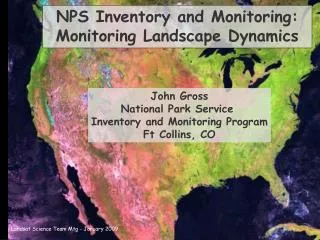
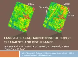
Monitoring Landscape Dynamics. John Gross I&M Annual Meeting San Diego, California 7 February 2006. I&M / NPS Highlights Lessons Into the future …. Highlight 1 – Look what we’re doing!!!. Quality, quantity, breadth, relevance. Disturbance Vegetation change Land condition

E N D
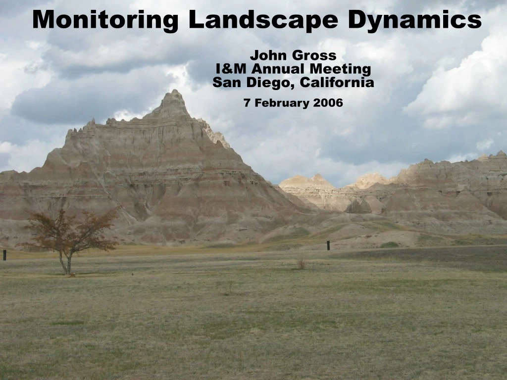
Monitoring Landscape Dynamics John Gross I&M Annual Meeting San Diego, California 7 February 2006
I&M / NPS Highlights • Lessons • Into the future …
Quality, quantity, breadth, relevance • Disturbance • Vegetation change • Land condition • Phenology (plants, ice, permafrost) • Topography (coasts, reefs, etc) • Pattern and context
Programmatic Goals • Wise choices • Consistency • Efficiency • Institutional learning
Shared learning among I&M Networks and collaborators: Cohen, Kennedy – NCCN, SWAN, NCPN, SCPN Townsend – APHN, NCRN Reed – SWAN, NCPN, SCPN Wang – NETN, NCBN Hansen – HTLN, GRYN Brock – GULN, SFCN, SECN, NCBN
With External Partners: • Workshop – NASA, PCA, CCRS, CSA, NPS • Ecosystem modeling – NASA (SIEN – YOSE) • NASA internship program (SIEN, Fire, USFS) • NASA Proposals and grants: • Invasive species & fire (Welch, Paintner, Benson, Morrisette) • Monitoring proposal (Hansen et al.) • Land use and climate effects on biodiversity in 70 large parks (Hansen & Running) • Park Science paper – I&M and NASA (Turner, Nemani, Gross) • National Phenological Network • Heinz Center – terrestrial and coastal groups NDMI, 1989 to 2004
Networks and Landscape Dynamics • Draft protocols: • NCCN • GRYN • NCRN Bandelier National Monument March 4, 1999
NCCN Protocol – Warren Cohen and Robert Kennedy • Very large and remote parks • Landsat focus: cheap, consistent, historical, good near short-wave • Track changes in broad physiognomic classes • Many changes described as proportional mixture changes broadleaf/grass/crop increasing canopy conifer DATE 1 shadow water soil burn snow/ice/cloud
NCCN Protocol – Warren Cohen and Robert Kennedy • Very large and remote parks • Landsat is core of effort • Cheap, consistent, historical, good near short-wave sensor • Track changes in broad physiognomic classes • Many changes described as proportional mixture changes • Multi-tiered validation approach • Focus on pixel-based products • Solid foundation for post-map analysis • Facilitate patch or super-pixel pattern analyses
GRYN Protocol – Hansen / Jones • Large area • Land use intensification in critical habitats • Excellent conceptual models linking landscape change to resources • Extensive use of remotely sensed and ancillary data
Linking landscape change to park resources (modified from Hansen and DeFries in prep)
Public data Plus: roads, lights, imagery archives (modified from Hansen and Gryskiewicz 2003)
NCRN Protocol – Townsend, Gardner, & Lookingbill • Many small parks in rapidly urbanizing landscape • Effects of imagery resolution • Pattern analysis based on graph theory • Comprehensive testing and review of protocol (Figure: Townsend et al. draft protocol)
Lessons leaned • Many opportunities for broad-scale analyses • Core vital signs, • Major potential to use inexpensive, widely-available data, • Change detection - use of inexpensive high-frequency, coarse-resolution data to strategically acquire expensive data, • Scale of objectives consistent with USGS, EPA, NOAA, PCA, • Potential for program-wide efficiencies in data processing and analysis, • Potential collaborations at local to international scales.
Finer-scale landscape dynamics (often vegetation change) • Partnership opportunities at regional, network or biome scale • Many more network- or park-specific issues • Change detection is a very big issue (resolution, cost)
Parks Canada Approach • Large collaborative project with limited set of objectives: • Habitat fragmentation / pattern • Vegetation succession / retrogression • Vegetation productivity • Biodiversity (species richness) Lesson: Efficiencies from a highly focused group with clearly objectives. Very rapid progress and consistency. Agencies: PCA, CCRS, CSA, Universities
What’s on the horizon? How can we best monitor linear park units? NETN, GLKN, HTLN Appalachian Trail & river-based parks
What’s in the future Emergence of a National Phenological Network • Seasonal changes are one of the most pervasive environmental variations on Earth • Effects seen in agriculture, transportation, health, hydrology, etc. • Direct link between monitoring results and broader social values • http://www.uwm.edu/Dept/Geography/npn/
Why we want a National Phenological Network • Priority vital sign for multiple networks, • Standardized protocols, • Ability to use and contribute to broader context, • Leverage activities by others, • Excellent means to link and add value to other measures. Implementation team meeting – March 22-23, 2006 Involves USGS, USFS, EPA, NOAA, NASA, NPS, universities
What’s in the future Greater use of ecosystem modeling for monitoring and management • Rama Nemani, NASA Ames – Terrestrial Observation and Prediction System (TOPS). • Current link to NASA internship program • Pilot project with SIEN – Yosemite NP • Hope to expand to Island Royale • Educational process http://ecocast.arc.nasa.gov/ (figure from http://ecocast.arc.nasa.gov/)
What’s in the future Coordinated acquisition of regional to national data? • Focus on broad-scale data sets: • Land cover, roads, population, agricultural records, pollution, etc. • Linkages to MRLC, Landfire • Consistent evaluation, system-wide context MRLC land cover zones
Landscape Dynamics Breakout Session – focus on partnerships Landfire and how it’s going to help us – Dr. Kevin Ryan, USFS Parks Canada’s approach – Dr. Donald McLennan NASA DEVELOP interns, NPN, modeling – John Gross
Selected Resources • Landscape dynamics • Landscape dynamics web site: http://science.nps.gov/im/monitor/lulc/LULC.cfm • NASA TOPS - http://ecocast.arc.nasa.gov/ • NASA DEVELOP Internship program - http://develop.larc.nasa.gov/ • Phenology and climate change: • National Phenological Network - http://www.uwm.edu/Dept/Geography/npn/ • European Phenological Network - http://www.dow.wau.nl/msa/epn/index.asp • Pacific West Region Climate Change Page - http://inside.nps.gov/regions/region.cfm?rgn=223&lv=3 John Gross 970 267-2111, johng_gross@nps.gov
http://science.nature.nps.gov/im/monitor Remote Sensing and Landscape Dynamics