Download
1 / 26
260 likes | 416 Views
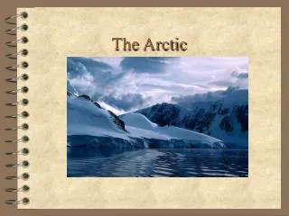
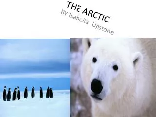
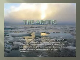
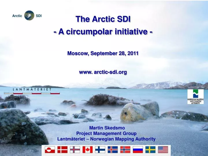
The Arctic SDI - A circumpolar initiative - Moscow, September 28, 2011 www. arctic-sdi.org. Martin Skedsmo Project Management Group Lantmäteriet – Norwegian Mapping Authority. The Arctic. 1/6 of the worlds land mass Vast wilderness areas Unique biological diversity

E N D
The Arctic SDI • - A circumpolar initiative - • Moscow, September 28, 2011 • www.arctic-sdi.org Martin Skedsmo Project Management Group Lantmäteriet – Norwegian Mapping Authority www.arctic-sdi.org
The Arctic www.arctic-sdi.org 1/6 of the worlds land mass Vast wilderness areas Unique biological diversity Largest freshwater resources (with Antarctic) Unique and diverse indigenous cultures
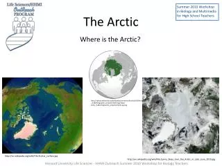
The Arctic • Coverage The Arctic SDI is to cover the Arctic regions of the involved participating countries, as defined by the countries themselves. 3 www.arctic-sdi.org
Background- Arctic Council - • The Ottawa Declaration of 1996 formally established the Arctic Council as a • High level intergovernmental forum – Foreign Ministers • SAO – Senior Arctic Officials from the Arctic Countries • Consensus based body • Promoting cooperation, coordination and interaction among Arctic States • Including the involvement of the Arctic Indigenous communities and other Arctic inhabitants • 6 Working Groups - CAFF (Conservation of Arctic Flora and Fauna) representing the working groups. • The Chairmanship is rotating – every second year • Sweden has just taken over the Chairmanship • www.arctic-council.org 4 4 www.arctic-sdi.org
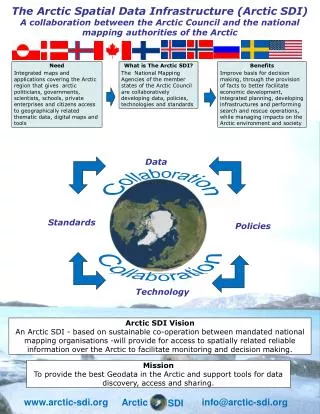
WhyArcticSDI? www.arctic-sdi.org Wide array of spatial data around the Arctic Datasets are distributed throughout many organisations often not integrated or coordinated Arctic SDI would allow for more robust management and manipulation of data for both research and management purposes.
Background - where did it all start?- first ideas of an Arctic SDI - GITBarents IPY GeoNorth 2007 (Yellowknife) GeoNorth II 2009 (Fairbanks) Arctic Council – paper from CAFF 6 www.arctic-sdi.org
Geographic Information Technology within the Barents Region 1998 – 2008 www.arctic-sdi.org
A co-operation project between the Federal &Regional Mapping and Cadastral Authorities within the Region - 4 Countries, 4 Mapping Organisations - EU and national financing www.arctic-sdi.org
GIT Within the Barents Region- main goals - • Production of homogenous & uniform geographic information within the region • development and implementation of internet-based technology for effective access and distribution of geographic information within the region www.arctic-sdi.org
The Barents GDB1:1 000 000 • no new mapping efforts have been executed • existing national map databases have been used and compiled • common feature Catalogue • the new database is a homogenous geographic (GIS compatible) map database www.arctic-sdi.org
The experiences gained during the GIT Barents project might be applicable also when building an Arctic SDI! The Barents SDI is up & running www.gitbarents.com www.arctic-sdi.org
Background- Arctic SDI support - www.arctic-sdi.org Arctic SDI discussions have been ongoing for a number of years. The Arctic SDI initiative received, after a request from the Nordic Mapping Organisations, the formal support of the Arctic Council at its Senior Arctic Officials (SAO) meeting in November 2009 Support of all the eight Arctic Council countries i.e. Canada, Denmark, Faroes, Finland, Greenland, Iceland, Norway, Russian Federation, Sweden and the United States
Background- the long and winding road - “Arctic SDI road trip 2008 – 2011” • Rotterdam 2009 (GSDI) • Fairbanks 2009 (GeoNorth) • Copenhagen 2009 (SAO) • Concept Paper 2009 (Kiruna) • Moscow 2010 (Rosreestr) • Reston 2010 (USGS/NRCAN) • Brussels late 2010 (Kick off) • Singapore late 2010 (GSDI) • Reykjavik April 2011 (Constitutional meeting) • Cambridge conference June 2011 • Advisory Group – meetings 2011 • Moscow September 2011 14 www.arctic-sdi.org
An Arctic SDI – based on sustainable co-operation between mandated national mapping organisations– which will provide for access to spatially related reliable information over the Arctic to facilitate monitoring and decision making The Arctic SDI - the vision - 15 www.arctic-sdi.org
The Arctic SDI- user driven approach - Palmér and Skedsmo October 2011 16 www.arctic-sdi.org Four main categories of users identified: • The Arctic Council Working Groups (AC WGs). • Research groups within the International Polar Year and other scientific communities engaged in Arctic research. • Government and governmental authorities involved in decision making processes concerning the Arctic. • Media and the public including NGOs.
Decision Analysis Thematic data NMA national reference data Arctic Council Working Groups and other Scientific Communities Governmental Authorities Data Environmental & other political issues Media, Public & Education Arctic SDI Arctic SDI Portal www.arctic-sdi.org www.arctic-sdi.org
Arctic SDI PROJECT FRAMEWORK - Project phases StructuringPhase 2010/2011 EstablishingPhase 2011/2012 OperationalPhase 2012/2013 18 www.arctic-sdi.org
Advisory Group - acknowledged professionals - The Board (NMA’s DG or corresponding managerial level) Decision making bodies Reference group: Arctic council Liaison CAFF WG Steering Committee (NMA’s ASDI coordinators) Project Management Group NMA Executive bodies Working Group A (Technical) Working Group B (Reference and Metadata) Working Group C (Data Access Terms) Project Organisation www.arctic-sdi.org 19 www.arctic-sdi.org
The Board Magnús Guðmundsson; Director General, NLS ofIceland, Chair – onbehalfofthe Nordic NMAs (Denmark (Faeroes), Finland, GreenlandIceland, Norway, Sweden) Canada – to be announced SergejVasiliev– Director General, Rosreestr, The Federal Service for State Registration, Cadastre and Mapping Carl Markon, Deputy Regional Executive – Alaska Area, US Geological Survey, USA 20 20 www.arctic-sdi.org
The Advisory Group Fraser Taylor, Distinguished Research Professor, Carleton University, Ottawa JarmoRatia, Director General of NLS, Finland Jacqueline McGlade, Executive Director European Environment Agency Robert Corell, Principal, Global Environment and Technology Foundation and Chair of GSA AbbasRajabifard, President GSDI, Associate Professor, University of Melbourne. 21 21 www.arctic-sdi.org
The Reference Group • The Arctic Council and its Working Groups, represented by CAFF, are participating in the Arctic SDI project work as Reference Group, representing the user community and thus exercising influence on the project and its results. • The Reference Group representative can be co-opted to the Steering Committee as required. 23 23 www.arctic-sdi.org
Working Groups • Proposed Working Groups: • Working group A will be responsible of design, architecture and standards for development of the Arctic SDI based on use of open source technology. • Working group B will be responsible of establishing a catalogue of existing and available reference data, specifications included and metadata. • There is a need for Working group C responsible of Data Access Terms. 24 24 www.arctic-sdi.org
Examples: • Access to relevant and updated geographic and thematic information covering the entire circumpolar region • Daily use of the project's web map services in schools and universities in the Arctic and elsewhere. • Possibilities for media to receive relevant and updated information • Possibilities to foster cooperation with industry on Arctic issues PROJECT FRAMEWORK - Expected results - 25 www.arctic-sdi.org
Futureaspects • Establishing phase • Operational phase • Management • User groups/Data providers • Satellite images www.arctic-sdi.com
Arctic SDI meeting in Moscow 12 – 13 September, 2011 • Thank you • www.arctic-sdi.org 27 www.arctic-sdi.org