Download
1 / 16
160 likes | 167 Views
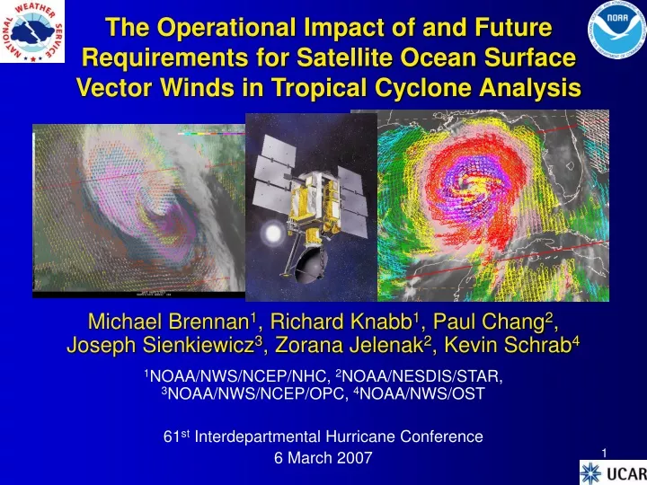
The Operational Impact of and Future Requirements for Satellite Ocean Surface Vector Winds in Tropical Cyclone Analysis. Michael Brennan 1 , Richard Knabb 1 , Paul Chang 2 , Joseph Sienkiewicz 3 , Zorana Jelenak 2 , Kevin Schrab 4

E N D
The Operational Impact of and Future Requirements for Satellite Ocean Surface Vector Winds in Tropical Cyclone Analysis Michael Brennan1, Richard Knabb1, Paul Chang2, Joseph Sienkiewicz3, Zorana Jelenak2, Kevin Schrab4 1NOAA/NWS/NCEP/NHC, 2NOAA/NESDIS/STAR, 3NOAA/NWS/NCEP/OPC, 4NOAA/NWS/OST 61st Interdepartmental Hurricane Conference 6 March 2007
Impact of OSVW Data on TC Analysis and Forecasting • QuikSCAT data available in operational workstations at NHC since 2000 • Some information on TC intensity, especially for tropical storms, but not major hurricanes • Limited by instrument resolution • Interpretation complicated by rain contamination • Improved detection/tracking of TC centers for analysis and model initialization • Often only source of outer wind radii information for open ocean systems affects watch/warning areas
Use of QuikSCAT at NHC Based on 2003–2006 Tropical Cyclone Discussions Does not account for instances where QSCAT used but not explicitly mentioned in TCD
NOAA OSVW Requirements Workshop5–7 June 2006 – NHC, Miami, FL Goals • Summarize utility and impact of currently available satellite OSVW data in operational weather forecasting • Define NOAA’s operational OSVW requirements • Explore sensor/mission concepts using proven remote sensing technologies to meet these requirements
Who Else is Using OSVW?Workshop Participants • NHC, CPHC, JTWC • TC analysis and forecasting • NWS Ocean Prediction Center, NHC’s Tropical Analysis and Forecast Branch (TAFB), NWS coastal WFOs, DoD • Marine forecasts, warnings, and analyses • Identification of hurricane force extratropical cyclones at OPC • NOAA/NESDIS – Develop retrieval algorithms, data processing, real time data distribution • NCEP/Environmental Modeling Center, FNMOC, ECMWF • Data assimilation for NWP modeling • NASA/JPL • Academic and research communities • Private sector marine forecasters, recreational mariners
Operational Requirements • All-weather retrievals • Accurate retrievals in rain • Accuracy levied upon 10-m 1-min sustained wind • Speed: +/- 2 kt in 0–165 kt wind range • Direction: • +/- 10° (2 σ) (10–165 kt) • +/- 20° (2 σ) (4–10 kt) • Revisit time: 6 h (1–3 h goal) • Interval between measurements at particular point on ocean surface Helene 23 September 2006
Operational Requirements • Reduce time from measurement to product availability (product latency) to 45–60 min • 15 min goal • 2.5 km x 2.5 kmspacing between unique wind vector retrievals (1 km goal) • Retrievals within 2.5 kmof coast (1 km goal) • Data delivered into operational workstations (N-AWIPS/AWIPS) and data assimilation systems • Product documentation/tutorials/training
User Requested Definitely Achievable Available Today! 2km resolution Max wspd 134.3 kts rms 2.14 kts 1km resolution Max wspd 137.8 kts True Wind Field 13km resolution Max wspd 120.7 kts Rms 5.71 kts 25km resolution Max wspd 105.9 kts rms 7.72 kts 35km resolution Max wspd 106.1 kts rms 8.88 kts 70km resolution Max wspd 91.0 kts rms 12.50 kts Likely range of NPOESS solution Available Today! Instrument Resolution Affects Ability to Measure Maximum Wind (Max retrievable wind speed does not account for rain effects)
India - OceanSat-2 CMIS/NPOESS-C1 China - HY-2 Current and Future OSVW Missions 97 98 99 00 01 02 03 04 05 06 07 08 09 10 11 12 13 14 15 ? 895 km X 1700 km WINDSAT 500 km AMI/ERS-2 ASCAT/METOP – 3-satellite series 2 x 550 km w/ 768-km nadir gap ~60% of QuikSCAT coverage SeaWINDS/ADEOS-II 1600 km Seawinds/QuikSCAT No CMIS on NPOESS C-1 A less capable CMIS-successor is planned beginning with C-2 in 2016. • Planned foreign missions • Unknown instrument designs • Research missions • Questionable data availability (no agreements in place to share data) In orbit Approved
Next Generation Ocean Vector Wind Mission (XOVWM) • Recommended to NOAA by National Academies’ Decadal Survey • XOVWM combines available technology and measurement heritage represents order of magnitude advance in scientific and operational capability with moderate risk and cost • Ku-band scatterometer (high resolution) • C-band scatterometer (less sensitivity to rain) • Multi-frequency polarimetric radiometer (provide rain corrections) • Meeting revisit time requirements (6 h) would require at least 2, and probably 3 satellites
Key Recommendations • Interagency Strategic Research Plan for Tropical Cyclones: The Way Ahead, February 2007 • “Due to the importance of OSVW data—for use by tropical cyclone forecasters and in tropical cyclone NWP systems—the JAG/TCR strongly endorses the development and acquisition of a capability to meet the OSVW observation requirements. This capability is absolutely critical to meeting the operational needs of the tropical cyclone forecast and warning centers…” • Sixth WMO International Workshop on Tropical Cyclones (IWTC-VI), San José, Costa Rica, 21-30 November 2006 • “IWTC-VI recommends that the WMO Space Program strongly endorse the specific recommendations of the US National Oceanic and Atmospheric Administration Operational Satellite Ocean Surface Wind Vector Winds Requirements Workshop Report….” • Majority Report, NOAA Science Advisory Board Hurricane Intensity Research Working Group, 8 October 2006 • “Combining a broad range of atmospheric and oceanic observing techniques provides the best overall observing capacity. The current mix of satellites,manned aircraft, buoys, radar, etc,should be maintained as a critical component of the overall hurricane forecasting process.”
Summary • Currently available operational OSVW data have led to significant improvements in TC analysis and forecasting • Advances in marine analyses, forecasts, and warnings from high seas to coastal waters • NOAA has no plans to launch an operational OSVW mission to maintain current data quality after QuikSCAT • Cannot afford take step backward and lose improvements made! • High-quality OSVW data critical to addressing hurricane intensity problem • Analysis tool for inner core structure for model input and validation of model output
Summary • OSVW data from NPOESS MIS likely of limited utility for TC analysis • Based on experience with WindSat at NHC • Resolution not sufficient for TC analysis needs, maybe no wind direction? • Future international research missions • Availability and quality of data unknown • Place XOVWM on accelerated timetable • Minimize post-QuikSCAT gap in high-quality OSVW data • Some of cost could be defrayed by limiting the ocean vector winds capabilities of MIS
Goals for Continued use of OSVW Data in Operations • Short term • Push QuikSCAT capabilities to limits • Attempt to improve WindSat retrievals • Expedite data processing, distribution, and training for ASCAT • Mid Term • Maintain operational availability of QuikSCAT data through instrument life span beyond FY09 • FY09 – Study and design of XOVWM mission (sensor, satellite bus and ground system) • Long Term • FY10–12 – procurement, integration, and testing of XOVWM • FY13 – XOVWM mission launch and calibration/validation ASCAT Coverage (courtesy COMET/EUMETSAT) QuikSCAT launch (courtesy NASA)
Activity since NOAA Workshop • July 2006 • Attended NASA Ocean Vector Winds Science Team meeting • August 2006 • Workshop report finalized and distributed • September 2006 • Briefed the Technical Director for the Oceanographer of the Navy • October 2006 • Briefed NWS Director Johnson • Attended NPOESS Polar Max meeting • November 2006 • Briefed NOAA CFO and Program Analysis and Evaluation Director • December 2006 • Presentations given at AGU Fall Meeting and NOAA Hurricane Conference • Interactions with NASA about next generation OSVW mission • January 2007 • Briefed Vice Admiral Lautenbacher • Presentation given at AMS Annual Meeting • February 2007 • Briefed NOAA Observing Systems Council
Feedback from DoD • DoD support for XOVWM would bolster efforts to move toward NOAA’s operational requirements and limit post-QuikSCAT data gap • Reference IHC Action Item #2: “Satellite Ocean Surface Vector Winds Operational Impacts and Requirements” – Thursday • Informal meeting in the hall after this session