Download
1 / 31
330 likes | 644 Views
NLRMP. 15’th December 2009 R.K.Awasthi. Elcome Technologies Private Limited (a Hexagon Company). Group Companies. Leica Geosystems Elcome Technologies AGL Allen Precision Brown & Sharpe Cable Detection CE Johansson CimCore CogniTens DEA Erdas Geomax

E N D
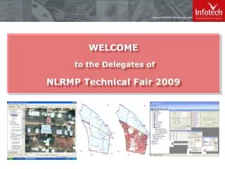
NLRMP 15’th December 2009 R.K.Awasthi
Elcome Technologies Private Limited (a Hexagon Company)
Group Companies Leica Geosystems Elcome Technologies AGL Allen Precision Brown & Sharpe Cable Detection CE Johansson CimCore CogniTens DEA Erdas Geomax Haselbach Surveying Instruments Hexagon Metrology Jigsaw JMTC Leica Geosystems Metrology Leitz m&h Group Mikrofyn MTWZ NovAtel PC-DMIS QBL Rinex Technology Romer SBG Scanlaser Serein Metrology Sheffield Surveyors Service Company Technodigit TESA Viewserve
Coverage Depth or Intelligence Space to Air to Ground Data Acquisition Satellite Remote Sensing Simple Aerial Photogrammetry GPS/GIS Intimate Sensing Depth of information 1:1250- 1:50,000+ Compex
Leica GS09 GNSS Introduction by Mirko Wiebking
Leica GS09 GNSS The GS09 is not the GPS900 • An entirely new GNSS combining the best features from GPS1200+ and GPS900: • Can be used for all types of GNSS setups and tasks • SmartStation capability • A wide range of licenced options are available • Spreads the market beyond Land Surveying • Replaces GPS900 which is phased out
Leica GS09 GNSS Hardware Components • CS09 Controller • Only one type with colour touch screen • Removable CF-card (up to 1GB) • Automatic recognition of connected devices • Accepts LeicaLite, Leica 4G, RTCM, CMR+ • Connects by Bluetooth to GS09 or ATX900 • Bluetooth connection to standard GSM phones
Leica GS09 GNSS Hardware Components • GS09 SmartAntenna • Latest 120 channel Novatel ME4 • Capable of receiving GPS and GLONASS • SmartStation connections • Operates as RTK base station without controller • Transmits LeicaLite RTK message (extended with future firmware release)
Leica GS09 GNSS Smartworx field software Icon-base SmartWorx • Based on GPS900 software with extended functionality • Continous improvement with ongoing firmware updates • SmartWorx provided as standard with CS09 controller • Same functionality available for all regions • Similar licenced options list as VIVA • CS09 supports Carlson SurvCE software
Leica GS09 GNSS USPs • Complete range of setups: RTK Base, RTK Rover, Network Rover, Post processing, SmartStation • Wide range of options & applications • Everything in one case (Base & Rover setup) • Low cost base station (no controller) • Extremely light rover setup when used with a Bluetooth mobile (2.85kg) • No training required for existing System1200 users
TPS1200+What‘s new? • New telescope with new opto- mechanical design and new generation of System Analyser of the EDM Modul. • Replacement of the existing black/white display by a colour display.
New TelescopeThe best reflectorless EDM Performance • Measure inaccessible or hard-to-reach targets up to 1000 meters away – without reflectors – and in true PinPoint accuracy. • With its combination of range, accuracy, laser dot size and measurement time, the TPS1200+ represents the market’s best reflectorless EDM. • Thanks to its extended range, there’s no need for additional instrument setups to reach missing points.
New TelescopeMeasurement with Reflector (IR-Mode) • Improved accuracy Distance 3500m (GPR1): 2 mm + 2 ppm1 mm + 1.5 ppm Leica Geosystems‘ special phase shift method makes it the most accurate EDM in the market with the longest range !
New Colour DisplayBest on the market • All TPS1200+ are equipped with high resolution colour display, which offers brilliant readability in all environmental conditions. • Black/white display no longer available, also not optionally. • Allows more efficient use of the onboard software especially in map view. “What you see is what you get!”
Leica FlexLine – As flexible as you areFlexLine Family • One family - Three series for more Flexibility and Performance • TS02 • TS06 • TS09
Leica FlexLine – As flexible as you areThe Choice is yours Additional Features, e.g. EGL Data Transfer • Bluetooth® wireless • Removable USB stick • Via Cable (MiniUSB, RS232) Electronic Distance Measurement • FlexPoint, 30m • PinPoint – Power, >400 m • PinPoint – Ultra, >1000 m Angular accuracy • 1“, 2“, 3“, 5“, 7“ Keyboard • Standard • Alpha-numerical Software • FlexField Software • FlexOffice Software Arctic Version -35°C Customer Care Packages
Leica FlexLine – Hardware FeaturesAdditional Features • Two-function Trigger key (ALL and DIST at the same time) • Two user definable keys for fast access to functions • Endless horizontal and vertical drives • Laser plummet for easy setup • IP-55 • Emitting Guide Light (EGL) guides rod-man effortlessly for stake out • Second keyboard for measurement in two faces • Multi-lingual
Leica FlexLine – Hardware FeaturesAddtitional Features – Theft Protection • Theft Protection:6 digit PIN-code can be defined and entered by user • Prevents unauthorized persons usage • Increases data security • Makes the equipment unattractive to steal • Lowers insurance cost • PUK-code required if PIN-code entered wrong for 5 times. PUK-code is part of delivery papers.
Leica Zeno GIS SeriesEasy-to-use Mobile GIS • The perfect field and office tools for maintaining your GIS whether you are working for a utility company, local government, federal agency, ensuring Public Safety, exploring Natural Resources or for anyone managing or mapping infrastructure or assets. • Together with the new Leica Viva System, Leica Geosystems ensures maximum scalability.
Leica Zeno GIS SeriesLeica Zeno 10 and Zeno 15 • The most rugged and versatile GNSS/GIS Handhelds in the market • IP67,1.2m drop, operating temp -30 to +60°C • High-Performance sub-meter GNSS/GIS Handhelds • Sub-meter accuracy both real-time and post-processed. • Packed with power for outstanding performance • The optional docking station ensures quick, direct and easy access to the data you have measured in the field. Just plug in and field data is downloaded, post-processed and updated in Zeno Office, with just one simple click.
Rugged, minimal weight and size, excellent handling and usability IP67, 1.2m drop, operating temp -30 to +60°C 14 channel GPS/GLONASS receiver with SBAS, 5Hz and external antenna connector Sunlight readable VGA screen (portrait or landscape) and 2MPixelintegratedcamera Rubber feel and illuminatedQWERTY or Numerickeypad Replaceable & rechargeable battery operating 8-9h, charging time just 2 hours SD slot, CF slot, RS232, USB A Host for memory sick, USBMini for data down-load, 7-pin connector for Docking Station Leica Zeno GIS SeriesLeica Zeno 10 and Zeno 15 Zeno 10 Zeno 15
Leica Zeno GIS SeriesLeica Zeno 10 and Zeno 15 • 14 channels: GPS + Glonass + SBAS • Accuracy • Post-Processing: • L1 Code: ~0.5 m internal and ~0.3 m external • L1 Phase (Static ~7 min): 10 mm + 2 ppm • SBAS <1.2 m (WAAS, EGNOS, MSAS, GAGAN) • DGPS ~0.5 m internal and ~0.3 m external • Supported Real-Time Protocols • RTCM 2.x, RTCM 3.0, Leica, CMR, CMR+ • Automated switch to the best available, user-defined real-time source. • External Antenna • Automatic switch to integrated or external antenna
Leica Zeno GIS SeriesEasy-to-use Mobile GIS
Leica Zeno GIS SeriesEasy-to-use Mobile GIS
Leica Zeno GIS SeriesEasy-to-use Mobile GIS EasyOut/EasyIn