Download
1 / 17
170 likes | 259 Views
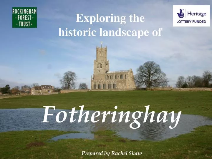
Exploring the historic landscape of. Fotheringhay Prepared by Rachel Shaw. Fotheringhay. Like the rest of Rockingham Forest, the landscape of Fotheringhay went through a process of change. The change that made most impact on the appearance of the countryside was Enclosure.

E N D
Exploring the historic landscape of Fotheringhay Prepared by Rachel Shaw
Like the rest of Rockingham Forest, the landscape of Fotheringhay went through a process of change. • The change that made most impact on the appearance of the countryside was Enclosure. • The surviving evidence shows the stages of this process.
A description of Fotheringhay in the reign of Henry VIII, by Leland, quoted in John Bridges ‘History of Northamptonshire’ 1791
Permission for a Deer Park, stocked from Rockingham Forest, was granted in 1230. The 5m wide boundary bank still survives in many places. The remaining land, too wet or poor for ploughing was left as open pasture for the animals to graze. By 1300, most available land was under the plough, to grow food. People worked communally. They owned scattered strips of arable land throughout the parish.
Around the village you can see earthwork remains, including the old back lane and the boundaries of individual tenements (’back gardens’) and the castle. RAF Vertical Air Photo 1940s, showing the ridge and furrow of the old open fields still surviving under the network of newer field boundaries. Since this photo was taken, much of the old ridge and furrow has been obliterated by modern ploughing.
By the 1600s, some of the pasture areas had been enclosed, making small individually owned meadows. But most of the land is taken up by the great open fields. Fotheringhay township: early C17thCliffe Bailiwick map (The National Archives)
In 1635 the land in Fotheringhay was reorganised. With a reduced population there was less demand for food and less available labour. Now the demand was for cloth so it was more economical to farm sheep. For this you needed enclosed fields. The system of common farming came to an end. Strip-owners were reallocated the equivalent amount of land as privately owned fields. The loss of common rights could cause great hardship to those who had depended on it and had little or no land of their own. It was often resisted.
This is what the land looked like in 1716, 80 years after the common fields were enclosed. In some places you can see that the new fields reflected the old arrangement of strips. The field names can hint at how the fields were used. Fotheringhay township: 1716(Northamptonshire Record Office)
1880s 1880s Use the detailed mapping of the village to identify where you might still see evidence of earlier buildings/ streets/ field layout etc. Work out your route for fieldwork and plot it on your base map.
1716 Fotheringhay village: 1716Northamptonshire Record Office
Close-up of the village, showing the Church and the College (or Priory) It was buit in the 1400s, dissolved in 1539, sold off and eventually demolished. Fotheringhay Village: early C17thCliffe Bailiwick map (The National Archives)