Download
1 / 30
300 likes | 437 Views
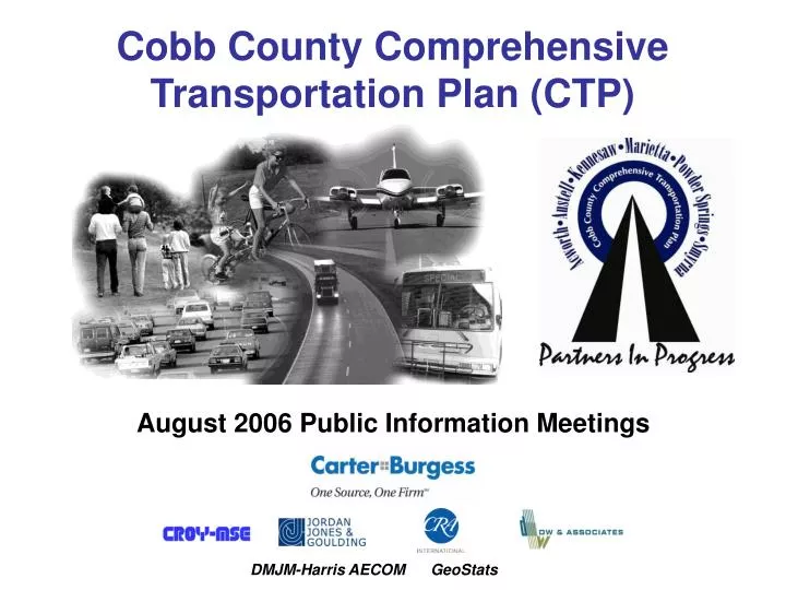
Cobb County Comprehensive Transportation Plan (CTP). August 2006 Public Information Meetings. DMJM-Harris AECOM GeoStats. Study Overview – What is the CTP?. Two part study: Part I –Transportation elements of comprehensive plans Part II: Enhanced Countywide multimodal recommendations

E N D
Cobb County Comprehensive Transportation Plan (CTP) August 2006 Public Information Meetings DMJM-Harris AECOM GeoStats
Study Overview – What is the CTP? • Two part study: • Part I –Transportation elements of comprehensive plans • Part II: Enhanced Countywide multimodal recommendations • “Ground-breaking” effort bringing together six (6) municipalities and Cobb County unincorporated area • Tailored to opportunities and challenges within countywide “vision”
CTP versus SPLOST • Cobb County 2005 SPLOST was approved in January 2006 for six years • SPLOST projects identified for referendum vote • CTP will identify additional improvements & prioritize projects based on level of need and community input • Recommended projects grouped into short, mid and long-range periods through 2030 • Provide input to the ARC transportation plans and programs for funding
Study Schedule Key Milestones AUGUST 2006
Outreach Activities • Project Website Launched www.cobbdot.org/ctp • Produced and distributed fact sheet, press releases, and articles for newsletters • Briefings and Speakers Bureau Activities (County Commission, Cities, District 4 Town Hall Meeting) • Stakeholder Interviews – completed 51 • Stakeholder Coordinating Committee – organized and two meetings held • Public Meetings – eight (8), covering all cities and countywide – average attendance 24; lively discussions
Major Themes of Public Dialogue • Growth • Impact from increased densities • Live-work-shop-play development • Housing to meet the needs of a diverse population • Plan for quality growth managed and supported by essential services • Pace the rate of growth to align with infrastructure improvements • Community Preservation • Preserve what makes Cobb attractive (small town character) • Preserve historic districts, including downtown areas • More pedestrian-friendly central business districts • Preserve quality schools
Major Themes of Public Dialogue • Traffic, Interstates and Roads • Need congestion management • Improve traffic operations • Traffic signal timing • Enforcement • Concern with through traffic • Improve connectivity and accessibility • More parking needed for areas such as downtown Marietta • List of “needed” project improvements
Major Themes of Public Dialogue • Transit • Need more transportation choices • Rail transit service (commuter / trolley / light rail) • HOV/BRT • Circulator systems in downtown areas • Park and Ride Lots • Carpools / Vanpools • CCT service is limited • GRTA Express buses • Transit must be safe, efficient, easy to use and frequent
Major Themes of Public Dialogue • Bike Paths/Pedestrian Trails/Parks • Build bike and pedestrian facilities in conjunction with proposed rail facilities • Need more park space – both active and passive • Connectivity • Emphasize efficient and safe connectivity to activity centers • Connectivity should be planned; not an after-thought
Major Themes of Public Dialogue • Where should more money be spent? On a scale of 1-10, the stakeholder interviewees responded as follows: • Streets and Highways – 8.2 • Public Transit – 7.5 • Pedestrian Facilities – 7.3 • Bicycle Facilities – 6.1
Random Public Opinion Survey • UGA Survey Research Center conducting survey • Survey instrument / questionnaire approved by County Management Team • 1,000 random phone interviews conducted of Cobb County residents. Over-sampled City residents • Results are being crosstabulated by: • Cities • Demographics of respondents (age, income, etc) • Commuting patterns • Results are being tabulated and reviewed
Cobb County’s transportation system will be environmentally compatible, financially sound, safe and an efficient and functional network providing multimodal service to all areas of the county. Founded on partnerships between public, private and nonprofit organizations, Cobb County’s transportation network will be integrated with local and regional land use and transportation plans, and supportive of a variety of uses including significant greenspace and “live-work-play” communities. Draft Countywide Vision Stakeholders Committee Meeting, June 14, 2006
Draft CTP Goals • System Performance and Safety – To improve the overall performance and safety of the transportation system • Multi-modal System – To develop a multi-modal system in which each mode is optimized providing the citizens of Cobb County with attractive and realistic travel alternatives
Draft CTP Goals • Land Use Connectivity – To develop a transportation system that is appropriate to the land uses it serves • Financial Management – To ensure that adequate financial resources are available to maintain properly the transportation system and to grow and adapt the system in keeping with changes in land uses
Scenario Development • Consider alternative socioeconomic projections from regional, local and other sources • Identify future transportation needs generated by proposed community plans • Identify areas where future land use plans or planned transportation improvements may be better coordinated
Developmentof “Increased Population Growth” Scenario • Input received from local jurisdictions: • Unincorporated Cobb County: Forecasts reflect future land use plan • City of Marietta: Specific Traffic Analysis Zones (TAZs) adjusted, none to lose population or employment as projected in ARC model. • City of Kennesaw: Forecasts reflect rate of growth from Comprehensive Plan and specific adjustments to ARC employment projections for individual TAZs • Cities of Acworth, Austell, Powder Springs, and Smyrna: Provided specific adjustments to ARC projections for individual TAZs • Review of development trends/future land use indicated slightly less employment growth to 2030
Travel Demand Model Assumptions *preliminary analysis
Scenario Performance *preliminary analysis
Scenario Performance *preliminary analysis
Roadway Service Level – Northwest *preliminary analysis
Roadway Service Level – Countywide *preliminary analysis
Bicycle/Pedestrian Analysis–Countywide • Bicycle Suitability Factors • Traffic Volume • Travel Speeds • Functional Classification • Outside Lane and Shoulder Width • Percent Truck Traffic • Roadway Miles by Suitability Score • Very difficult conditions for bicycling – 49.9 miles • Difficult conditions for bicycling – 121.3 miles • Medium conditions for bicycling – 1,848.5 miles • Best conditions for bicycling – 546.6 miles • Summary • 171 miles (6.7%) of roadway in Cobb County with difficult to very difficult bicycling conditions • 2,395 miles (93.3%) of Cobb County roadway offers medium to best bicycling conditions • 655 miles of sidewalk needed within ¼ mile of activity centers • 462 miles of existing sidewalk and 113 planned (97-SPLOST and 16 RTP)
Bicycle/Pedestrian Analysis– Northwest • Roadway Miles by Suitability Score • Very difficult conditions for bicycling – 15 miles • Difficult conditions for bicycling – 37 miles • Medium conditions for bicycling – 343 miles • Best conditions for bicycling – 84 miles • Bicycling Summary • 52 miles (11%) of roadway in planning area with difficult bicycling conditions • 427 miles (89%) of roadway in planning area offers medium to best bicycling conditions • Pedestrian • 54 miles of sidewalk needed within ¼ mile of activity centers
Safety Needs – Northwest High Crash Locations (2001-04) • Cobb Place Blvd @ Barrett Parkway (465) • Barrett Parkway @ Bells Ferry Road (132) • Town Center Drive @ George Busbee Parkway (127) • Chastain Road @ Bells Ferry Road (96) • Shallowford Road @ Bells Ferry Road (87) • Cobb Parkway @ Cobb International Blvd (87) • Interstate 75 @ N. Marietta Parkway (54) • Cobb Parkway @ Dobbs Drive (48) • Frey Road @ Shiloh Road (46) • White Circle @ Old US Highway 41 (43)
Community “Assessments” for Jurisdictional Comprehensive Plans • Transportation Elements developed by CTP team utilizing: • Transportation Inventory reports • Input from local jurisdictions • Transportation Elements incorporated into overall “Assessments” will be submitted to ARC by mid-August
Topics for Breakout Session • What do you mean by land use character changes in certain corridors? How will this impact use of alternate modes in the future? • What needs or issues have we missed or left out ? • How did you hear about this meeting? How can we continue to improve our outreach activities?