Download
1 / 21
210 likes | 689 Views
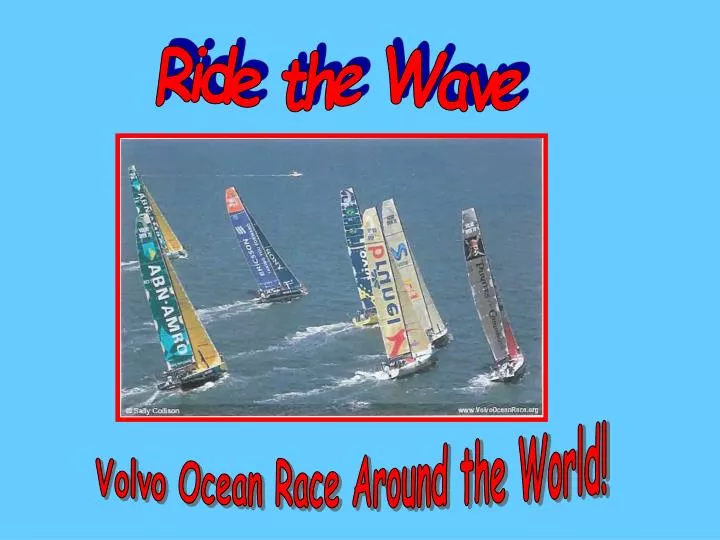
Ride the Wave. Volvo Ocean Race Around the World!. Ride the Wave! Catherine Maloney Susan Bogart Cold Spring Harbor School District Cold Spring Harbor, New York. Ride the Wave!. What is the Volvo Ocean Race Around the World? Where can I find information about the Volvo Race?

E N D
Ride the Wave Volvo Ocean Race Around the World!
Ride the Wave! Catherine Maloney Susan Bogart Cold Spring Harbor School District Cold Spring Harbor, New York
Ride the Wave! • What is the Volvo Ocean Race Around the World? • Where can I find information about the Volvo Race? • How can I use the Volvo Ocean Race in the classroom? • How can I integrate the Volvo Ocean Race into my curriculum? • What skills in technology will the class learn creating an • outcome reflecting its understanding of the ports of call.
What is the Volvo Ocean Race Around the World? Imagine putting your class aboard a high-tech, seventy-foot sailboat and spending the school year vicariously racing six other boats on a 32,000 nautical miles spin around the world, visiting nine fascinating ports of call along the way! The Volvo Ocean Race, sponsored by the Swedish auto maker, allows your students to follow the race, via the internet (www.volvooceanrace.org), plotting positions and reading action-packed e-mails from the crews, describing the problems faced daily in some of the world’s wildest waters! The internet has made it possible for my students to learn so much about geography, navigation, survival skills and develop respect for the cultural differences around the world.
Race Track for the Volvo Ocean Race Around the World 2005-2006
How can I use the Volvo Race in my classroom? Working in pairs, students visit www.volvooceanrace.org daily to read up-to-date news coverage, record position data and plot their boat on map in their ship logs. Boat tracking is color coded on a master map on the bulletin board, so once the students plot their boat’s latitude-longitude, they can compare their boat’s position to the other racers. During opening exercises, students share the news from their boats. Depending on which leg is involved, news could relate to dismastings, rudder problems, sighting of sea-life, flying fish landing on decks, iceberg ahead, slippery decks, rough seas, injuries or damaged sails.
How can I integrate the Volvo Race in my curriculum? Literature Graham, Robin Lee, The Dove Avi, True Confessions of Charlotte Doyle Avi, Windcatcher Fox, Paula, Slave Dancer Stevenson, R.L., Treasure Island Paulsen, Gary, Voyage of the Frog Social Studies Customs, cultures Latitude/Longitude Different maps, different uses Time Zones History of sailing, exploration and trade Newspapers, E-mails from skippers “Life at the Extreme,” Volvo Ocean Race 2005-2006 Biographical sketches of crew at ww.volvooceanrace.org
More Curriculum Connections Math Estimation Mileage calculations Time?Distance?Speed Conversion from Celsius to Farenheit Geometry Compass Rose, Degrees,Angles Averaging Problem solving Elapsed Time Calculations Graphing Data Grids and Coordinates Science Global Communications Computer technology Global weather patterns Weather instruments Astronomy Ecology/Environmental Saving Long Island Sound Seasons and the Hemispheres Wind belts Ocean Currents
Health and Physical Fitness Nutrition FDA Food Pyramid Physical Fitness First Aid Survival Skills Clothing Nutrition at Sea Risk vs. Accomplishment Leadership qualities Coping Skills Time Management In Crisis...Stop! Think! Action! The Arts Sea Chanties Folk Songs Classical Music...Debussy’s La Mer Music defining Port of Call Creative Outcomes Port of Call Power Points Poems celebrating the sea Music Appreciation Around the World
What supplies do I need to set the stage for learning? Computers with Internet Connection www.volvooceanrace.com www.googleearth.com Globes, Atlases, Nautical Charts www.worldatlas.com Good for verifying accurate latitude/longitude for ports of call. Hand-out Booklet provides the following: Legs and Dates Keeping a Daily Log for one boat Plotting Map of the World Plotting Map for Leg 5 (Rio de Janeiro to Baltimore) Plotting Map for Leg 7 New York to Portsmouth, England) Logging Data Sheets Compass Rose Summary sheet for review of E-mails and news Port of Call PowerPoint Requirements Around Alone 1998-1999
Position and Data Sheet...February 22 CMG=Compass Heading EDC=Estimated Distance Completed DTF= Distance to Finish Pirates of Caribbean Data Sheet...February 22
Leg 4 – Wellington, New Zealand to Rio de Janeiro Atlantic Ocean 0 20 s 80 s N W E S
Plotting Sheet Leg 5 Rio de Janeiro to Baltimore
Think of all the treasure hunts you can set up on the playground so your students can practice using their compass skills! The compass is also a great tool for teaching angles.
Leg 5 – Rio de Janeiro to Baltimore/Annapolis March 25 5,000 Nautical Miles Daily Duties Aboard! Log on to www.volvooceanrace.org. Record data on Daily Data Sheet Plot your boat’s position on your Leg 5 map Use your Daily Data Sheet to answer the following questions: 1. In what direction is your boat sailing? 2. How far is your boat from Rio de Janeiro? 3. How many nautical miles is the closest boat off your stern? 4. How far is your boat from the leader? 5. If your boat continues to sail at its present speed, on what date is your ETA (Estimated Time of Arrival)? 6. What is your range of wind speed from March 25 to April 1? What reasons can you give for the change in wind speed? 7. Review your log and create a T-Bar chart reflecting the relationship between the wind speed and the speed of your boat. 8.Round out the DTF for the fleet, to the nearest ten. 9. What was the average speed of the fleet for today? 10. Through what body of water will you be sailing as you approach Baltimore? 11. Any news from your boat? Check E-mails and news releases. Record news on Comments sheet. 12. When your boat reaches Baltimore, create a headline and a lead paragraph summarizing the highlights of the events aboard your boat for leg 5. 13. Using information from your Daily Data Sheet, create a bar graph showing the distances covered by each boat by April 1.
Volvo Ocean Race 2005-2006 Comment Sheet Leg______________ Check E-mails and news on www.volvooceanrace.org daily and summarize highlights.
Field Trips Baltimore/Annapolis...May 5-7 Family will travel to Baltimore and Annapolis to see the Volvo boats. After spending a day touring the sites in Baltimore, families will tour colonial Annapolis, the Naval Academy and Annapolis Harbor. The highlight of the trip will be a walk across the Chesapeake Bay Bridge, where they will watch the boats take off on Leg 6 to New York City. New York City...Boats will be at South Street Seaport from May 8-11 preparing for Leg 7, New York to Portsmouth, England. Soundwaters...June 19 Sail aboard an 80-foot, three-masted schooner, into Long Island Sound, where students will get to hoist the sails, haul the fishing net, and learn about Long Island Sound’s ecology at the salt marsh and the water station. They’ll sit silently for a while and listen to the waves slapping the hull, the sails snapping in the breeze, and they’ll hear the whistle of the wind through the halyards...great time to ” think poetry!”
Additional Information from Around Alone 1998-1999 • Nutrition and Sea Fare • The Compass • Latitude and Longitude • Time Belts • Map Reading on land and at sea • Plotting • Waves, Weather and Currents • Weather Station • Seasons • Sails: The Engines of a Sailboat • Ocean Ecology • Navigation • Making landfall • Nautical Glossary