Download
1 / 5
60 likes | 84 Views
We offer licensed surveys include 3D tampa mapping, aggregate & stockpile volume measurement in Miami, East & West Coast at Florida Aerial Survey Technologies<br><br>Website: https://www.floridaaerialsurvey.com/

E N D
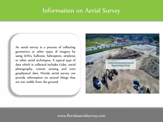
Information on Aerial Survey An aerial survey is a process of collecting geometrics or other types of imagery by using UAVs, balloons, helicopters, airplanes or other aerial techniques. A typical type of data which is collected includes Lidar, aerial photography, remote sensing and even geophysical data. Florida aerial survey can provide information on several things that are not visible from the ground. www.floridaaerialsurvey.com
How 3D Mapping Works for Various Industries Aerial surveying is very important as the data collected becomes a source of information for studying landscapes and appropriate planning. Several industries like Landfill management, Land development, Civil Engineering, Coastal Engineering, Landscape designing etc. need aerial surveying to study the landforms and then go ahead with planning, designing, developing etc. www.floridaaerialsurvey.com
South West Florida survey Look for a South West Florida survey company that is experienced to work in several industry sectors. The company should possess all the necessary licenses and should be insured. The training and skills of the pilot play a very important role, when it comes to a drone flight and data collection. An experienced and licensed pilot will be able to access hard to reach areas without any difficulties and get you the best pictures for gathering information. www.floridaaerialsurvey.com
Drone Survey Data Is Realistic Aerial surveying captures images of the earth’s surface from various angles. Several organizations that manage or build on landforms rely on the data collected by aerial surveying. The pictures and data collected by aerial surveying helps in communicating concepts, measurements and problems to developers, planners etc. Local governments and municipalities utilize aerial survey data to improve town planning, mining companies require aerial surveying for quantifying and managing disturbance, www.floridaaerialsurvey.com
Contact us +1 239-249-5228 info@floridaaerialsurvey.com www.floridaaerialsurvey.com www.floridaaerialsurvey.com