Download
1 / 34
340 likes | 663 Views
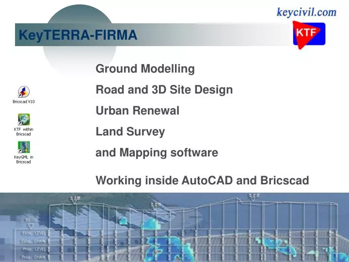
KeyTERRA-FIRMA. Ground Modelling Road and 3D Site Design Urban Renewal Land Survey and Mapping software Working inside AutoCAD and Bricscad. KeyTERRA-FIRMA. KeyTERRA-FIRMA Ltd. Established 1998. Bricsys Partners from 2009 - we supply Bricscad V11 Member of the Key Systems Group.

E N D
KeyTERRA-FIRMA Ground Modelling Road and 3D Site Design Urban Renewal Land Survey and Mapping software Working inside AutoCAD and Bricscad
KeyTERRA-FIRMA Ltd. Established 1998. Bricsys Partners from 2009 - we supply Bricscad V11 Member of the Key Systems Group. Based in Worcestershire with clients throughout the UK. Highly successful policy of evolving software to meet user requirements and ease of use. Key Systems are one of the original UK Autodesk Dealers and Developers.
KeyTERRA-FIRMA Release 7 Working inside AutoCAD 2007 to 2012 platforms plus Bricscad. Highly suitable for a broad range of Civil, Environmental, Landscape and Land Survey projects. Unsolicited endorsement from Seer Projects Ltd. in Windsor “I like KTF ….. … I can’t remember how long we have used it for now but I am sure our first version was 4.0 - I have used it continuously.”
KeyTERRA-FIRMA Users Large number of City, County and District Councils. Leading Consultants including Arup, Atkins, Peter Brett, Hyder, Jacobs, Mott MacDonald, RPS, SLR and WYG. Developers, Water and Port Authorities, Ordnance Survey plus many Land Surveying and Landscape companies consolidate a strong established user base. The most northern users are in Finland and Shetland The most southern are based in Port Stanley in the Falklands KTF has also been used in Montserrat
KeyTERRA-FIRMA is used for :- Residential and Industrial Estate design New Road schemes and improvements General earthworks and volume calculations Urban Road design, Regeneration and Maintenance Landfill, Quarrying and Reclamation Car park and Sports pitch design River surveys and simple flood modelling Embankment calculations and bund design Zones of Visual Impact analysis (ZVI) Water and gas pipelines Pond design and other water related applications Airport related projects including approach surveys Land Survey work of all shapes and sizes
KeyTERRA-FIRMA The six modules Most users have the mainstream version including modelling and design :- Base Ground Modelling Design Rivers Land Survey Translators “Add on” modules for :- Survey observation input Two way WinDes translator ZVI
KeyTERRA-FIRMA Land Survey Direct input from Dataloggers, Total Stations and GPS. Automated 3D wire frame survey drawing using MX type feature codes.
KeyTERRA-FIRMA Sections Road and river sections created rapidly from survey drawing
KeyTERRA-FIRMA Ground Modelling Models created directly from 3D drawing entities. 3D Polylines recognised as break lines. Existing site or design represented as a series of triangles.
KeyTERRA-FIRMA Ground Modelling From 3D CAD drawing …. (or large .xyz files)
KeyTERRA-FIRMA Ground Modelling to Ground model in seconds
KeyTERRA-FIRMA Model outputs Rapid Contouring and annotation
KeyTERRA-FIRMA Model outputs 3D Grids (for viewing and rendering) Slope direction and gradient at any location Average level calculation for slab levels etc. Landfill settlement calculation Drape 2D drawing entities Interpolated level grid Interpolated levels
KeyTERRA-FIRMA Model outputs Sections KTF is very strong in all aspects concerning sections Represent a Horizontal Alignment as a 2D Polyline ….
KeyTERRA-FIRMA Sections Sections rapidly drawn with intelligent structure for subsequent enhancement and design functions etc.
KeyTERRA-FIRMA Sections Sections drawn at natural scale or with vertical exaggeration. Enhanced in CAD or graphics package.
KeyTERRA-FIRMA Ground Modelling Embankments are calculated from design features represented as 3D Polylines. Volume calculations compare existing and design models to report cut and fill quantities. Easy water volume calculation. Cut and fill colour mapping (isopachytes) ….
KeyTERRA-FIRMA Ground Modelling Z value colour mapping Superb presentation for cut and fill, hydrographic survey, coastal erosion studies and ZVI results.
KeyTERRA-FIRMA Water functions Volumes (EA banding). Flood area mapping (from horizontal and sloping surfaces). Water storage and balancing pond modelling. Bund design. 3D views. Pipelines. Landfill cell floor design.
KeyTERRA-FIRMA Road Design Horizontal and Vertical Alignment designs combined by powerful 3D String functions. Suitable for new roads, complex estate road layouts, junctions, widening, improvements and roundabouts. Suitable for urban renewal and regeneration projects. Not just Road Design but a powerful and flexible set of tools for 3D Site Design.
KeyTERRA-FIRMA Alignment Design Horizontal Alignment represented as 2D Polyline. Designing on a long section, tools exist to help with vertical curves, K values and optimisation to represent the Vertical Alignment as a 2D Polyline.
KeyTERRA-FIRMA String Design The Master String combines Horizontal and Vertical Alignments Standard or complex string definitions (including non parallel channel geometry and super-elevation). Highly flexible individual String design functions. 3D Polylines, sections and report outputs. “Cruise along the road” viewer. CHAINAGE 0.000 BEARING 127d15'14" point Easting Northing Level Offset String Name 1 750.984 997.440 20.897 -6.173 (Embankment) 2 750.667 997.024 20.723 -5.650 lpath 3 749.457 995.432 20.673 -3.650 lkerb 4 749.457 995.432 20.548 -3.650 lchan 5 747.247 992.527 20.639 0.000 Centre 6 745.038 989.621 20.548 3.650 rchan 7 745.038 989.621 20.673 3.650 rkerb 8 743.827 988.029 20.723 5.650 rpath 9 743.162 987.155 20.357 6.748 (Embankment)
KeyTERRA-FIRMA 3D Site Design Special projects that have relied on KeyTERRA-FIRMA include the rock revetment scheme at Easington in East Yorkshire to protect the Gas Terminal and the unique dual guided bus lanes at Leeds.
KeyTERRA-FIRMA 3D Site Design KTF is excellent for sports pitch and car park design plus general site development. Combining the Base module, Ground Modelling and Design functions in a variety of sequences provides the most powerful and flexible solution.
KeyTERRA-FIRMA Rivers River section generation and preparation for modelling inputs KTF River survey CAD drawing Efficient river cross section production Output to Environment Agency EACSD format Translators to ISIS, Hec-Ras, Mike 11, EEB and simple .csv format
KeyTERRA-FIRMA ZVI Zones of Visual Impact. A powerful analysis and presentation tool to assist with visibility studies. Typically working with very large .xyz data sets including OS LandForm Profile DTM. Single or multiple targets.
KeyTERRA-FIRMA ZVI Targets may be proposed wind turbines, masts, chimneys, buildings and roads (point, linear or area). Results relate number of visible targets to user specified colours. Calculation works on a radial basis
KeyTERRA-FIRMA ZVI Field of view analysis KTF ZVI now includes the option to calculate the impact in the field of view. Working on the effects of the horizontal range of targets. Results displayed as colour mapping related to the receptor’s angle of view.
KeyTERRA-FIRMA ZVI Translators Two way MOSS / MX Genio files. OS LandForm and other products. WinDes onto Sections, Schedule drawing and Network generation
KeyTERRA-FIRMA KTF 7 Excellent support Terrific Value (to buy or hire) Continuous Development Expanded new reference and tutorial documentation Training courses (for established and new users) KTF is developed to be as easy to learn and use as possible!
KeyTERRA-FIRMA KeyGML Working inside AutoCAD or Bricscad to read OS MasterMap .gz and .gml files. Drawing created in a structured and user controlled way. Read multiple files (chunks). Extract and draw only an area of interest (e.g. defined by closed Polyline). Polygons drawn as Polylines or solid hatch. Batch mode to create traditional 1:1250 and 1:2500 tiles. Easy tile input by location.
KeyTERRA-FIRMA KeyGML Bricscad V11 Pro - the alternative CAD platform From Bricsys in Belgium www.bricsys.com Download a 30 day evaluation and purchase the license from us. Unsolicited endorsement from Maccus-Well Ltd. in West Yorkshire “I'm impressed with the Bicscad software - can't believe how simple the transition was from AutoCAD. I haven't had any real problems so far.”
KeyTERRA-FIRMA Ltd. UK 01527 68888