Download
1 / 33
330 likes | 757 Views
Timothy S. Hare Kentucky Center for Geospatial Education, Research, & Outreach Institute for Regional Analysis & Public Policy Morehead State University t.hare@morehead-st.edu Geographical Tools to Facilitate Class Activities with Project Wild Aquatic Activity Outline (~45 minutes)

E N D
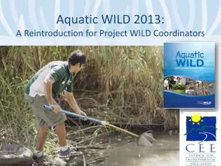
Timothy S. Hare Kentucky Center for Geospatial Education, Research, & Outreach Institute for Regional Analysis & Public Policy Morehead State University t.hare@morehead-st.edu Geographical Tools to Facilitate Class Activities with Project Wild Aquatic
Activity Outline (~45 minutes) • What tools are available? • How can one use the tools? • Demonstration of several free online resources and tools. • Demonstration & hands-on trial with GPS receivers
Free Multimedia Ways to Explore… • Static Web Sites • Where Storms Are Worsening • Global Warming Art • World Atlas of Flooded Lands • Interactive Climate Map • US • Wetlands Mapper • Historical Hurricane Tracks • World • Google Earth • National Geographic Map Machine
Google Earth • Free • Must be installed to computer • Compatibility • Windows • Mac • Details • Interactive web mapping of the Earth & sky • Very popular with kids • Numerous educational materials available
Google Earth Resources • Downloading Google Earth • Google Earth User Guide • Google Earth Outreach • Google for Educators • Google Earth Galleries • Main Gallery • Outreach Gallery Additional Resources • User Forums • Google Earth Blog • Google Maps Mania
Google Earth Demonstration • Main Interface • Address locations • Built-in modules • Add-in modules
The Global Positioning System • 24 high-altitude satellites • Built for the US Military • Ongoing improvements
GPS Satellites • > 24 at all times. • 3 atomic clocks per satellite • Built to be resistant to blocking & jamming • Rockwell: • 17 feet • 1900 lbs
Ranging, why are 3 needed? GPS Satellite
Relative Timing • Each satellite sends out the same sequence of signals • Receivers calculate the shift between identical parts of the code Time difference
GPS Uses • Mapping • Natural Resource-based: • Animal/plant locations • Soil/water sampling locations • Human-based: • Air & sea navigation • Emergency Services Locating • Airplane landing systems • Car-based direction services.
Why is the system not perfect? • Error sources • Atmospheric • Multipath scatter • Positional error • Cheap GPS Units • Limited satellite channels • Poor internal processors
One solution to the Error – Differential GPS • Use two receivers to eliminate much of the signal error • Increases accuracy to a few centimeters with good units
GPS Hardware Options • Consumer-grade • Garmin III plus • >3 meter accuracy • eTrex • Garmin V • <3 meter accuracy 95% of the time • WAAS • GPSMAP 60Cx • Survey-grade • Trimble 5700
Other GPS Units • Survey Grade • Thales Promark2 • Navigation • WAAS <3 m • Post-processing • <1 cm • Kinematic • ~1 cm
GPS Activity Learn how to navigate with GPS Collect some locations with GPS
How do you use the GPS to record a location? Quick & Dirty • Record the coordinates on the GPS unit’s screen Sophisticated • Press ENTER/MARK button to record your location. • Use the ROCKER button to specify information about the point • Select “OK” and press the ENTER
How do you use the GPS unit to navigate? Quick & Dirty • Try to match the coordinates on the GPS unit with the coordinates on the handout. Sophisticated • Use navigation tools on the GPS unit. • Enter location coordinates as a new waypoint on the GPS Map Page. • Use the GOTO button to set the waypoint for navigation.
Using the GPS Unit’s Navigational Tools • Manually Create a New Waypoint: • Change the screen to the Map Page. • Use the ROCKER button to move the pointer to the desired location on the map. • Press the ENTER/MARK button to create the new waypoint. • Use the ROCKER button to edit the name or additional information about the new waypoint. • Use the ROCKER button to select the ‘OK’ button and press ENTER to save the waypoint. • Navigating to a Prerecorded Waypoint: • Press the GOTO button. • Use the ROCKER button to scroll through the list to either the named location you created or ‘Waypoint’ and press the ENTER button. • Use the ROCKER button to scroll through the list to the desired waypoint and press the ENTER button to select the waypoint. • Use the Pointer Page to determine which direction to go.
WARNINGS • REMEMBER – GPS units only show the correct direction after the unit is in motion. • Look where you are going, not just at the GPS unit.
What else can be done with GPS • Collect locations of important things: • Animal & plant species • Data collection locations • Places to which one needs to return • Transfer locations in GPS to computer • View locations in Google Earth or other free mapping programs
How do these tools fit into Project Wild Aquatic? • As classroom demonstrations • As supplements for prepared activities • As stand-alone activities • To support class & individual student projects
As stand-alone activities • Targeting content standards • Environment & wetlands • Social Studies • Math • Geography • Economics • History
Benefits • Free • Easy to use • Hands-on activities • Depth of knowledge & understanding • Gee-Whiz affect for students
Timothy S. Hare Kentucky Center for Geospatial Education, Research, & Outreach IRAPP, Morehead State University 100D Lloyd Cassity Building t.hare@morehead-st.edu 606-783-9436 Thank You
Kentucky Center for Geospatial Education, Research, and Outreach • Expand the use of geospatial technologies at MSU • Improve students’ technical & analytical abilities • Support faculty & staff use of geospatial technologies • Contribute to the development of potential business opportunities in our region.
Institute for Regional Analysis and Public Policy (IRAPP) Center of Excellence, MSU AKentucky Program of Distinction http://irapp.morehead-st.edu