Download
1 / 13
130 likes | 141 Views
Land Navigation. GPS For the Light Infantry Leader. What is GPS. A navigational system to determine location and velocity on land, at sea and in aircraft over the Earth A system; your receiver is just one part of it Installed and operated by the USAF; fully operational in 1995

E N D
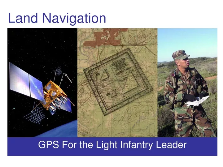
Land Navigation GPS For the Light Infantry Leader
What is GPS • A navigational system to determine location and velocity on land, at sea and in aircraft over the Earth • A system; your receiver is just one part of it • Installed and operated by the USAF; fully operational in 1995 • 28 satellites (incl. 4 spares), orbiting 22,200 km up • Satellites send microwave signals with very precise time signals; synchronization of several of these signals with the GPS unit’s clock and triangulation gives a location on the surface of the Earth • You can only see a few at a time due to the shape of the Earth; at least 4 are required for a good location fix
What GPS is good for • Indicates location on (or above) the Earth • Tells time very precisely and accurately • Indicates speed, direction, altitude • Does most of this with great precision • Reasonable accuracy; location as good as a few feet with most modern hand-held units • All units have some added features: • Waypoints • Routes • Tracks • Dynamic heading/distance • Moving map display
What GPS is not • A compass*; the north arrow is (generally) only relative to the track when moving • Always accurate or available; certain conditions can degrade accuracy or cause total loss of signal, including: • Being indoors, or under any structure • Terrain, including trees, mountains and ravines, buildings • Space weather (e.g. solar flares) • Sandstorms (due to static electricity) • Geometric Dilution of Position; sometimes, your satellites will be in bad positions, and accuracy will drop for several hours, by as much as a factor of 10** • Active jamming (loss of signal) or spoofing (showing false positions) by adversaries • Some units do have built in real-time compasses, but these have their own limitations, and vary by device. GPS itself does not have a live compass, so understand the north arrow only counts when moving, and relative to the track ** If GPS precision is important for a mission, have the USAF Space Command contact for your theater run the GIANT program to tell you the best times.
What GPS is not • Free-standing. Satellites and radio has to work for your receiver to operate. • Permanent. Selective Availability (S/A) allows the DoD to degrade performance of commercial units in wartime. • Proof against enemy interference. Jamming and spoofing has been demonstrated, and used in the field.
Pitfalls: Precision vs. Accuracy • Precision vs. Accuracy: A precise rifle groups well; an accurate one hits the target. While both is best, accuracy is paramount. • The GPS, like most electronic devices, implies great accuracy due to its display of data very precisely. • Recognize the possibility and keep it in mind; most modern GPS units will display an accuracy value. Use this, the number of satellites tracked and other behaviors to help determine how accurate the unit is reading at that moment.
Pitfalls: Tool in the Toolbox • GPS is a supplemental navigational tool, not a crutch • Use GPS in conjunction with: • Compass • Distance (pace or odometers) • Terrain association • Common sense • GPS will let you down if you have poor landnav skills, or are getting poor results with other methods
Setup • Carry extra batteries; know how to change them in the dark • Read the manual; some of these setup functions are complex or counter-intuitive • Find a place to put it on your gear (should allow the antenna to see the sky; best if it can do this all the time to speed its use, track your travel, etc.) • Configure it to not beep, and be secure* • Set the grid to MGRS; UTM will do, but avoid lat/long in degrees** • Set Datum. WGS84 is a good default, but look at your maps every time. You may have to change it in the field, so memorize how to • Enable WAAS (EGNOS in Europe and MSAS in Japan are the same thing) for increased accuracy * The Garmin Rhino is a reasonably popular series of handheld units that combines GMRS radio with a GPS unit. It also can transmit position information to other Rhinos in the area. This should, of course, be disabled in any tactical situation to avoid enemy interception. ** While all ground units, and much air support, refer to ground locations using MGRS, the USAF in general uses Lat/Long. If you can set a secondary grid, go ahead and have it set to Lat/Long, in DDMMSS.S format, just in case. Know how to change it in the field as well.
Pre-mission • Mapping GPS units, especially, will benefit from use of software on desktop computers. With this, you may more easily load information into the unit. • Plug the GPS into the PC, and load mission plan information into the unit. • Load maps for the area if you have a mapping GPS • Load waypoints and expected routes; remember to use maps and be flexible, a few good points and routes are better than many cluttering up the display • Review the GPS maps and compare to your issue printed maps, other information issued or which you have from previous observation. Digital maps have flaws and are often out of date; Note the discrepancies so you are prepared for contingencies when you get on the ground • Keep OPSEC in mind; just like a printed map, use codenames for objectives. Do not store waypoints for rear areas, and other items not required for the mission
Using in the field • Use GPS units in conjunction with compasses, distance measuring equipment and terrain association • Know what you want to get from the GPS unit before pulling it out; do not stare at the screen while walking, or just hope it will tell you the answer • Refer to the GPS unit for current coordinates, distance and bearing to waypoints, and to observe your recorded track • Do not burden your decision making with technology-management or get possessive about the cool toy; allocate the GPS and its tasks to team members
Field Use: Exercises • These may be performed anywhere there is suitable room and a GPS signal • Ex: Refer to GPS to confirm pacecount; it may be useful to allocate the 2nd man in line the GPS for this reason • Ex: Use the track recording function to assure a good box-search in difficult terrain; fill in gaps in the search so far • Ex: Set a deliberate waypoint (e.g. patrol base); use GPS functions to find distance/heading back to the base, then return using compass/pacecount • Ex: Set a hasty waypoint while on the march, such as a road intersection or observed enemy position • Ex: Confirm the actual location of a feature (as of the patrol base above) using all data sources (map, gps, terrain). Decide how to discard bad data if they do not all agree
Post-mission • After the mission, do essentially the reverse of the pre-mission planning • Do this as quickly as practical, so your memory can fill in gaps in notes, and while the information is still relevant • Plug the GPS into the PC, and upload the unit’s stored data into the computer • Upload new waypoints you may have entered while in the field; if short (or no) labels were allocated, refer to your paper notes to give them more useful labels for the future • Upload track information to see the path you actually moved along; compare this to your planned path and determine why it varied • Compare this information to other notes and information obtained by other navigational techniques. Attempt to determine where you actually went and where you actually found points of interest. Even if you will not be travelling in this area again, someone else might; more information is always useful