Download
1 / 14
220 likes | 924 Views
MAPS. What is a map? Maps are a visual representation of the Earth’s surface, drawn to scale and made for a specific purpose. TYPES OF MAPS. Physical Maps show the physical (natural) features of an area Ex. Elevation Mountains Rivers Deserts Etc. TYPES OF MAPS. Political Maps

E N D
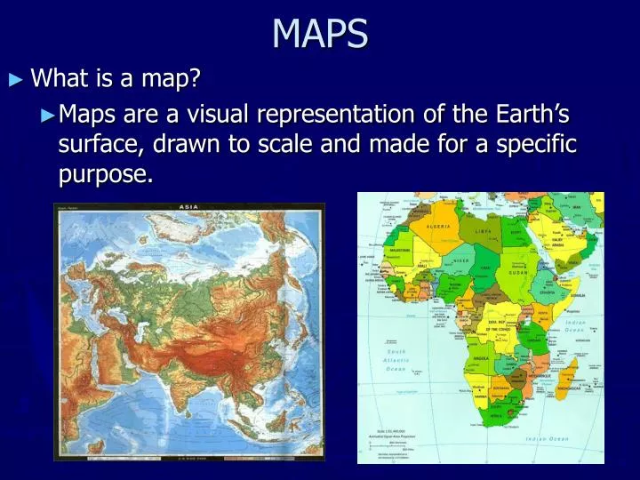
MAPS • What is a map? • Maps are a visual representation of the Earth’s surface, drawn to scale and made for a specific purpose.
TYPES OF MAPS • Physical Maps • show the physical (natural) features of an area • Ex. • Elevation • Mountains • Rivers • Deserts • Etc.
TYPES OF MAPS • Political Maps • Show the political (man-made) features of an area • Ex. • Countries • Cities • Capitals • Etc.
SPECIAL PURPOSE (THEMATIC) MAPS • Maps designed for a special purpose • Ex. • Highway • Climate • Population • Etc.
CARTOGRAM World Energy Consumption • A Cartogram is a special purpose map that shows the size of a country based on data rather than actual land size.
TODALSIG • Components of a map: • T = Title • O = Orientation (Compass) • D = Date • A = Author • L = Legend • S = Scale • I = Index • G = Grid
BASIC COMPONENTS OF MAPS • Which component tells us the pieces of information we can learn from the map? • the Legend / Key • Which component tells us the subject of the map? • the Title • Which component indicates direction? • the Compass (Orientation) • What do we call the lines running north/south and east/west? • the Grid
SCALE • What does scale tell us? • How the map size compares to the size of the actual area
LATITUDE AND LONGITUDE • What are the imaginary parallel lines that circle the earth called? • Lines of Latitude • 0° Latitude is known as what? • the Equator • Other Important Lines of Latitude: • 23.5° N: Tropic of Cancer • 23.5° S: Tropic of Capricorn • 66° N: Arctic Cirlce • 66°S: Antarctic Circle
LATITUDE AND LONGITUDE • What are the imaginary lines that run from the North Pole to the South Pole called? • Lines of Longitude • What is the central line of longitude called? • the Prime Meridian
HEMISPHERES • What is the name of the line on the globe to the left? What does it do? • The Equator; • It divides the globe into Northern and Southern Hemispheres • What is the name of the line on the globe to the right? What does it do? • The Prime Meridian; • It divides the globe into Eastern and Western Hemispheres
BIAS • a particular tendency or inclination, especially one that prevents unprejudiced consideration of a question; prejudice. DISTORTION • A change in the shape of an image
GEOGRAPHY ALIVE! MAPS LAB ACTIVITY • Your assignment is to create a map of your choosing. • Examples: A room @ your home, your home, a classroom of yours, etc. • Your map should include the following features: • An appropriate Title • A compass rose (Orientation) • The Date the map was created • Your Name (Author) • A Legend or Key
CONTINENTS AND OCEANS • How many continents are shown on the map? • Seven • What are their names? • North America • South America • Europe • Africa • How many oceans are shown on the map? • Four • What are their names? • Pacific Ocean • Atlantic Ocean • Indian Ocean • Arctic Ocean • Asia • Australia • Antarctica