Download
1 / 19
190 likes | 304 Views
Geography of Georgia. Geography Defined:. Studying Earth as home of humans Must have earth and humans or some other science involved. Take notes with your map out. location. Northern/Western hemispheres North of Equator/ West of Prime Meridian North America Southeastern United States .

E N D
Geography Defined: • Studying Earth as home of humans • Must have earth and humans or some other science involved. • Take notes with your map out.
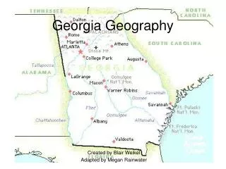
location • Northern/Western hemispheres • North of Equator/ West of Prime Meridian • North America • Southeastern United States
Appalachian plateau • Located in TAG corner, extreme NW corner • Often called Cumberland Plateau • Made up of plateau formations, canyons, limestone caves • Main feature: Lookout Mountain and Cloudland Canyon • Hardwood forest/pastures • Only source of coal (mining) • Chickamauga Battlefield located here
Ridge and valley • Located in Northwestern area of state • Topography dominated by high ridge lines separating a series of valleys • Economic activity is somewhat diverse: forests, pastures, farmland, apple orchards • Dalton known as “carpet capital of the world” • Large textile industry particularly hard hit during current economic downturn.
Blue ridge • Located in extreme NE Georgia • Most mountainous terrain in state • Brasstown Bald (about 5,000 ft. elevation) • Agriculture dominated by hardwood forests, vegetable farming and apple orchards • Appalachian Trail begins here – runs to Maine • Scenic beauty includes Brasstown Bald, Amicalola Falls, Tallulah Gorge • Alpine village of Helen (tourism) • Important cities: Dahlonega – home of America’s first gold rush • Receives most rain annually.
Piedmont Plateau • Location: begins in mountain foothills and goes to Fall Line (“piedmont” means at the foot of the mountains) • Geography is rolling hills and plains • Suitable for various types of agriculture including commercial farming • Granite bedrock formation runs all the way to Delaware (Stone Mountain) • Contains ½ of state’s population including Atlanta metro area – most populous
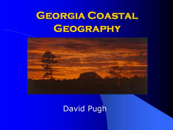
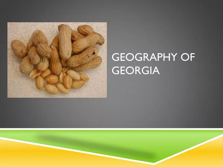
Coastal plain • State’s largest regions (about 60%) • In prehistoric times was underwater. • Has an inner and outer part. • Inner coastal in major agricultural region in state of Georgia (peanuts, Vidalia onions, peaches, pecans) • Outer coastal plain has sandy soil (naval stores and pulp from pine trees) • Pulp and paper production • Okefenokee Swamp located here: largest freshwater wetland in U.S. • Savannah – oldest city
Barrier Island • Located off Georgia’s coastal shoreline • Called “sea islands” or Golden Isles” • 14 islands • Act as a “buffer” in protecting GA’s beaches from storm erosion • Significant tourism in parks and wilderness sanctuaries • Protect/form Intracoastal Waterway
Fall line • Natural boundary that separates Piedmont from Coastal Plain • Elevation of land drops significantly • Water drops and speeds up creating good sources of power • Numerous settlements on Fall Line (Columbus, Macon, Augusta) • Shoreline of prehistoric sea.
Okefenokee Swamp • Swamp/wetland located in outer coastal plain in extreme southern part of state • Largest freshwater wetland in U.S. • Home to diverse population of wildlife • Federal/national park • Indian name meaning “land of trembling earth”
Chattahoochee River • Runs south through Atlanta and forms part of southern border with Alabama
Savannah River • Forms border between South Carolina and Georgia. • Important commercial waterway. • Entry to port of Savannah • First permanent settlement (1733) at mouth of river.
Deepwater ports • Savannah and Brunswick • Brunswick – construction port during WWII building Liberty Ships • Two inland barge terminals: Bainbridge and Columbus • Economic impact: about 2 billion dollars per year. • More than 80,000 jobs • Over 90 steamships lines serve Georgia • Serviced by two interstates (95 and 16) and a railroad hub • 5th busiest port in the nation • Large amounts of imports flow through these ports • Supports idea of world market/provides us with access to international markets
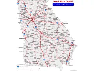
Interstate highways • Facilitates flow of goods and services • Commuter traffic • Atlanta, interstate hub, serviced by I-20, I-75, and I-85
Hartsfield-jackson international airport • One of the busiest airports in the world • One of the largest employer in the state • Connects state with rest of the world • Named for William Hartsfield and Maynard Jackson
railroads • Atlanta developed as result of railroad -First city not developed along a waterway (Terminus). • Important to state’s economy today moving goods in and out of state. • Dominated by CSX and Norfolk Southern
Summaries • 1. Write 3-5 sentence paragraph s summarizing the following: • A. The regions and physical features of Georgia. • B. The four transportation systems that comprise Georgia’s transportation infrastructure.