Chapter 11 - Soil Resources
540 likes | 797 Views
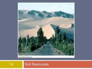
Chapter 11 - Soil Resources. i t’s just dirt!. I. Soils: Products of Weathering. Soil loose surface materials composed of weathered rock and mineral materials with variable amounts of organic matter can support growth of plants resting upon bedrock. Soils.

Chapter 11 - Soil Resources
E N D
Presentation Transcript
Chapter 11 - Soil Resources it’s just dirt!
I. Soils: Products of Weathering • Soil loose surface materials composed of weathered rock and mineral materials with variable amounts of organic matter • can support growth of plants • resting upon bedrock
Soils B. Residual vs. Transported Soils • Residual formed “in situ” via weathering • Transported formed elsewhere & deposited alluvial, glacial, wind deposited Example loess soils & the Palouse
Soils C. Soil Profile vertical section of soil from surface to bedrock D. Soil Horizons layers of soil (in profile) distinguished by color, texture, structure & composition
Soils E. Color & Texture 1. Color indications of composition • Higher organics darker color • Higher iron redder color • Higher calcium or salts whitish colors
Soils 2. Texture • Grain sizes Sand, silt, clay • often determines physical properties -looseness/compactibility -drainage & moisture retention
Soils F. Soil Classification “a pain in the _____!” • Early attempts Zonal classificationbased on climate controls, temp. vs. rainfall
Classification • “modern” classification soil science vs. engineering classification • Classified by physical characteristics • 14,000 soil “series” now recognized! • Forgetaboutit!
II. Soil Resources & Problems Soil a renewable resource? • Soil Erosion • U.S. farmlands, 1992 = 2 billion tons • ~4.8 tons/acre, average annual loss • ~1.6 tons/acre, avg. annual formed • accumulated side effects!
Soil Erosion Styles of erosion • Sheet • Rill • Gullying • Wind
II. Soil Resources & Erosion B. Causes • Natural • Human-related • Overgrazing & bad agriculture techniques • Deforestation • Recreational activities
Case Study: Palouse soil erosion • Palouse region, eastern WA Go COUGS! • Loess soil wind blown silt
Case Study: Palouse soil erosion • Formed during Pleistocene glaciation • Several hundred feet thick in places • High fertility, important physical properties & agricultural potential • Interesting historical ramifications
Palouse soil erosion • Up to 25 tons/acre/year erosion • Highest rates 200 tons/acre/year! steeper slopes • ~.17 inches/year 8.5 inches/50 years *Farm near Thornton, WA 4.5 feet of soil lost in less than 50 years!
Palouse soil erosion • 20% + of cropland eroded to subsoils • Decreased yields • Increased fertilizers needed, decreased soil pH (acidifying) Dirt: The Erosion of Civilizations, 2007, David Montgomery, University of California Press
Palouse soil erosion Contributing factors to Palouse erosion? • Intensive mechanized farming tractor plowing began (1930’s) • Plowing on hillsides • Rain on freshly plowed land rilling/gullying • Wind storms age-dated lake cores 4-fold increase in erosion w/modern plowing
II. Soil Resources B. Soil Contamination • Industrial pollution • Salinization
II. Soil Resources & Problems C. Expansive Soils • expansion upon water saturation • shrink when dried out • $6 billion/year damages • Clay-rich soils Why is clay the culprit?
Expansive Soils Mitigation • How to deal with expansive soils? • Hire a geoengineering firm & spend lots of $$$$ fixing the problem after, or….. • Spend less $$$$$ before • http://web.mst.edu/~rogersda/umrcourses/ge341/
II. Soil Resources & Problems D. Settlement • Non-uniform settling and compaction • Differential settlement • Soils with strength & cohesion differences READ Leaning Tower of Pisa
II. Soil Resources & Problems E. Permafrost • Permanently frozen ground • Northerly, polar latitudes • Freezing depth (winter) exceeds thaw depth (summer)
Case Study: The Trans-Alaska Pipeline • Prudhoe Bay (North Slope) oil fields • Discovered 1968 – “world class field” • Remote location, cold water port • No oil tankers! How to get the oil to market? • 1300 km (~800 mi) pipeline
Trans Alaskan Pipeline B. Pipeline Route • Prudhoe Bay to Valdez (Prince William Sound) • Inaccessible wilderness • 2 mountain ranges, large river crossings • LARGE areas of permafrost
Trans Alaskan Pipeline C. Planning Studies, Designs, & Cost • Prefeasibility studies mapping & drilling bedrock vs. permafrost • Identified faults active Denali fault • Permafrost dilemma oil needs to flow @ 65oC in 48” pipeline *1/2 of pipeline must be above ground why?
Trans Alaskan Pipeline Above ground design MUST: • Dissipate heat away from ground • Allow for fault movements & earthquakes • Vertical support members (down to 60’) w/heat exchangers & refrigerant • Horizontal beam & jiggle joints for magnitude 8 quake