Download
1 / 4
40 likes | 155 Views
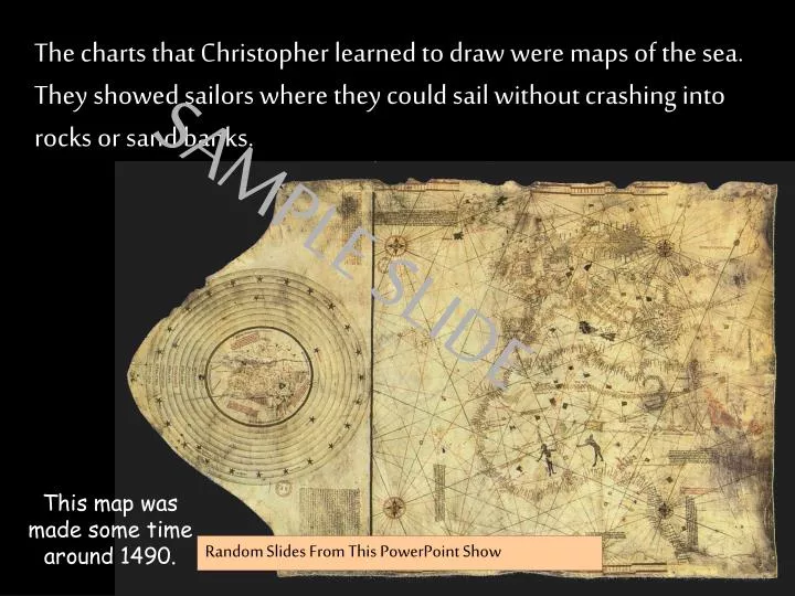
The charts that Christopher learned to draw were maps of the sea. They showed sailors where they could sail without crashing into rocks or sand banks. SAMPLE SLIDE. This map was made some time around 1490. Random Slides From This PowerPoint Show.

E N D
The charts that Christopher learned to draw were maps of the sea. They showed sailors where they could sail without crashing into rocks or sand banks. SAMPLE SLIDE This map was made some time around 1490. Random Slides From This PowerPoint Show
Christopher Columbus studied hard at school and dreamed of going to sea. He wanted to be a brave sea captain and to set out on voyages of discovery. SAMPLE SLIDE Random Slides From This PowerPoint Show
N W E S SPAIN This is what Columbus thought the world looked like and why he was so convinced he should go west to find Cathay. SAMPLE SLIDE Random Slides From This PowerPoint Show
www.ks1resources.co.uk KS1Resources.co.uk If your back button doesn’t work……… to return to your last webpage CLICK HERE www.graphicsfactory.com www.clipart.com


![⚡Read✔[PDF] Time Was](https://cdn7.slideserve.com/13156089/slide1-dt.jpg)