Download
1 / 60
620 likes | 1.11k Views
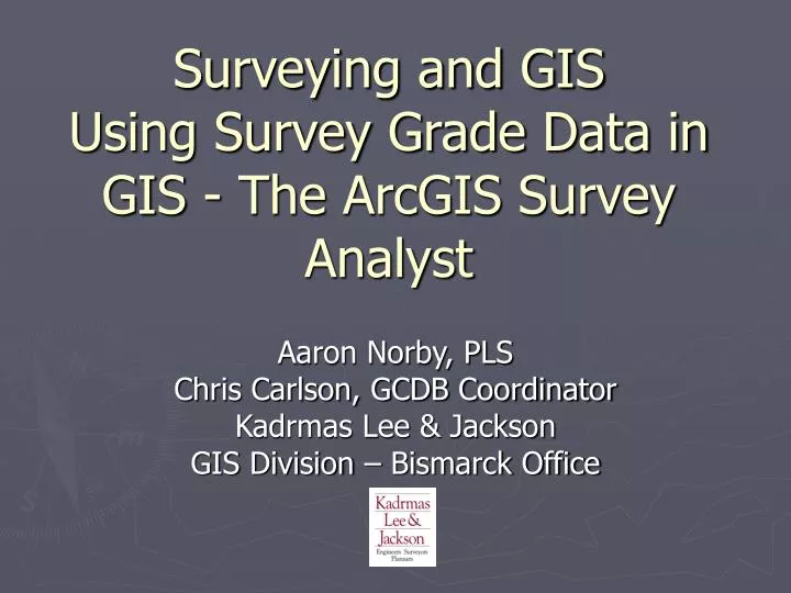
Surveying and GIS Using Survey Grade Data in GIS - The ArcGIS Survey Analyst. Aaron Norby, PLS Chris Carlson, GCDB Coordinator Kadrmas Lee & Jackson GIS Division – Bismarck Office. Presentation Overview. A brief on the Public Land Survey System and using PLSS data in GIS

E N D
Surveying and GISUsing Survey Grade Data in GIS - The ArcGIS Survey Analyst Aaron Norby, PLS Chris Carlson, GCDB Coordinator Kadrmas Lee & Jackson GIS Division – Bismarck Office
Presentation Overview • A brief on the Public Land Survey System and using PLSS data in GIS • BLM GCDB Program – PLSS Data Construction, Availability and use in GIS • The Survey Analyst – The ESRI Extension for Managing Survey Data in the GDB • A Look Ahead to ArcGIS 9.2 for Surveying and Cadastral Mapping
Public Land Survey System – (PLSS) Started in 1785 A series of separate surveys and beginning at an Initial Point - the intersection Of the Principal Meridians and a Base Lines
Construction of the PLSS • Basis for Initial Point are Baselines (ND 5th Principal Meridian) • 1 mile by 1 mile sections – 36 Sections per Township • Townships Constructed from the Initial Point and error placed in the North and West side • Specific rules for reconstruction by surveyors – the Manual of Surveying Instructions 1973
The Cadastre of the US Subdivisions of the PLSS - Township/Range and Sections
Survey Methods to Construct the PLSS • Performed many years ago with good but limited instrumentation • Sometimes performed in very hostile environments • Distances measured by Chaining • Magnetic Bearings were used for direction • Field notes and plats filed with the GLO marking the footsteps of the original surveyor
Survey Error placed in the North and West Sections of a Township
Field Notes and Monuments • GLO Field notes and plats show the original survey calls • Monuments placed in the field – from stone mounds, to brass caps
Found and Called For • Found Original and Called for Monuments hold over Field Note Descriptions • Record : 80.00 ch • Measured: 80.02 ch
PLSS Data Available for GIS • Available in several formats – PLSS shapefile from the ND Geological Survey • BLM GCDB data – discussion and demonstration following
GCDB (Geographic Coordinate Database) What it is and how you might use it in your GIS applications.
Overview of GCDB • The Bureau of Land Management's (BLM) Geographic Coordinate Data Base (GCDB) is a collection of geographic information representing the Public Land Survey System (PLSS) of the United States. The GCDB grid is computed from BLM survey records, local survey records, and geodetic control information. The GCDB data is collected by the BLM Offices to provide a high-quality framework for Geographic Information Systems (GIS).
Building GCDB Data: Software • GCDB is built using a free program called WinGMM; WinGMM (Geographic Measurement Management) was created specifically to build GCDB data. WinGMM and its supporting documents are available for download from New Mexico State University. • http://web.nmsu.edu/~kwurm/Software.html
What you need. • The first step to building a new township is to compile the historic data. • Now, the original GLO plats have been scanned along with the original survey notes and are available online to download through the North Dakota State Water Commission website. • http://www.swc.state.nd.us/
Building GCDB data, in a nutshell: • You must first define some parameters. • Elevation, default control error estimates, project name are among other things must be defined at the start of a project. • You may then begin entering control points or bearings and distances. • Entering control first is recommended so you can view the lines you are building.
Control Points • Control points in most instances are derived from 24k DRG’s 4-way road intersections, and are incorporated with an error tolerance of 35 feet. Found corners on DRG’s are also used as control with an error tolerance of 30 feet. Control points can be added or removed at anytime in the building process, and importantly, surveyed points from contractors that carry high precision, such as Stark County.
Bearings and Distances • Entering bearings and distances is a straightforward process of taking distances (in chains) and bearings off of either the plat or the survey notes. • Often plats have only distances printed on them, so bearings must be retrieved from the survey notes.
Original Plats and Survey Notes Here are examples of what you would typically find for original notes and plats.
“Regioning” the data • Once the data has been entered and made sure that it is error free the data can be “regioned”. • Regioning is the process of matching edges of townships that have been built with ones that are in the process of being built. This process makes the final adjustments to the geometry of un-regioned data.
Subdividing and Attributing • The last step is to subdivide the sections in quarter-quarters, this is an automated process built in to WinGMM • Occasionally the subdivisions will need some adjustments. • Attributing is also mostly automated with WinGMM.
Finished Product • Where can you find them? • Finished GCDB data is available from the BLM website in flat-file format: http://www.mt.blm.gov/cadastral/gcdb/index.html • It is also available for download from the BLM’s GeoCommunicator IMS site in the form of shapefiles. http://www.geocommunicator.gov/GeoComm/lsis_home/home/index.html) • Flat-file data available from the BLM currently covers a larger area than the data available from the GeoCommunicator.
Making flat-files useful in a GIS • Exporting flat-file GCDB to a GIS format is a straightforward process in WinGMM • Load your Township • Choose: File>Export>DXFW • From command prompt choose 2 (LINES REPRESENT LLD POLYGONS) then 6 (LINES DRAWN FROM FINAL .IID ATTRIBUTED POLYGONS) and enter out. • You now have a DXF ready to convert to the GIS format of your choosing.
Using GCDB Data with ArcGIS • A quarter-quarter data from GCDB as a dxf in ArcMap – compared to the PLSS shapefile
GCDB Demonstration • Obtaining the data • Downloading and exploring • Using the data with ArcGIS • Site for GCDB Flat Files: • http://www.mt.blm.gov/cadastral/gcdb/index.html
Using Surveying data and GIS • Using survey data within GIS is not new – some of which are: - ArcInfo ArcCogo – early 90’s - Use of CAD and 3rd party COGO to the dxfarc command - ESRI ArcCAD – The AutoDesk/ESRI union of the CAD and GIS
Finished Product • Survey data was brought into GIS, but with no survey attributes • No measurement, computation, or additional coordinate data available in the data base • No previous ability in GIS to use survey data in networks to control GIS features automatically
Concept – Refining Feature Location Based on New Measurements • Coordinates are transient – and may be refined over time – don’t start over
The Survey Analyst Extension • Manages and processes Survey Data in ArcGIS • Supports popular Raw Data Collector files for direct introduction to GIS – no need for data to CAD to GIS • Data is stored in the Survey Data Set in the GDB – allows for double precision data in the integer based data storage of the GDB • Allows for incremental adjustments over time of features in the GDB using the survey control
Surveying Data in the GDB The Survey Data Set and Project Folder supports multiple Survey Projects Features linked to survey points for higher spatial integrity in the GDB
The Survey Dataset and Survey Projects – Differences from Standard GDB Feature Datasets • The survey data model enforces the maintenance of x,y,z coordinates in separate fields of double precision. Only these fields are used when performing computations. • Survey Projects are managed in a special folder within the Survey Feature Data Set • Each Survey Project may have its own spatial domain (Coordinate System)
The Survey Project – Where survey data is stored and managed • Created and managed in ArcCatalog • May have many projects in a Survey Folder
The Survey Project – Where survey data is stored and managed • Data is imported from Field Data Collectors to the Survey Project in ArcCatalog - TDS, SDR, GSI, ASCII
Survey Project Organization • Survey data is managed as a subset of records by a survey project – but may be used by other projects for coordinate generation • Projects have Unique ID’s
Data in a Survey Project • Measurements – Angles, Distances, Back sights • Computations – Traverses • Coordinates – Computed from Measurements or Imported • Survey Points – Created from Coordinates
Survey Data in ArcMap • Visualize and Edit Survey Data in ArcMap and use Edit Session commands for the Survey Analyst
Survey Sub Layers • Each Survey Project is a group layer with sub layers comprising of Measurements and Points
Tools – The Survey Explorer • The SA has 3 toolbars in ArcMap – - Survey Explorer – Browse for survey record in the Survey Dataset - Look at detailed records for each point or full pages of records
Survey Editor Toolbar • Control Survey Object lists and access Survey Explorer • Change Projects for edits • Enter computations during an edit session • Link Survey Aware FC’s
Survey Analyst Toolbar • Compute Survey Networks • Update Points with new coordinates • Checks for point tolerances
Survey Points Multiple Coordinates • In the SA – a survey point could have many coordinate pairs (but is represented in GIS as the GIS Coordinate • Over time, the measurements become more accurate and original points either entered through digitizing or COGO may be updated with a GPS point • Old coordinates are not removed – but are saved and may be averaged for the new coordinate and as part of the metadata for each point • In effect – a Survey Database has metadata on each point in the database
Coordinate Manager Allows for averaging and choosing the Current Coordinate for a point
Survey Aware Feature Classes • One key feature of the SA is the ability to make existing FC’s in a dataset Survey Aware • By do so, the FC may be adjusted over time, to more accurately represent the true location of the data
Feature Linked Adjustments • Features that are linked to survey points may be adjusted over time, better representing the feature as it is
Feature Links With Displacement Vectors • Manual or automated processes to Link Features to survey points
Survey Analyst Workflow • Go Directly to GIS with survey data • No need to work with CAD – COGO then to GIS GIS Survey Software CAD
Survey Analyst Demonstration • Downloading Data from a Data Collector • Survey Explorer • Coordinate Adjustment • Feature Linking • Feature Adjustment using Survey Points
What’s Ahead at 9.2 – The Cadastral Editor in the Survey Analyst • The Cadastral Editor – Will work inside the Survey Analyst • You create a Cadastral Fabric from your existing parcel data
Cadastral Fabric Topology • Internal Arc-Node topology will be maintained by the Cadastral Editor and manages left-right polygon information like ArcInfo • COGO attributes will Automatically be created, even if they never existed in your original CAD, Shapefiles!