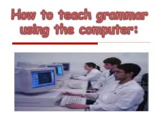
Download
1 / 22
220 likes | 661 Views
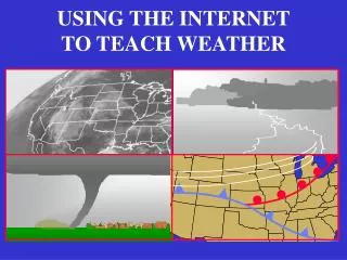
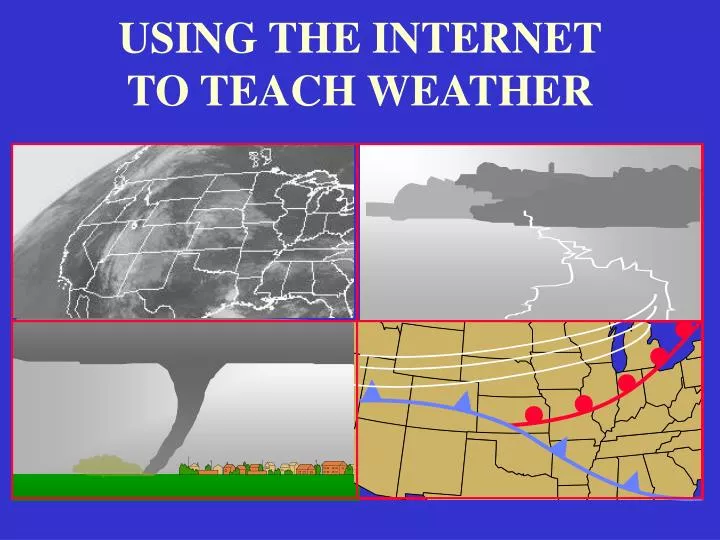
USING THE INTERNET TO TEACH WEATHER USING THE INTERNET TO TEACH WEATHER Christopher G. Herbster Applied Aviation Sciences Debbie Schaum Applied Aviation Sciences Susan Sharp Aeronautical Science Embry-Riddle Aeronautical University Daytona Beach, Florida Our Goal

E N D
USING THE INTERNET TO TEACH WEATHER Christopher G. HerbsterApplied Aviation Sciences Debbie Schaum Applied Aviation Sciences Susan Sharp Aeronautical Science Embry-Riddle Aeronautical University Daytona Beach, Florida
Our Goal Instructors will leave with internet resources to aid in teaching interpretation and application of weather phenomenon.
METAR TAF AREA FORECAST WINDS ALOFT PROG CHARTS STABILITY THUNDERSTORMS HAZARDS RADAR SATELLITE GROUP ACTIVITY? Presentation Outline Presentation Outline
METAR Federal Meteorological Handbook No. 1 - Surface Weather Observations and Reports http://www.ofcm.gov/fmh-1/fmh1.htm Handy Decoder Keys: http://wx.erau.edu/reference/text/metar_code_format.pdf http://wx.erau.edu/reference/text/metar_decode_key.pdf ADDS: METARs Page http://adds.aviationweather.gov/projects/adds/metars/ Texas A&M Weather Pagehttp://www.met.tamu.edu/personnel/students/weather/ weather_interface.html
Station Models 80 115 15 75 Interpreting Surface Observation Symbols: a quick overview http://ww2010.atmos.uiuc.edu/(Gh)/wwhlpr/sfcobs.rxml?hret=/guides/maps/sfc/obs/sfcobs.rxml Weather Station Model http://profhorn.meteor.wisc.edu/wxwise/station/index.html
TERMINAL AERODROME FORECAST TAF Decoder http://aviationweather.gov/static/help/taf-decode.shtml Aviation Digital Data Service (ADDS) http://adds.aviationweather.gov/
Area Forecast / Airmets, Sigmets Area Forecast, AIRMETS, SIGMETS Aviation Weather Center Official Forecast Products http://aviationweather.gov/
WINDS ALOFT CHARTS NWS FAX CHARTS http://weather.noaa.gov/fax/nwsfax.html Upper Air Charts Explanation http://www.met.fsu.edu/CUDOS/rawin.html FDs Winds and Temps Aloft http://aviationweather.gov/products/nws/fdwinds/
PROG CHARTS Low Level SIGWX Progs http://aviationweather.gov/products/swl/
STABILITY REVIEW NWS Louisville:Convective Parameters and Indices http://www.crh.noaa.gov/lmk/soo/docu/indices.htm “The Cumulus Cloud” Applet http://profhorn.meteor.wisc.edu/wxwise/thermo/makeCU.html “Change the Stability” Applet http://profhorn.meteor.wisc.edu/wxwise/thermo/thermogram.html “Create Thunderstorm Cloud” Applet http://profhorn.meteor.wisc.edu/wxwise/thermo/tstm.html
WIND SHEAR ZONE WIND WIND SHEAR
Thunderstorms/hazards Thunderstorm structure http://ww2010.atmos.uiuc.edu/(gh)/guides/mtr/svr/comp/up/home.rxml Microburst - windshear and downbursts http://www.srh.noaa.gov/jax/events/windshear.html Microburst graphics http://ww2010.atmos.uiuc.edu/(gh)/wwhlpr/microburst.rxml?hret=/guides/mtr/svr/comp/wind/home.rxml&prv=1
Downbursts Glideslope X Y Z The aircraft encounters point X, where it enters the microburst zone; a headwind causes it to rise above the normal glideslope. At the center of the microburst, point Y, there is a downdraft causing the aircraft to sink. The aircraft now enters the most lethal zone, point Z, where a sudden tailwind causes the aircraft to lose airspeed.
Severe Storms Severe Storm/Tornado http://zuul.ncsa.uiuc.edu/arrott2/media/maxtornado.ram
Frontal Dynamics Pressure Pressure Activity: http://ww2010.atmos.uiuc.edu/(Gh)/guides/crclm/act/prs.rxml Airmass Air Masses Activity: http://ww2010.atmos.uiuc.edu/(Gh)/guides/crclm/act/arms.rxml Frontal animations Precipitation Along Fronts Activity: http://ww2010.atmos.uiuc.edu/(Gh)/guides/crclm/act/fpr.rxml
Icing Hazards Icing Assessment Using Surface and Pilot Observations http://www.meted.ucar.edu/icing/pcu62/pcu622/start622.htm
Radar Meteorology http://ww2010.atmos.uiuc.edu/(Gh)/guides/rs/rad/home.rxml
Satellite Meteorology Geostationary Operational Environmental Satellites (GOES) and Polar Orbiting Environmental Satellites (POES) http://ww2010.atmos.uiuc.edu/(Gh)/guides/rs/sat/home.rxml
The End! The End!