Download
1 / 18
180 likes | 319 Views
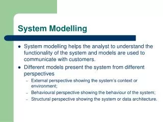
Building the new integrated modelling system for Australia. eWater Road Show 21 Feb – Part 3 of 5 Dr Peter Wallbrink Source Project Director, eWater. Integrated modelling system (IMS) for rural and urban water management. Catchment & Rivers. Urban. Irrigation. Ecology.

E N D
Building the new integrated modelling system for Australia eWater Road Show 21 Feb – Part 3 of 5 Dr Peter Wallbrink Source Project Director, eWater
Integrated modelling system (IMS) for rural and urban water management Catchment & Rivers Urban Irrigation Ecology
Why a new modelling suite? Current models struggling to handle 21C policy and management complexity Recognition by COAG partners that their models are reaching their ‘use-by’ date (IQQM, REALM, BigMOD). Need for nationally consistent modelling base, integrating engineering, environment and management city water supplies in a catchment context planning & operational requirements scalable and customisable
Overall Vision for Source IMS • To provide a ‘Catchment to Sea’ modelling capability • Runoff and constituent generation in upland areas • Transport through a regulated system • Representation of urban and rural areas, including newer urban infrastructure options • Link to ecological function (environmental watering demands, response models) • To be sufficiently flexible in capability and usage to last ~20 years • Combining the various strands of eWater product development to enable whole of system analysis
What Source will provide A national catchment and river system modelling platform Flexible, fit for purpose across jurisdictions Applicable from sub-catchment to basin scales Spatially explicit representation of processes Relevant for next 20 years – extensible Consistency of modelling approach Surface water modelling guidelines, community of practice Considering Consumptive and environmental water use Groundwater use & interaction with surface water Associated contaminant impacts
Benefits of a common modelling approach National adoption of common approaches, standards, guidelines, methods etc. - Removal of ‘rail gauge’ issue Common platform for repeatable and transparent multi-stakeholder conversations to explore alternatives for wise/efficient water allocation and use Common platform for integrating best science (from anywhere) into management Creation of ‘community of practice’ Common skill base amongst jurisdictions/agencies
Specific Value to partners and Australian water industry Better forecasting & evaluation of scenarios Operational efficiency – better implementation of complex policy Integration of surface/groundwater, climate and environmental outcomes Capability to optimise for human and environmental use Uniformity cross jurisdictions and regions Proven track record across Eastern Australia - support for real-world problems Support - training, user manuals, user guides
For River Managers & River Operators Example:
Planning Long term planning and policy development and support From years to decades Supply, demand and use in rural regulated systems (capability required to underpin water sharing plans) • Operations • Operational decision support for regulated rivers • from days to seasonal • Built on same river model • Dynamically switch models and data sources
Sample of required functionality – generic and specific • Flow Routing • Water Quality (specifically salinity) • Complex River Networks - * • Water Use - * • Water Storage • Surface water – Groundwater interactions • River Regulation • Water Accounting - *
Water accounting • Annual accounting (+ carry over) • Continuous accounting • Continuous sharing • Off allocation flow sharing • Allocation forecasting
Quality Assurance fundamental to Source Trial applications of Source products Improvement on existing models Consistency of application across jurisdictions Test capability using real data in real situation Chosen to address real world issue for partners
Source for Rivers – Application Trials Goulburn Broken Namoi Macintyre-Brook Murray
Source for Catchments – Application Trials • Extensive testing of existing and new functionality across Australia via Application Projects over past 4 years
Best Practice triangle Model Development • User requirements - captured • Specifications - reviewed and endorsed • Industry standard testing - of software • Use cases • Application trials • Developer workshops Model Application(s) Model User(s) • Guidelines for model use • Tips and help functions • Documentation: • Application workshops • Community of Practice • Training courses • On line and face to face • Accreditation..