Download
1 / 28
280 likes | 386 Views
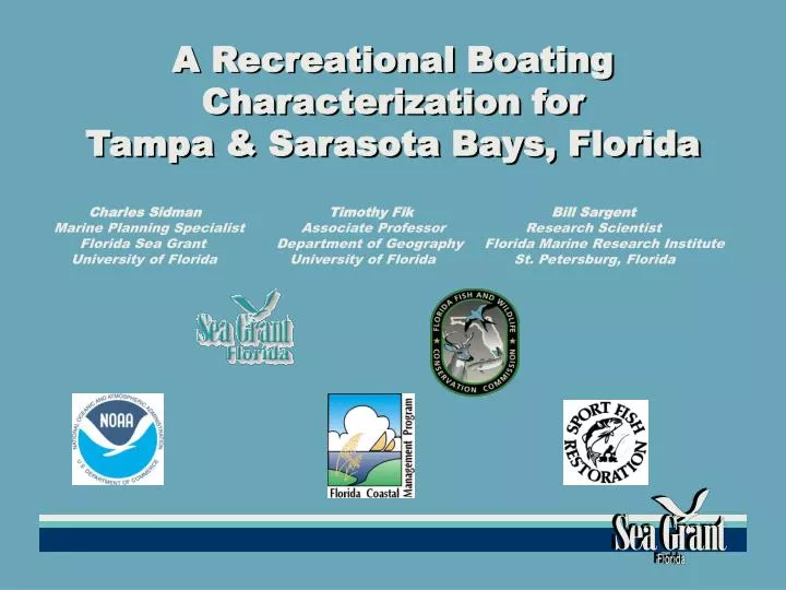
A Recreational Boating Characterization for Tampa & Sarasota Bays, Florida. Charles Sidman Timothy Fik Bill Sargent Marine Planning Specialist Associate Professor Research Scientist

E N D
A Recreational Boating Characterization for Tampa & Sarasota Bays, Florida • Charles Sidman Timothy Fik Bill Sargent • Marine Planning Specialist Associate Professor Research Scientist • Florida Sea Grant Department of Geography Florida Marine Research Institute • University of Florida University of Florida St. Petersburg, Florida
Presentation Outline • Project goal and objectives • Sampling framework • Descriptive analyses • 4. Upcoming research
Project Goal • Characterize the preferences, activities, and use patterns of Tampa Bay and Sarasota Bay boater populations.
Survey Objectives • Acquire spatially explicit information on trip origins, destinations, and travel routes. • 2. Determine if preferences, use-patterns, and activities differ among boating groups. • 3. Identify boating issues and information needs.
MARINA SAMPLE5,317 vessels at 75 marinas 3,075 in wet-slips 2,242 vessels in dry storage facilitiesLogged vessel registration number or vessel name and hailing portOwner names and addresses from VTRS or USCG
RAMP SAMPLETAMPA BAYFMRI surveyed 19 Tampa Bay ramps over 1 year periodtag numbers from 1,991 boat trailersSARASOTA BAYFSG surveyed 10 popular Sarasota Bay ramps tag numbers from 1,733 boat trailers __________________________________Names and mailing addresses Tampa Bay (N = 1000) Sarasota Bay (N = 722) from VTRS
DOCK SAMPLEShoreline data used to select waterfront parcelsMatch VTRS name and address to Parcel owner name and address
DOCK SAMPLESample size—500 each countySpatial distribution by geographic coordinates(sort on parcel centroids)
RECREATIONAL BOAT TRIPSBoaters Identify:3,481 trip origins 3,481 travel routes5,193 destinations1,635 congested areas
TRIP ORIGINSPlaces where largest numbers of boaters typically begin trip Trip information aggregated in GIS Presented as ‘density of occurrence’ Lower (higher) densities mapped with lighter (darker) shades of red. Areas that experience highest concentrations of trip origins typically contain combination of ramps and marinas—St. Petersburg Pier, Gandy Bridge, Anna Maria Island areas)Other locales with high densities of launch origins include Fort DeSoto Park, Upper Manatee River and southern portion of Sarasota Bay (city of Sarasota).
TRAVEL ROUTE DENSITYPrimary Boating Node—Lower Tampa Bay area (Ft. DeSoto Park, Indian Key, Pinellas Point, the Sunshine Skyway, and Anna Maria Sound) High traffic volume also at major passes—Longboat Pass, Blind Pass, John’s Pass, and Clearwater PassBeyond barrier islands, flow of traffic follows radial pattern to and from prominent artificial reefs in the Gulf of Mexico
FAVORITE DESTINATIONSDensity analysis reveals two clear boating destinations:1. Egmont Key 2. Longbeach/Longboat PassSecondary destinations: 1. Three Rooker Bar/ Honeymoon Island2. Weedon Island3. Shell Key4. Sunshine Skyway
CONGESTED AREASWhere boaters experience congestion—“more boats than you prefer” At favorite destinations and certain passes: Egmont Key, Longbeach/Longboat Pass Clearwater Pass, John’s Pass
ACTIVITY PROFILES Database structure facilitates mapping of activity and temporal use information from survey questionsLinkage of attributes to spatial trip information—origins, routes, favorite destinationsFor example—can map daily, and seasonal use-patterns, by activity and trip origin type—marina wet slip, marina dry storage, ramp, and dock
Trip Profiles • Cockroach Bay Ramp • 30 Origins • 30 Routes • 96 Destinations
Density of • Travel Routes
Density of • Favorite Destinations
Content Analysis—Helpful information by boating region and trip origin type • Types of vessels owned • Average departure times • Average time on the water • Monthly counts of trips—seasonal • Reasons for selecting travel routes • Reasons for selecting departure site • Reasons for selecting favorite destination • Travel times to destinations • Categorization of boating activities • Boater experience and safety training
Most-important Reason for Selecting a Favorite Departure Site • -------------------------------------------------------------------------------------------------------------------- • Category / DescriptionCountPercent • Close to home 298 35.7% (1) • Close to favorite boating spots 183 21.9% (2) • There is no parking or launching fee 14 1.7% • There is adequate parking 29 3.5% • Don’t have to wait too long to launch 33 4.0% (5) • The parking is safe and secure 18 2.2% • Prefer deep water access 61 7.3% (4) tie • Nearby amenities (restaurant, mini mart, etc.) 20 2.4% • Well-marked channel access 13 1.6% • Ease of launching and retrieving boat 88 10.5% (3) • Gas, pump-out, or maintenance services 12 1.4% • Availability of restrooms 2 0.2% • Availability of fishing supplies, including bait 3 0.3% • other reason 61 7.3% (4) tie • N = 835 • --------------------------------------------------------------------------------------------------------------------
Most-important Reason for Selecting a Favorite Boating Route • -------------------------------------------------------------------------------------------------------------- • Category / Description CountPercent • Easy access to favorite boating spots 481 35.9% (1) • Scenic beauty 282 21.1% (2) • Avoid shallow water 110 8.2% (4) • Prefer calm waters 72 5.4% • Avoid congested areas 100 7.5% (5) • Avoid manatee zones 8 0.6% • Easy access to supplies or marina 26 1.9% • Avoid speed zones 12 0.9% • Prefer well-marked channels 78 5.8% • None are important (I just cruise around) 55 4.1% • other 115 8.6% (3) • N = 1,339
Most-important Reason for Selecting Favorite Boating Destination • ------------------------------------------------------------------------------------------------------------------------- • Category / DescriptionCountPercent • Prefer calm protected waters 168 11.3% (3) • Enjoy scenic beauty 191 12.8% (2) • Prefer a natural/undeveloped shoreline 88 5.9% (5) • Preference to observe wildlife 35 2.3% • Fishing opportunities are important 531 35.6% (1) • Swimming / shelling opportunities 70 4.7% • Avoid crowds 76 5.1% • Availability of shoreline entertainment/restaurants 105 7.0% (4) • Availability of fuel or fishing supplies 15 1.0% • Beaches for picnicking / socializing 56 3.8% • To socialize with other boater 51 3.4% • I have no favorite spots. I just cruise around 74 5.0% • Other reason 33 2.2% • N = 1,493 • -------------------------------------------------------------------------------------------------------------------------
Boaters’ Activities by Category • -------------------------------------------------------------------------------------------------- • Percentage • Activity/Category CountNof respondents • Beach Picnicking 502 1,648 30.5% • Nature Viewing 706 1,648 42.8% (3) • Sightseeing 672 1,648 40.8% (5) • Beach Camping 681 1,648 41.3% (4) • Daytime Anchoring 501 1,647 30.4% • Socializing 658 1,648 39.9% • Cruising 968 1,648 58.7% (2) • Overnight Anchoring 308 1,648 18.7% • Visit Restaurant 644 1,648 39.1% • Diving 212 1,648 12.9% • Sailing 302 1,648 18.3% • Swimming 649 1,648 39.4% • Fishing 1,055 1,648 64.0% (1) • Other 112 1,648 6.8% • ---------------------------------------------------------------------------------------------------
How Data Can Be Used? • Combine with FMRI landside ramp analysis • What interior counties are contributing to use? • Identify locations for additional facilities. • Determine spatial patterns by activities and origins • Link activities to origins—educational products • Planning for future access and on-the-water traffic patterns for level of service or carrying capacity. • Compare with habitat and manatee information.
2004 Work Plan • Content Analysis of Open-Ended Questions • What detracts most from boating experiences. • What is most needed to improve boating experiences. • Identify Information needs. • Test for congruency between mail-out sample and returns • Are survey respondents spatially representative of initial sample. • Has a sufficient sample been obtained for major marinas and boat ramps (number and distribution).
Ramp Shed Analysis • Land Based Profile • Delineate ‘market area’ or area of influence. • Quantify ‘drawing power’ or use potential. • Water Based Profile • Characterize boating patterns for specific ramps and marinas. • Test if differences exist in preferences and use patterns according to activity type and launch origin type. • Identify Use Overlaps • What ramps and destinations compete for the same boater populations – overlapping geographic and demographic profiles. • What ramps and destinations are stand-alone –distinct geographic, demographic profiles.