Download
1 / 48
870 likes | 1.88k Views
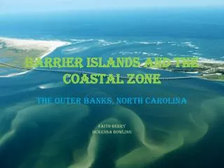
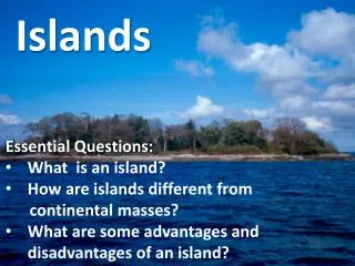
Barrier Islands. Functions of Barrier Islands. Protect the mainland from wind and tidal energy Provide habitat for plants, birds, fish, shellfish Recreation. What is a barrier island?. Forms along the mainland coastline

E N D
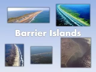
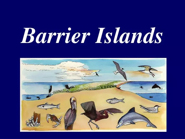
Functions of Barrier Islands • Protect the mainland from wind and tidal energy • Provide habitat for plants, birds, fish, shellfish • Recreation
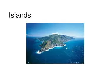
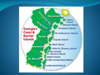
What is a barrier island? • Forms along the mainland coastline when material accumulates parallel to shore forming a barrier between the sea and the coast • Provides protection to the mainland from the high energy of storms • Constantly changing due to wind, waves, tides, currents • Examples: Dauphin Island (Alabama), Outer Banks (North Carolina), Chandeleur Islands (Louisiana)
Cross Section of a Barrier Island GULF OF MEXICO (high energy) MARITIME FOREST MISSISSIPPI SOUND (low energy) SALT MARSH TERTIARY DUNE FRESH WATER POND SECONDARY DUNE BEACH PRIMARY DUNE
Cross Section of a Barrier Island Beach Pond
Barrier Island: an island just off the coast of the mainland; it protects the mainland during big storms and on a daily basis
Overwash Zone: a place on barrier island where water from the “ocean” washes across to the sound side during a large storm
Two primary theories: sea level rise and sediment accumulation Requirements for Barrier Island Formation: 1) sand supply 2) flat surface where sand can accumulate (broad continental shelf) 3) enough wave energy to move the sand 4) rising sea level
Barrier islands form as a result of rising sea levelThere are 3 stages 1. shoreline was further out2. the beach ridge becomes a barrier island backed by a bay 3. the barrier system migrates across the shelf and sea level continues to rise Dune Ridge Theory Rise in Sea Level
A spit is a length of accumulated sand attached to land at one end, pointing in the direction of the longshore drift “Spit’s”
Waves come on shore at an angle. -Sand and sediment flow back with the water at this angle -The motion of the backwash causes a longshore current. -Longshore drift occurs as the current moves material down the coast Waves Longshore Current
Longshore Current: current of water parallel to the shoreline generated by waves hitting the beach at an angle and flowing back out at an angle
Littoral Drift: (longshore drift) the movement (or current) of sand along the shoreline being carried by the longshore current
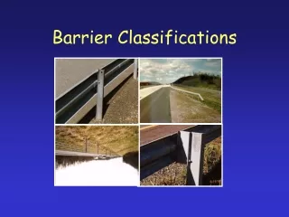
Approaches to Beach Erosion: 1) Hard Stabilization 2) Beach Replenishment 3) Moving Manmade Structures
Projected Population Change from 1994-2015: Absolute Numbers Source: National Oceanic and Atmospheric Administration (NOAA). 1998 (on-line). “Population: Distribution, Density and Growth” by Thomas J. Culliton. NOAA’s State of the Coast Report. Silver Spring, MD: NOAA.
Population Density, 1960-2015 (not including Alaska) Sources: U.S. Bureau of the Census, 1997; National Planning Association Graphic Credit: National Oceanic and Atmospheric Administration (NOAA). 1998 (on-line). “Population: Distribution, Density and Growth” by Thomas J. Culliton. NOAA’s State of the Coast Report. Silver Spring, MD: NOAA.
Coastal Barrier Resources Act (passed by Congress in 1982): restricts federal monies to undeveloped barriers and areas of undeveloped barriers to discourage development
Coastal Barrier Resources Act 3 Purposes: 1) to minimize loss of human life 2) to reduce wasteful expenditure of federal revenues 3) to reduce damage to fish and wildlife habitat & other natural resources of barrier islands
Zonation on a Sandy Beach High Tide Low Tide Supratidal Submerged, but sand interacts with rest of beach. Intertidal Subtidal
Original Map Adapted from GeoMap Interactive GIS Software for Grades K-12, Version 1.4 by H&T Software, Inc., NASA/TSEI & Johnson Controls World Services
What is here today ……… May be gone tomorrow… H.H. Roberts BARRIER ISLANDS
Dauphin Island Sand GrainConcentration quartz greatest abundance _________________________________________ shell fragments (CaCo) 0.2% to 0.6% by weight __________________________________________ heavy minerals (magnetite, 1% or 2% by weight or rutile, ilmenite, zircon, monazite, greater concentrations spinel, kyanite, staurolite, tournmaline, epidote, amphibole, sillimanite, garnet, leucoxene) _______________________________________________ organic debris present
WHAT IS A BARRIER ISLAND? -It is an island that forms along the coast of the mainland. It protects the mainland from wind and tidal energy during big storms and on a daily basis.
Requirements For Barrier Island Formation • Sand supply • Flat surface where sand can accumulate (continental shelf) • Enough wave energy to move sand around • Rising sea level
Barrier Islands are Dynamic -They form along the mainland -High energy area -Constantly change due to wind, waves, tides, and currents – not stable bodies of land -DI’s east end is shrinking while the west end is stretching out…
Forces Moving Barrier Islands: • On a Daily Basis – longshore currents and wind • Longshore current = current of water parallel to shoreline generated by waves hitting the beach at an angle and flowing back out at an angle • Littoral drift = the movement (or current) of sand along the shoreline carried by the longshore current • Movement of sand and water in the Gulf of Mexico is from East to West (FL to TX) due to typical wind patterns. Now this isn’t everyday, water and sand flow depend greatly on wind direction… • So, DI is traveling westward
Catastrophic Forces – Hurricanes • The largest storms on Earth can make or break an island… • Hurricane Camille – 1969 • Hurricane Frederic – 1979 (no bridge until 1982) • Hurricane Elena – 1985 • Hurricane Opal – 1995 • Hurricane Danny – 1997 • Hurricane Georges – 1998 • Tropical Storm = winds 39-74 mph (distinct CCW) -It is now named • Hurricane= winds 74+
Pre Camille 1952 Ship Island, MS Post Camille 1996
Ship Island after Georges 1998 The Georges cut on the right spans a little more than a mile. Depending on tide, the depth at this cut may be as shallow as only 4-5 ft deep. Overwash zone = area where storm waves wash over beach between or around dunes ***
SAND CYCLE -Sandy beach = the area from the edge of the dunes to about 30 ft underwater. -“Recreational Beach” – the sand above the water (according to Orrin Pilkey). *But all of the sandy beach to 30 ft underwater interacts and is in almost constant motion The Sand Sharing System involves sand being moved between the continental shelf and the island. -storm waves pull sand away from dunes to beachfront or farther out to continental shelf -regular waves return sand to beach, sea breezes blow sand from beach up to dunes What one area of the island loses another area gains along the length of the barrier. Sand travels by Littoral Drift and the Longshore Current, sometimes from one island to another.
GLOBAL WARMING ISSUES Greenhouse gases are increasing the world’s temperature, causing glaciers to melt, with sea level rising as a result. This has a major impact on Barrier Islands and coastlines.
Approaches to Beach Erosion • Hard Stabilization – putting hard structures on the beach to slow erosion • Groins – rocks put on the beach perpendicular to the shoreline • Jetties – rocks put on either side of an inlet or boat channel, parallel to the channel and perpendicular to the shoreline. • Groins and Jetties are not perfect solutions, upstream may work okay in trapping sand, but on the downstream beach it can cause erosion to happen even faster. • Seawalls – are built parallel to the shoreline and reflect waves at an angle downward. • This is the most drastic action taken – rigid masses of rock or concrete, considered irreversible because beach in front of wall will disappear, eventually another wall will have to be built behind it when the first one collapses and is left as rubble in the surf – unsightly and hazardous! Vital processes of sand sharing, overwash sedimentaion, and island migration are brought to an abrupt halt!
Beach Replenishment– putting sand back on the recreational beach. • -This has a short life span since the sand on the recreational beach will be taken back out to the continental shelf becoming part of the “underwater beach system” • -$$$ Expensive process • -Continuous process • Moving – move houses back as the shoreline approaches! • NO EASY ANSWERS!!!
Values of Barrier Islands -It is a barrier to the mainland against storms, erosion, etc. -Nesting sites for many shore birds and turtles -Recreational C.C. Lockwood
Pressures on Barrier Islands -Development – destruction of dunes, erosion, severe hurricane damage and destruction of nesting grounds for shorebirds and sea turtles -Coastal Population growth – some positives – economic growth, jobs, tax profits; negatives – less habitat for wildlife, less nesting ground, decreased water quality, more trash, nonpoint source pollution, etc. I.A. Mendelssohn
MANAGEMENT EFFORTS -Coastal Barrier Resources Act of 1982 -designed to discourage overdevelopment of coastal barriers along the Atlantic and Gulf Coasts -the PURPOSE – 1. minimize loss of human life 2. reduce wasteful expenditure of federal revenues 3. reduce damage to fish and wildlife habitat and other natural resources -This act states that federal flood insurance and federal assistance for construction of sewer systems, highways, water supply systems, airports, bridges, and jetties will not be provided for coastal barrier islands.
1. Sand moving through the system follows the natural path along the beach to the edge of the ebb tidal delta, destined for Dauphin Island beaches. 2 The sand trap The movement of sand has been interrupted by the deepened shipping channel that serves Mobile Bay. Because of that, some scientists say parts of Dauphin Island are suffering from chronic erosion 2.But the trip is cut short when the sand falls into the man-made shipping channel, trapped in water too deep for the wave-driven system to reach it.