Download
1 / 24
260 likes | 411 Views
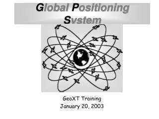
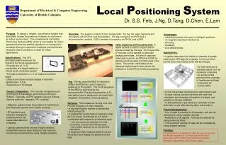
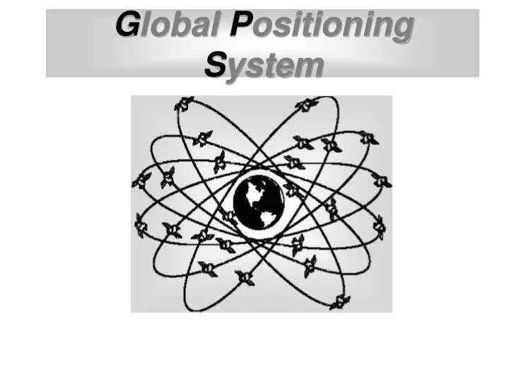
G lobal P ositioning S ystem. What is GPS?. The Global Positioning System (GPS) is a precise worldwide navigation system, and consists of a constellation of satellites and their ground stations, operated and maintained by the US Department of Defense. User. How Does it Work?.

E N D
What is GPS? The Global Positioning System (GPS) is a precise worldwide navigation system, and consists of a constellation of satellites and their ground stations, operated and maintained by the US Department of Defense.
User How Does it Work? The GPS Segments Space Colorado Springs Control
Space Segment • 24 satellites in 6 inclined orbits • 4 satellites per orbit - 12 hour revolutions • 12,600 miles (20,000 km) altitude
U S Air Force Control Segment • Managed by the U.S. Air Force • 4 monitoring and 3 upload stations • Daily location updates • Transmits clock and orbit corrections • Disable use of satellites • Degrade accuracy of the signals
User Segment • U.S. Military • Civilian shipping • Scientific high accuracy applications • Resource managers (GIS data capture) • Survey and mapping control
What is GPS Used For? Applications Point Features Line and Area Features Navigation
Nest trees Survey monuments Fence corners Trail markers Instream structures Search and rescue Monitoring devices Reference points Cultural sites Wells Helispots Photo points Hazard sites Vehicles Point Features
Roads Trails Fire perimeters Cultural sites Campgrounds Fences Timber sale units Stream channels Vegetation type Riparian area Line and Area Features
Navigation • Relocate points of interest with known coordinates • Locate mapped features using projected or estimated coordinates
Trilateration from satellitesto determine position • Satellite positions in space are known
Measuring the distance to a satellite • Determination of the range is done by measuring travel time of GPS radio signals traveling at the speed of light.
distance = Elapsed time x 186,000 miles per second Range Trilateration
x miles • The distance (x) from one satellite tells us we're located somewhere on the surface of an imaginary sphere centered on that satellite with a radius of x.
Distance measurements from two satellites limits our location to the intersection of two spheres, which is a circle.
A third measurement narrows our location to just two points.
A fourth measurement determines which point is our true location
Number of visible satellites • Satellite Geometry • Occupation time • GPS Quality • Atmospheric Effects • Operator knowledge and awareness GPS Position Accuracy • Many factors can affect the accuracy of GPS data. Accuracy can range from 1 centimeter to over 40 meters Significant Parameters:
Satellite Geometry HDOP (Horizontal Dilution Of Precision) Using satellites from the 4 compass quadrants will provide a good Horizontal solution (Low HDOP). Using satellites from only 1 or 2 quadrants will provide a poor Horizontal solution (HIGH HDOP).
Satellite Geometry VDOP (Vertical Dilution Of Precision) Using satellites well spread out in the sky will provide a good Vertical Solution (Low VDOP). Using only satellites which are located low on the horizon will result in a poor Vertical Solution (HIGH VDOP).
Satellite Geometry PDOP (Position Dilution Of Precision) PDOP is the combination of both the Horizontal and Vertical components of position error caused by satellite geometry. PDOP Values 2-4 = Excellent 4-6 = Good 6-8 = Fair 8-10 = Poor 10-12 = Marginal above 12 PDOP is too High Do Not Use
GPS Position Accuracy • General Statement of Accuracy: • Taking all of the error sources into account, GPS accuracy will be approximately 10 meters for most GPS units. However, any given position may result in accuracy as low as 5 meters or up to 40 meters. • No Post-processed or Real-time Differential Correction
Increasing GPS Accuracy through Differential Correction Rover or Remote (unknown) Base Station (known)
Limiting Factors • Dense canopy • Steep topography • Large and numerous structures • Microwave antenna interference