Download
1 / 30
300 likes | 386 Views
Update on the Drought of 2011 . TWCA Mid Year Conference June 16, 2011 Bob Rose, Meteorologist LCRA. Rainfall Since October 1st. Rainfall Since October 1st. Rainfall Since Oct. 1 Midland 0.16 Marfa 0.25 Fort Stockton 0.08 El Paso 0.45 Brownfield 0.77.

E N D
Update on the Drought of 2011 TWCA Mid Year Conference June 16, 2011 Bob Rose, Meteorologist LCRA
Rainfall Since October 1st Rainfall Since Oct. 1 Midland 0.16 Marfa 0.25 Fort Stockton 0.08 El Paso 0.45 Brownfield 0.77
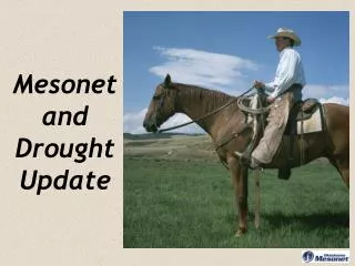
One of the Worst Droughts on Record • 3rd Worst Drought in History next to 1918 and 1956. • October through May, the driest of any 8 months on record. • Driest on record for December through May, February through May, and March through May.
Comparison with Worst of 2009 Drought September 1, 2009
La Niña has Ended. Now in Neutral. June 13th
Trending Back to La Niña? El Nino La Nina
NWS July through September Outlook Temperature Precipitation
Dry Wet
NAEFS Forecast through July 1st Probability for Greater than 1/2 inch of Rain
Colorado State ‘11 Hurricane Outlook “We continue to foresee well above-average activity for the 2011 Atlantic hurricane season. We are predicting the same levels of activity that were forecast in early April due to the combination of expected neutral ENSO conditions and very favorable atmospheric and oceanic conditions in the tropical Atlantic. We continue to anticipate an above-average probability of United States and Caribbean major hurricane landfall. William Gray and Phil Klatzback, Colorado State University, June , 1st Update 16 Named Storms (normal is 9.6) 9 Hurricanes (normal is 5.9) 5 Major Hurricanes (normal is 2.3)
Years with Similar Conditions 1971, 2008
Bob Rose Meteorologist, LCRA bob.rose@lcra.org 512-473-3350