Download
1 / 31
320 likes | 456 Views
GEO HP: http://earthobservations.org. Global Earth Observation System of Systems ( GEOSS ) and the CEOP High Altitude Observatories. Toshio Koike, CEOP Lead Scientist The University of Tokyo. Earth Observation Summit I. DECLARATION Affirmed need for:

E N D
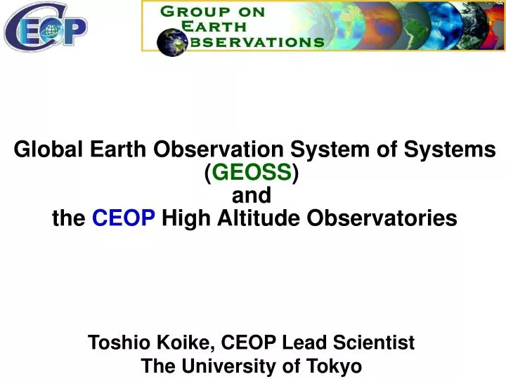
GEO HP: http://earthobservations.org Global Earth Observation System of Systems (GEOSS) and the CEOP High Altitude Observatories Toshio Koike, CEOP Lead Scientist The University of Tokyo
Earth Observation Summit I DECLARATION Affirmed need for: • Comprehensive, coordinated, sustained Global Earth Observations • Capacity-building related to Earth observations • Exchange of observations in a full and open manner • A 10-year Implementation Plan The ad hoc Group on Earth Observations (ad-hoc GEO) U.S. Department of State, Washington DC July 31, 2003
Earth Observation Summit II • Framework Document • Nine specific areas of socio-economic benefit; • Disasters, Health, Energy, Climate, Water, Weather, Ecosystems, Agriculture and Desertification, Biodiversity • The Global Earth Observation System of Systems (GEOSS) • A 10-Year Implementation Plan; • The Implementation Planning Task Team (IPTT) Hotel Okura, Tokyo, Japan April 25, 2004
Earth Observation Summit III • Summit Resolution • Endorsed the GEOSS 10-Year Implementation Plan • Noted with appreciation the extensive supporting material in its companion Reference Document • Established formally the Group on Earth Observations (GEO) • Issued special communiqué relating to support for tsunami and multi-hazard warning systems with the context of the Global Earth Observations System of Systems (GEOSS) Palais d’Egmont, Brussels, Belgium February 16, 2005
The 10-Year Implementation Plan Vision for GEOSS The vision for GEOSS is to realize a future wherein decisions and actions for the benefit of humankind are informed by coordinated, comprehensive and sustained Earth observations and information.
The 10-Year Implementation PlanReference Document The end-to-end nature of data provision, the feedback loop from user requirements, and the role of GEOSS
Coordinated Enhanced Observing Period (CEOP) an Element of WCRP initiated by GEWEX CEOP HP : http://www.ceop.net EOP-1 EOP-2 EOP-3 EOP-4 Data Collection:2001-2004 / 2005-2007: Research
WARM COLD
Reference Site Diurnal Cycle: TRMM, ADEOSII,Terra+Aqua Radiation:CERES, MODIS, GLI Cloud Properties:MODIS,GLI Precipitation Profile:PR Atmos. Column Values(WV, CWC, Rain): AMSR/AMSRE Atmos. Column Values(Precip.): AMSR/AMSRE H Atmos. Profile: AIRS Atmos. Profile:: AIRS,AMSU,MHS SSW:QuickSCAT, SeaWinds, ASAR, PALSAR, AMSR/AMSRE Land Surf. Hydrol. Soil Moist. Snow, Surf. Temp, VWC. AMSR/AMSRE H SST:MODIS,GLI,AMSR,AMSRE Land Cover: ETM, ASTER, MODIS, GLI Land Surf. Heterogeneity: ETM,ASTER+MODIS,GLI ASAR,PALSAR+AMSR,AMSRE Equator Ocean Land Himalayas Tibetan Plateau Satellites Atmos. Profile: AIRS
Validation of Mixing Ratio at 600-500hPa Level, Tibet Reference Site, 2004) Comparison of the Errors of Mixing Ratio at Each Level Radio Sonde(g/kg) daytime nighttime NCEP/NCAR Corrected AIRS AIRS(g/kg) Time Series of Corrected AIRS Water Vapor Product Lhasa600~500hPaLevel, Daytime, 2004 corrected product In-situ data Mixing Ratio (g/kg) Validation of AIRS Water Vapor Product Nomoto et al, 2005
W SE SW SW SE W Increase of Column Water Vapor mm mm Nomoto et al, 2005
Reference Site Diurnal Cycle: TRMM, ADEOSII,Terra+Aqua Radiation:CERES, MODIS, GLI Cloud Properties:MODIS,GLI Precipitation Profile:PR Atmos. Column Values(WV, CWC, Rain): AMSR/AMSRE Atmos. Column Values(Precip.): AMSR/AMSRE H Atmos. Profile: AIRS Atmos. Profile:: AIRS,AMSU,MHS SSW:QuickSCAT, SeaWinds, ASAR, PALSAR, AMSR/AMSRE Land Surf. Hydrol. Soil Moist. Snow, Surf. Temp, VWC. AMSR/AMSRE H SST:MODIS,GLI,AMSR,AMSRE Land Cover: ETM, ASTER, MODIS, GLI Land Surf. Heterogeneity: ETM,ASTER+MODIS,GLI ASAR,PALSAR+AMSR,AMSRE Equator Ocean Land Himalayas Tibetan Plateau Satellites Land Surf. Hydrol. Soil Moist. Snow, Surf. Temp, VWC. AMSR/AMSRE
AWS ASSH Location of AWS and ASSH in AMSR experimental fields of the study area (UB:Ulaanbaatar, CY:Choir, MG:Mandalgobi, SA:Study area)
Temporal Variation of Spatially Averaged Validation (Koike et al, 2003)
West 5.7% average of the absolute errors 8.1% East
Seasonal Variation of the Soil Moisture in the Tibetan Plateu
Reference Site Diurnal Cycle: TRMM, ADEOSII,Terra+Aqua Radiation:CERES, MODIS, GLI Cloud Properties:MODIS,GLI Precipitation Profile:PR Atmos. Column Values(WV, CWC, Rain): AMSR/AMSRE Atmos. Column Values(Precip.): AMSR/AMSRE H Atmos. Profile: AIRS Atmos. Profile:: AIRS,AMSU,MHS SSW:QuickSCAT, SeaWinds, ASAR, PALSAR, AMSR/AMSRE Land Surf. Hydrol. Soil Moist. Snow, Surf. Temp, VWC. AMSR/AMSRE H SST:MODIS,GLI,AMSR,AMSRE Land Cover: ETM, ASTER, MODIS, GLI Land Surf. Heterogeneity: ETM,ASTER+MODIS,GLI ASAR,PALSAR+AMSR,AMSRE Equator Ocean Land Himalayas Tibetan Plateau Satellites
Atmospheric Heating over the Tibetan Plateau CEOP/CAMP-Tibet IOP in 2004 (Taniguchi et al, 2005)
Diurnal Cycle of Atmospheric Heating N S N S CEOP/CAMP-Tibet IOP in 2004 2 hourly Change of Atmospheric Temperature (Taniguchi et al, 2005)
Reference Site Diurnal Cycle: TRMM, ADEOSII,Terra+Aqua Radiation:CERES, MODIS, GLI Cloud Properties:MODIS,GLI Precipitation Profile:PR Atmos. Column Values(WV, CWC, Rain): AMSR/AMSRE Atmos. Column Values(Precip.): AMSR/AMSRE H Atmos. Profile: AIRS Atmos. Profile:: AIRS,AMSU,MHS SSW:QuickSCAT, SeaWinds, ASAR, PALSAR, AMSR/AMSRE Land Surf. Hydrol. Soil Moist. Snow, Surf. Temp, VWC. AMSR/AMSRE H SST:MODIS,GLI,AMSR,AMSRE Land Cover: ETM, ASTER, MODIS, GLI Land Surf. Heterogeneity: ETM,ASTER+MODIS,GLI ASAR,PALSAR+AMSR,AMSRE Equator Ocean Land Himalayas Tibetan Plateau Satellites
Four Dimensional Data Assimilation Soil Moisture Snow Land Surface Scheme Snow Physics Model Microwave Radiometer Precipitation CloudPhysicsModel Aqua Surface Emissivity & Temp. TRMM
Game-Tibet Pathmathevan & Koike, 2001 Soil Moisture Surface Temperature Assimilated Brightness Temperature Observed Brightness Temperature
Minimization Scheme Reference Site Data Atmospheric Forcing Data Land Data Assimilation System Land Surface Scheme TMI/AMSR-E Radiative Transfer Model Cost Function
Minimization Scheme NWP Centers Prediction, Re-analysis Land-Atmosphere Data Assimilation System Satellite Regional Products Regional Model Land Data Assimilation System Land Surface Scheme TMI/AMSR-E Radiative Transfer Model Cost Function
L-A DAS Only Regional Model (Boussetta et al, 2005)
SCIENTIFIC ACTIVITIES OF CEOP PHASE2 MODEL OUTPUT REFERENCE SITES REFERENCE BASINS SATELLITES Global Regional Local Diurnal Intra-seasonal Seasonal DATA INTEGRATION & DISSEMINATION WATER & ENERGY SIMULATION & PREDICTION (WESP) Water and Energy Budget Studies Global Land Data Assimilation Systems Inter-CSE Transferability Study Semi-arid Region Study Cold Region Study CEOP INTER-MONSOON STUDY (CIMS) Coordinated Model Integration Process Monsoon System Inter Comparison Aerosol - Monsoon Water Cycle Interaction CEOP Analyses Intercomparison Project Extreme Events Impact Analysis Project Down Scaling 2007-2010: Implementation of New Activities 2005-2006: Completion of Phase1 Preparation for New Activities Watershed Hydrology Study Water Resources Study