Download
1 / 35
350 likes | 538 Views
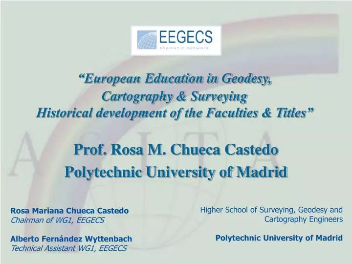
“European Education in Geodesy, Cartography & Surveying Historical development of the Faculties & Titles”. Prof. Rosa M. Chueca Castedo Polytechnic University of Madrid. Higher School of Surveying, Geodesy and Cartography Engineers Polytechnic University of Madrid.

E N D
“EuropeanEducation in Geodesy, Cartography & Surveying Historical development of the Faculties & Titles” Prof. Rosa M. Chueca Castedo Polytechnic University of Madrid Higher School of Surveying, Geodesy and Cartography Engineers Polytechnic University of Madrid Rosa Mariana Chueca Castedo Chairman of WG1, EEGECSAlberto Fernández WyttenbachTechnical Assistant WG1, EEGECS
The Italian Tradition European Situation: Introduction University & Faculty: Types University & Faculty: Evolution Bachelor & Master in Europe Bachelor: Names & Duration Bachelor Fields Master Programs in Europe Master: Names & Duration Master Fields Conclusions Summary
The Italian Tradition The Cartography tradition… • Petrus Vesconte & Battista Agnese (s.XIII) • The Chart Pisana: the first “Portulano”, a term used for all such maps showing the position of ports. • Paolo dal Pozzo Toscanelli (s.XV) • Cristobal Colón sailed with its nautical chart (1474), during the first trip to America. • Giovanni Matteo Contarini (s.XVI) • The first printed World Map including América (1506).
The Italian Tradition Leonardo D VINCI (1452-1519) • Engineer and Mathematician, but also Cartographer: • When he worked as Architect he did several maps: • Map of Imola • Map of Arezzo (Chiana Valley) Galileo GALILEI (1564-1642) • Born in Pisa • Besides, the astronomic contribution: • Surveying lectures in Padua Military Academy.
The Italian Tradition Joseph Louis LAGRANGE (1736-1813) • Born in Turin • With 18 years he lectures in Geometry in the Military Academy • Mathematisian, astronomer, cartographer and geodetist: • Magnetic Field into a ellipsoidic model of Earth • Globular Cartographic representation. • Chairman of the Metrical System Comision • Count and Senator by Napoleon
The Italian Tradition • Since the s.XVII, many Italian geodesists or gravimetrists are over the world recognized: • Padri Riccioli (Measurement of the arc of meridian) • Cassini (Saga devoted to Geodesy) • Pizzetti and Somigliana (International Gravity Formula) • Morelli (Italian Gravimetric map) • Caputo, Sanso, etc.. • Santoni, Salmoiraghi, Porro, etc.. (Instruments constructors)
The Italian Tradition • 1953 – The International Association of Geodesy (IAG) proposed to create an International Gravity Standarization Net that was defined after a few years: IGSN 71 • There were 6 Bases or Primary Stations, all around the world: • Norway • Chile • Alaska • New Zealand • Japan • ITALY in CATANIA!!
European White Paper The data we present here is a little piece of the European White Paper that, concerning European Education in Geodesy, Cartography & Surveying and coordinate by WG1, is being prepared by EEGECS and will be finished before march 2006.
European Study Search Criteria: • Faculties or Schools or Departments in those Universities from the Countries included above (one University can include several Faculties in the survey) • History and Tradition of the Faculties (Historical Evolution) • Bachelor and Master Titles or programmes by: • COUNTRY • NAME • DURATION • FIELD • Great European Countries Comparison (The European Countries of the G8)
European Situation: Introduction (Education in Geodesy, Cartography and Surveying)
European Situation: Introduction • MALTA • CYPRUS *Applicant countries are included
Universities & Faculties: TYPES 182 Faculties in Europe
Bachelor in Europe • ITALY • LUXEMBOURG
Bachelor: Programmes & Duration *Geomatics includes the term Geoinformation
Master in Europe • MACEDONIA • PORTUGAL • SLOVENIA • YUGOSLAVIA • ALBANIA • FINLAND • GEORGIA • KAZAKHSTAN
Master: Programmes & Duration *Geomatics includes the term Geoinformation
The Great European Countries • How is the situation between the European Countries and the G8 countries? • USA • FRANCE • RUSIA • GERMANY • U.K. • JAPAN • CANADA • ITALY • FRANCE • “EUROPEAN RUSIA” (The URSS Countries) • GERMANY • U.K • ITALY
9 6
The Italian Education POLITECNICO DI MILANO • Since 1989: • Laurea Specialistica (MSc.) in Civil Engineering (specialization: Surveying & Geometric control) – 120 ECTS 4 Sem UNIVERTITY OF TRIESTE • Since 2003: • Laurea Specialistica (MSc.) in Environmental and Land Planning Engineering (specialization: Geomatics) – 120 ECTS 4 Sem • Since 2005: • Specialization Master in Cartography and Geographical Information Systems – 2 Sem
The Italian Vocational Qualifications • 1872 - Istituto Geografico Militare (IGM) • 1867 - Società Geografica Italiana (SGI) • 1881 - Società Geologica Italiana • 1895 - Società di Studi Geografici (SSG) • 1951 - Società Italiana di Fotogrammetria e Topografia (SIFET) • 1957 - Programma Nazionale di Ricerche in Antartide • 1964 - Associazione Italiana di Cartografia (AIC) • 1977 - Associazione dei Geografi Italiani (A.Ge.I) • 1990 - Automated Mapping/Facilities Management/Geographic Information System (AM/FM/GIS) • 1996 - Federazione Italiana di Scienze della Terra • 1996 - Associazione Italiana di Telerilevamento (AIT) • 1997 - Associazione Italiana di Scienze Regionali (A.I.S.Re.) • 1997 - Federazione delle Associazioni Scientifiche per le Informazioni Territoriali e Ambientali (ASITA)
Conclusions • The mayority of Europe countries start a strong education in Geodesy (BSc in Geodesy) and next a Geomatics specialization (MSc in Geomatics) • Italy include some MSc in Geomatics as the majority of Europe but what happens with the primary education in Geodesy??
9ª Conferenza Nazionale ASITA Catania 2005 Thanks for your attention Prof. Rosa Mariana Chueca CastedoChairman of WG1 - EEGECS