Download
1 / 14
140 likes | 419 Views
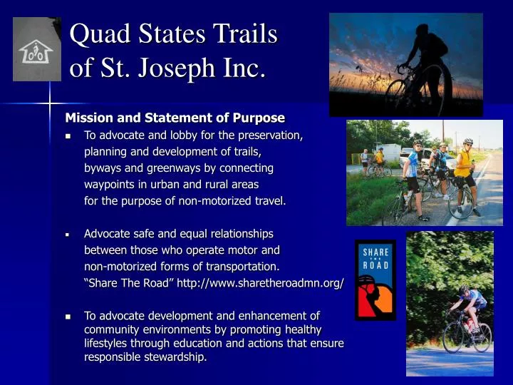
Quad States Trails of St. Joseph Inc. Mission and Statement of Purpose To advocate and lobby for the preservation, planning and development of trails, byways and greenways by connecting waypoints in urban and rural areas for the purpose of non-motorized travel.

E N D
Quad States Trails of St. Joseph Inc. Mission and Statement of Purpose • To advocate and lobby for the preservation, planning and development of trails, byways and greenways by connecting waypoints in urban and rural areas for the purpose of non-motorized travel. • Advocate safe and equal relationships between those who operate motor and non-motorized forms of transportation. “Share The Road” http://www.sharetheroadmn.org/ • To advocate development and enhancement of community environments by promoting healthy lifestyles through education and actions that ensure responsible stewardship.
Quad States Trails of St. Joseph Inc. Action Plan: Exercise Political Will and Create Vision create a zone of protection for bicycling and walking rather than accepting the attitude of indifference Elected Officials Elected Officials Bicycle Advocacy Groups Citizens’AdvisoryGroups Staff, Professionals
Saint Michael’s MeadowTrail Foundation, Inc. Purpose: A non-profit 501(c)3 tax exemption To promote bicycling as environmentally friendly, healthful and enjoyable, to educate the public as to the best practices related to bicycling and road safety for everyone. To create curriculums for and provide bicycle safety training, to plan, develop and construct bicycle and pedestrian byways and to work with organizations and agencies to create better policy, planning, design, and infrastructure for bicycling and walking. The mission of the Foundation is to provide a charitable and educational platform to make Missouri a better place to bicycle and walk, through the advancement of bicycle and pedestrian access, safety and education.
Linear Path Development,A Network of Paths Connecting Waypoints and Communities A Network of Paths Trails and Byways: Three Categories • Trans State Trails & Byways • American Discovery Trail • Lewis & Clark Bicycle Trail • Priority Regional Trails (PRT) & Byways • Katy Trail, Missouri • Wabash Trace Trail, Iowa • Mo Pac Trail, Nebraska • Steamboat Trace Trail, Nebraska • Community Trail Systems & Byways • St. Joseph Hike/Bike Trail • The Lewis & Clark Trail - Atchison, KS) • Lewis & Clark Trail North - Yankton, Nebraska • Local Bicycle Club Byway Routes
Linear Path Development,A Network of Paths Connecting Waypoints and Communities Connecting Waypoints and Communities, A Wide Spectrum of Relationships • Trans State Trails & Paths and Their Points of Interest • National Historic Places • National Parks and Forests • Trans-continental non-motorized travel across the United States • Priority Regional Trails (PRT) & Byways • Regional points of interest: • State Parks, Conservation Areas and State Lakes • Regional History both Private and Government Managed • State to State & Within State non-motorized travel • Community Trail Systems & Byways • Local Points of Interest • Historic Places and Local Parks • Bed & Breakfasts, Hotel/Motel, Restaurants & Food Stores • Marketing to Outdoor Activities
Trans State Trails The American Discovery Trail is a coast-to-coast hiking and biking trail across the mid-tier of the United States. It starts on the Delmarva Peninsula on the Atlantic Ocean and ends on the northern California coast on the Pacific Ocean, and is signed on over 6,800 miles of trail (about 11,000 kilometers). This includes the doubled trail stretches. It is possible to complete the coast to coast hike by covering just over 5,000 miles of trail. It is the only non-motorized coast-to-coast trail. The trail passes through 14 national parks and 16 national forests and utilizes sections of or connects to five National Scenic Trails, 10 National Historic Trails, and 23 National Recreation Trails. For part of its distance, it is coincident with the North Country Trail and the Buckeye Trail. From western Ohio to northern Colorado, the trail has two parallel stretches.
Trans State Trails The Lewis & Clark Bicycle Trail. For more than 25 years, the Missoula, Montana-based Adventure Cycling Association has been sending research teams into the field to track down the very best cycling byways in North America. Now, the American Cycling Association has mapped a new trail to honor the Lewis and Clark Expedition. This new Adventure Cycling route follows the famous explorers' trail as closely as possible and includes options for the different routes the corps took on their return trip. Tours are divided into three categories. Self Contained, Supported and Education.
Trans State Trails Other Trans State Trail Systems • National Millennium Trailshttp://www.railstotrails.org/index.html • Appalachian National Scenic Trail • Cascadian Marine Trail: Olympia WA to Point Roberts Canada • Puget Sound, Mount Rainier: being built through the cooperative efforts of the Washington State Parks, Recreation Commission, Washington Water Trails Association, Department of Natural Recourses & other State and Local Governments. • East Coast Greenway: 15 States from Main to Florida • The Mississippi River Trail: A 7 State 1,000 Mile Long Trail • North Country National Scenic Trail • Traverses 7 states, connecting New York to North Dakota, along its 4,600-mile route. Topography ranges from the Adirondack Mountains, hills and valleys of Pennsylvania, rural landscapes and cities of Ohio and lower Michigan, the northwoods and freshwater lakes of upper Michigan, Wisconsin and Minnesota, and to the vast plains of North Dakota. The trail meanders through 160 state parks, forests and wildlife areas. Numerous historic sites appear along the trail, including Native American cultural and religious sites, Revolutionary War forts, canal towpaths and modern engineering feats, such as the Mackinaw Bridge and the Garrison Dam. The trail is supported by many active, private trail groups, including the North Country Trail Association, Finger Lakes Trail Conference, Buckeye Trail Association and the Superior Hiking Trail Association.
America Discovery Trail & Lewis & Clark Trail In The Quad States Area
Priority Regional Trails,The Quad States Trail • Major Waypoints • Connecting with the Katy Trail at Kansas City, MO. • Connects Weston, MO & Leavenworth, KS. • Northward to St. Joseph, MO, Atchison, KS & Marysville, KS • Northward to Rulo, NE, Brownville, NE, & Squaw Creek Game Refuge & Maryville, MO. • Northward to Wabash Trace Trail in IA, Steamboat Trace Trail & Mo Pac Trail in NE.
Priority Regional Trails The Wabash Trace Trail The trail runs from Council Bluffs to Blanchard, Nebraska on the Missouri border, crossing through Pottawattamie, Mills, Fremont, and Page Counties. The 63 mile Wabash Trace is surfaced with finely crushed limestone surface provides for easy biking, and the many towns and trailheads in the area have good support facilities, which enable you to choose form out-and-back rides of many different lengths. Along the trail there is an interesting contrast of towns ranging form busy county centers to quiet villages left over from the railroad era that time is slowly passing by. Open rural vistas alternate with heavily wooded sections, where the trail forms a shady tunnel through the trees. Wildlife is common along the trail corridor.
Priority Regional Trails Steamboat Trace Trail 21 miles of abandoned railroad corridor paralleling the Missouri River from approximately 6 miles south of Nebraska City to just south of Brownville, Nebraska. In 1995, the title was provided to the Nemaha NRD by the National Rails to Trails Conservancy.
Priority Regional Trails Mo Pac Trail The trail corridor runs form the eastern outskirts of Lincoln in Lancaster County to a point east of Wabash in Cass County. Running easy from Lincoln into the rural countryside is Nebraska's major rail-conversion trail, the MoPac East Recreation Trail. This 25-mile, multi-use "linear" park runs along a corridor that alternates between a wooded canopy providing shade and wind protection and open vistas of farms and fields. About an 18-mile stretch of the trail surface is finished with crushed limestone as far east as Elmwood, but the unfinished roadbed is mountain bikeable to Wabash.
Trail & BywayPlanning and Development • Saint Michael’s Meadow Trail Foundation, Inc. • Committees • Planning & Development • Route locations • Path design and construction • Land acquisition • Events and Promotions • Public relations, Events planning • Education and Sponsorship • Funding • Grants and Contributions • Investments • Finance • Audits, Oversight