Download
1 / 21
210 likes | 362 Views
TAMP RWANDA. PDF-B ACTIVITIES, FINDINGS AND AREAS OF ACTION. PROJECT START:. Appointment of the Project Focal Point by MINAGRI: October 2004 Recruitment of the National Project Coordinator (Manager): November 2004 Project Office provided by MINAGRI and equipped by FAO: January 2005

E N D
TAMP RWANDA PDF-B ACTIVITIES, FINDINGS AND AREAS OF ACTION
PROJECT START: • Appointment of the Project Focal Point by MINAGRI: October 2004 • Recruitment of the National Project Coordinator (Manager): November 2004 • Project Office provided by MINAGRI and equipped by FAO: January 2005 Finding: High support from MINAGRI
MEETINGS WITH LOCAL AUTHORITIES • With representatives of the provinces and districts: January 2005 • Presentation of the project and invitation to the launching meeting Finding: The project addresses felt problems: i.e. Land degradation (declining productivity) and Climate changes (frequent droughts).
PROJECT COMMITTEES • TAC was established in February 05 • Members were appointed by and from: MINAGRI (3) MINITERE (3) REMA (1) Provinces (3) FAO (1)
PSC: November 05 • Members were appointed by: MINAGRI (1) MINITERE (1) FAO (1)
MEETINGS • Project launching meeting: February 05 • 37 people (Representatives from Ministries, Provinces, Districts, Projects and Research Institutes) attended. • Agenda: Information sharing on the project Contribution on the needs and implementation plan of the project
Findings: They contributed ideas, Were interested to collaborate with the Kagera TAMP Later on, they participated in the field diagnosis assessments.
First TAC meeting: March 2005 • 14 people (Members and Observers) attended • Agenda: Roles and responsibilities of the Committee Discussion of the Action Plan Proposed a visit to the project areas
TAC 2-day reconnaissance field visit in June 05 • Visited the most degraded sites in two provinces • Met and discussed with provincial, districts, projects and community representatives • Formulated recommendations on potential priority interventions
FIELD WORK The field diagnosis training in July 2005 Field diagnosis study: Sept. 2005 Study sites: Six; i.e. 2 per province in 3 provinces Sites selection criteria: altitude, topography, And major agro-ecosystems
PEOPLE ENCOUNTERED • Executive Secretaries of the provinces • Mayors of the districts • In charge of Agriculture and Environment at the provinces’ level. • Staff of some of the projects • Agronomists and Vets of the Districts • Elders and Community representatives at the villages level.
All these contributed information on the status and trends of NR degradation in respective areas; and • Helped in problems and solutions identifications and • Made suggestions / recommendations for the project to take into consideration.
FIELD DIAGNOSIS • Five consultants conducted the diagnosis: • Specialisties in: 1. Land and crops use and management 2. Soil quality and degradation 3. Forests and Agro-forestry 4. Livestock and pastures, and 5. Water, flora and fauna.
At each of the 6 sites, the study was through transects and PRAs • 3 days per site; i.e. transect (1 day), PRA (1) and restitution (1) • Draft reports are available
DESK STUDY • In addition to field studies, consultants conducted desk studies for secondary data and information • Documentation was already gathered by the NPM
GIS / RS STUDY • Was conducted by the GIS/RS department of the NUR – Butare • Draft data are available
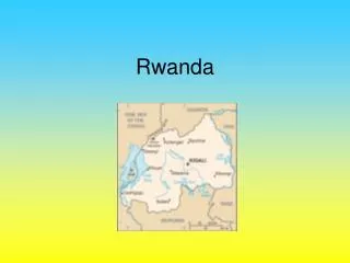
LESSONS LEARNT FROM THE STUDIES • The Rwandan Akagera river watershed covers almost the entire country (+/- 80%). • The data collection was extended to the entire watershed • The watershed was divided into three ecological zones:
Higher Zone (in the West and North of the Watershed) characterized by: High altitudes High hills with steep slopes Narrow tops and bottom valleys High soil erosion on hillsides Population on tops and bottoms of the hills Very few vegetation cover.
Medium Zone in the center of the country : Medium altitudes Large plateaux Low soil erosion Rich vegetation cover and biomass
Lower Zone in the East: Low altitudes Flat and rolling plains Dominated by livestock keeping, And rangelands
These are described in the consultants reports • Conclusions from the studies will help in choosing project sites; at least one in the lower, one in the medium, and one in the higher zone. End