Download
1 / 17
170 likes | 288 Views
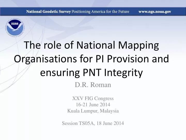
The role of National Mapping Organisations for PI Provision and ensuring PNT Integrity. D.R. Roman XXV FIG Congress 16-21 June 2014 Kuala Lumpur, Malaysia Session TS05A, 18 June 2014. OUTLINE. NAD 83 Replacement CORS Enhancements OPUS-Projects RTN Support Outlook. NAD 83 Replacement.

E N D
The role of National Mapping Organisations for PI Provision and ensuring PNT Integrity D.R. Roman XXV FIG Congress 16-21 June 2014 Kuala Lumpur, Malaysia Session TS05A, 18 June 2014
OUTLINE • NAD 83 Replacement • CORS Enhancements • OPUS-Projects • RTN Support • Outlook XXV FIG Congress, Kulala Lumpur, Malaysia 16-21 June 2014
NAD 83 Replacement • Continental “plate-fixed” geodetic datum to be adopted in the United States • More geocentric than the current NAD 83 reference frame • Must coordinate with Mexico and Canada • By 2022, reduce all definitional and access related errors in the geometric reference frame to 1 centimeter when using 15 minutes of GNSS data XXV FIG Congress, Kulala Lumpur, Malaysia 16-21 June 2014
Two possible ways to align • Using a newly defined NGS network such as the projected “foundation CORS.” • Must build a sufficient number prior to 2022 to establish a viable, independent national network • Rely on stations currently in the IERS network located in the North American continent. • Presumes continued NGS participation in IERS (AC) XXV FIG Congress, Kulala Lumpur, Malaysia 16-21 June 2014
Two Important Questions • What will be the 14-parameter transformation between the redefined geodetic reference datum frame and the standard geocentrically assumed ITRFxxxx frame? • What will be the adopted plate rotation models introduced to correct for the North America, Pacific, Mariana and Caribbean plate rotations? • HTDP will be relied upon to propagate these transformations in a consistent manner XXV FIG Congress, Kulala Lumpur, Malaysia 16-21 June 2014
CORS Networks Stations • As of February 2014, all CORS stations provide extra signals beyond current GPS L1 and L2: • GPS's L2C and L5 • Russia's GLONASS satellites L1 and L2 • Over 40% of CORS sites will distribute these extra signals • These additional signals also enhance system robustness and better ensure PNT XXV FIG Congress, Kulala Lumpur, Malaysia 16-21 June 2014
Satellite Orbital Processing • NGS continues to serve as an Analysis Center (AC) for the IERS • GPS satellite orbital processing is key to overall accuracy and contribution to future ITRF models • NGS must expand to perform additional orbital analysis for other GNSS (e.g., GLONASS) • Accuracy of orbits and data archived from the CORS Network stations are critical to success XXV FIG Congress, Kulala Lumpur, Malaysia 16-21 June 2014
OPUS-Projects • Utilizing the GNSS data from CORS and rovers • Data are loaded through OPUS(-Static) • Project name is tagged • A series of adjustments are performed: • OPUS-S: for each observation set at a station • Session: for all points observed at the same time • Network: least squares combination of sessions • Performs a network adjustment at the local level XXV FIG Congress, Kulala Lumpur, Malaysia 16-21 June 2014
Network Components • Think of project as having 2 components: • Local network • Think precision - get best relative positions. • Reference network • Think accuracy - multiple CORS tie the local network into NSRS. Suggested Processing Guidance
Local Network • Think precision - get best relative positions: • Use common-mode errors to your advantage. • Use identical antennas when possible. • Keep baselines short maximizing simultaneous observations. • Use a single Hub per session. • Use the same Hub for all sessions when possible. • Include at least one distant CORS to stabilize tropo corrections. • Normal constraints. Suggested Processing Guidance
Reference Network • Think accuracy - multiple CORS tie the local network into NSRS: • Include the Hub(s) and distant CORS in all sessions. • Multiple CORS remove single reference mark bias. • Normal constraint weights allow for small variations in positions typical of CORS or any mark. Suggested Processing Guidance
Example 6: Single project Hub Not too bad … … but much better Suggested Processing Guidance
RTN Validation • NGS does not have regulatory authority over RTN’s • Provide, by 2015, a process for RTN operators to validate that their RTNs are aligned to the NSRS using NGS-acceptable standards. • Make the tool available to RTN customers, too • Use OPUS-Projects for State-wide systems • Enhances robustness of solutions by providing alternative means for passing correction information to rover receivers (RTN/RTK) XXV FIG Congress, Kulala Lumpur, Malaysia 16-21 June 2014
RTN Basics City limits City limits 100 Ref. Ref. 100 Ref. * * Northing (km) Northing (km) Ref. Ref. 0 0 Easting (km) 0 Easting (km) 100 0 100 Single baseline approach Network approach
RTN Basics • Reference frame – adopt latest realization of NAD 83 (NAD 83 2011 epoch 2010.00) • CORS + RTN – include a few CORS in the RTN • Adjustments • Constrain CORS that are included • Base station monitoring • Process data periodically • Monitor coordinates over time • Base station information • Coordinates, velocities, epoch
SUMMARY • NAD 83 replacement will be more geocentric • Tied through 14-parameter transformation to ITRF • Goal by 2022: 15 minutes of GNSS for 1 cm accuracy • CORS data already storing GLONASS+GPS • More to follow • Need orbits for all GNSS • Access to the future NSRS will be by: • OPUS-Projects for geodetic control data • RTN’s for real-time applications XXV FIG Congress, Kulala Lumpur, Malaysia 16-21 June 2014
Contact Information • Daniel R. Roman, National Geodetic Survey Chief (acting) SRSD/GRAV-D P.I./Geoid Team Lead • dan.roman@noaa.gov • 301-713-3200 x103 • Relevant NGS webpages: • CORS: http://www.ngs.noaa.gov/CORS/ • OPUS Page: http://www.ngs.noaa.gov/OPUS/ • OPUS-Projects: http://www.ngs.noaa.gov/OPUS-Projects/OpusProjects.shtml XXV FIG Congress, Kulala Lumpur, Malaysia 16-21 June 2014