Download
1 / 23
230 likes | 483 Views
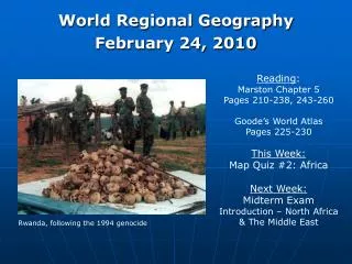
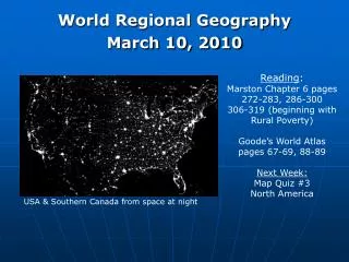
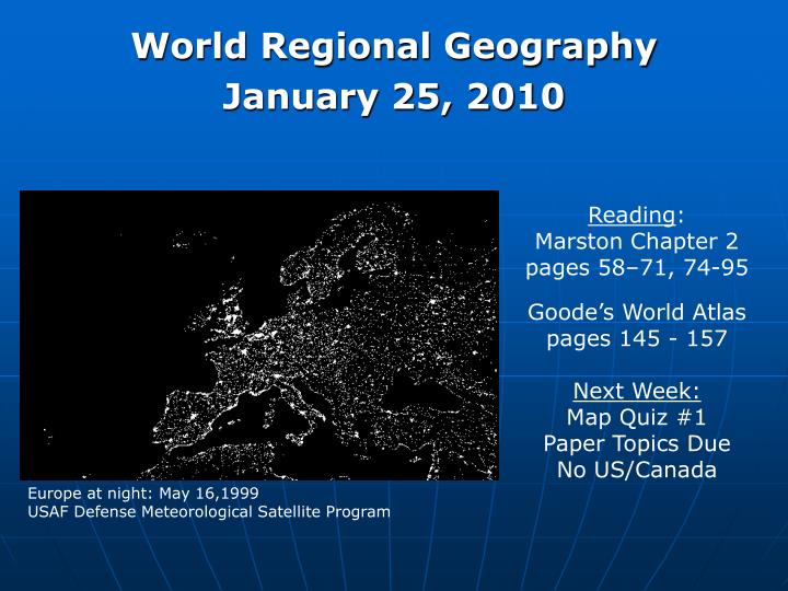
World Regional Geography January 25, 2010. Reading : Marston Chapter 2 pages 58–71, 74-95 Goode’s World Atlas pages 145 - 157 Next Week: Map Quiz #1 Paper Topics Due No US/Canada. Europe at night: May 16,1999 USAF Defense Meteorological Satellite Program. Transportation Geography.

E N D
World Regional Geography January 25, 2010 Reading: Marston Chapter 2 pages 58–71, 74-95 Goode’s World Atlas pages 145 - 157 Next Week: Map Quiz #1 Paper Topics Due No US/Canada Europe at night: May 16,1999 USAF Defense Meteorological Satellite Program
Transportation Geography Medical Geography Population Geography Political Geography Economic Geography Human Cultural Geography Historical Geography Location Analysis Climatology Oceanography Biogeography Geology Glaciology Physical Geomorphology Hydrology Ecology Pedology Geography
How do geographers analyze the spatial organization of people, places, and environments on earth’s surface? • Geographers refer to both the features of Earth’s surface and activities that take place on Earth’s surface as phenomena. • Physical: topographic, climate, vegetation. • Human: cities, trade flows, spread of disease. • Physical & Human: resort planning and climate. Central to geography is the belief that there is pattern, regularity, and reason to the locations of physical and human phenomena on Earth’s surface and that there are spatial structures and spatial processes that give rise to them • Why are these phenomena located in these places? • How did they get here? • Why is this pattern significant?
How do geographers analyze the spatial organization of people, places, and environments on earth’s surface? • Description and analysis of patterns of spatial organization: • Local • Global • Interdependence • Spatial linkages: • Human and physical • How do physical processes in one place affect physical and human processes in other places? • How do human decisions at one location affect human and physical processes in other locations? • What patterns exist?
Physical Geographers • The physical processes that shape the patterns of Earth’s surface: • Atmosphere • Lithosphere • Hydrosphere • Biosphere • The characteristics and spatial distribution of ecosystems on Earth’s surface: • How do various patterns in Earth’s physical processes combine to create unique ecosystems? • How do these ecosystems interact with one another? • What physical processes are leading to change in ecosystems? Understanding how these processes operate allows us to establish baseline measures from which we can analyze the impact of human activity.
Human Geographers • The characteristics, distribution, and migration of human population on Earth’s surface: • Where do populations concentrate? Why? • Demographic characteristics in certain locations. • What factors influence population change? • The characteristics, distribution, and complexity of Earth’s cultural mosaics: • Location specific cultural characteristics. • Needs, wants, and the use of technology. • The interaction of different cultures. • The patterns and networks of economic interdependence on Earth’s surface: • Distribution of capital, labor, and resources. • Transportation and communications patterns. • Economic relationships.
Human Geographers • How the forces of cooperation and conflict among people influence the division and control of Earth’s surface: • Interaction of political, economic, and cultural systems. • Conflict over land: • Strategic • Resources • Cultural • The processes, patterns, and functions of human settlement: • Economic activities • Transportation and communications systems • Political systems • Cultural and entertainment. Understanding how these processes operate, and the interaction of the various human systems, allows us to begin to understand the potential effects of policy decisions.
Human & Physical Geographers By examining the interaction between physical and human spatial processes, geographers can then address questions related to: • How human actions modify the physical environment: • How do certain population characteristics affect physical systems? • How do certain cultural values affect the physical environment? • What affect do certain economic activities have on the environment? • How do human settlement patterns affect physical processes? • How does conflict over land (space) impact physical systems? And…..
Human & Physical Geographers • How do physical systems affect human systems: • How do changes in atmospheric temperature affect the spatial pattern of agricultural output? • How do existing hydrologic systems impact human settlement patterns? • Do certain characteristics of regional ecosystems favor the spread of human disease? • How will climate change impact human systems: • Future land-use patterns • Water availability • Ecological change • Potential for future conflict over land • Probable future settlement patterns
Geography • Geographers from the various geographic subfields: • Identify spatial patterns in certain phenomena. • Analyze the spatial patterns and ask why they exist. • Determine what processes led to a specific spatial pattern. • Analyze how this process operates, which allows for prediction. • Analyze how this spatial process interacts with other phenomena and processes. • Which allows one to create larger more realistic models of spatial interaction between both human and physical spatial systems.
For example: • A population geographer might ask: • What economic, social, physical characteristics of a particular place make it more or less likely that a young adult will choose to out-migrate? • This is a question about human migration patterns, but to answer it requires information about: • Economic characteristics • Cultural values • Climate and topographic characteristics • and…… • 4) How all of these characteristics of place affect the migration decision-making process of young adults.
Europe • Political Boundaries: What/Where is Europe? • Physical Geography • Physiographic Regions • Climate & Land Use • Environmental History & Issues • Human Geography • Population Characteristics • Migration Patterns / History • Cultural and Ethnic Characteristics • Key Concepts • Nations & States • The Welfare State • Europe in a Global Context: Historic & Contemporary • Political • Economic
Physiographic Regions Physiographic Regions: a broad region within which there is a coherence of geology, relief, landforms, soils, and vegetation. • Northwestern Uplands • North European Lowlands • Central Plateaus • Alpine System
Europe: Environmental History • Europe was initially dominated by temperate forests (deciduous). Today only 5% of Europe remains forested. • 1000 – 1300: Agriculture becomes dominate land-use. • Warm climactic period. • Technological advances in agriculture. • Population boom (~36 million to ~80 million). • Need for more agricultural land: • Large-scale drainage projects • Sea-reclamation projects • Settlement on less-than-optimal agricultural land. • 1300 – 1500: Reduction in agricultural land use. • Black Plague • “Little Ice Age” shortens growing season. • Marginal agricultural lands abandoned. • 18th century industrialization dramatically altered the landscape: • Population concentration • Mining • Pollution
Europe: Environmental Issues • Derelict landscapes: • Strip mining • Exposed chemical hazards • Air / Water pollution: • Originally a western European issue resulting from industrialization. • Eastern European countries suffer from sub-standard industrial infrastructure. • Water usage / scarcity: • Nine EU nations currently using water at unsustainable levels. • Agricultural and personal use. • Natural Resources: • Many resources used in production must be imported. • Over-fishing.